Fort Gaines in Clay County, Georgia — The American South (South Atlantic)
In the Confederacy
Photographed by David Seibert, August 14, 2011
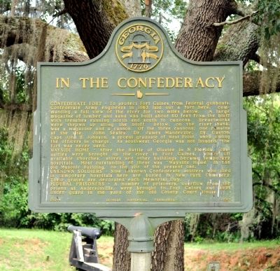
1. In the Confederacy Marker
WAYSIDE HOME - After the Battle of Olustee in N Florida, casualties were brought up the river to Fort Gaines, where all available churches, stores and other buildings became temporary hospitals. Most outstanding of these was “Wayside Home” in the old Masonic Building, on the site of the present one.
UNKNOWN SOLDIERS - Nine unknown Confederate soldiers who died in temporary hospitals here are buried in New Park Cemetery. Their graves are decorated each Memorial Day.
FEDERAL
this page online
Erected 1957 by Georgia Historical Commission. (Marker Number 030-5.)
Topics and series. This historical marker is listed in these topic lists: Cemeteries & Burial Sites • Forts and Castles • War, US Civil. In addition, it is included in the Georgia Historical Society series list. A significant historical year for this entry is 1863.
Location. Marker is missing. It was located near 31° 36.365′ N, 85° 3.287′ W. Marker was in Fort Gaines, Georgia, in Clay County. It was on Bluff Street south of Commerce Street, on the right when traveling south. The marker is a short distance off the road near the bluff. Touch for map. Marker was in this post office area: Fort Gaines GA 39851, United States of America. Touch for directions.

Regionally, this marker was on the Coastal Plain. It was also in the American South and specifically in the Deep South. Globally, it was in North America, the Western Hemisphere, the Western World, and the Anglosphere. Historically,
Photographed by David Seibert, August 14, 2011
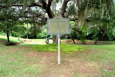
2. In the Confederacy Marker
The cannon mentioned on the marker is visible in the distance.
Other nearby markers. At least 8 other markers are within walking distance of this location: The Old Lattice Bridge (a few steps from this marker); The 1836 Fort (a few steps from this marker); Fort Gaines (about 300 feet away, measured in a direct line); Old Pioneer Cemetery (about 700 feet away); Site of the First Clay County Courthouse and Jail (approx. ¼ mile away); Chattahoochee River Crossings (approx. 0.3 miles away in Alabama); Franklin - First Beachhead into East Alabama (approx. 0.3 miles away in Alabama); Fort Gaines Guards (approx. 0.3 miles away). Touch for a list and map of all markers in Fort Gaines.
Another marker is no longer nearby. Site of Fort Gaines Female College (was about 600 feet away but has been confirmed missing).
Photographed by David Seibert, August 14, 2011
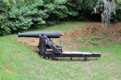
3. Confederate Cannon
As mentioned on the marker, this cannon has stood here since the Civil War.

Photographed by James L.Whitman, August 12, 2024
4. In the Confederacy Marker missing
Credits. This page was last revised on August 12, 2024. It was originally submitted on September 7, 2011, by David Seibert of Sandy Springs, Georgia. This page has been viewed 1,270 times since then and 52 times this year. Last updated on August 12, 2024, by James L.Whitman of Eufaula, Alabama. Photos: 1, 2, 3. submitted on September 7, 2011, by David Seibert of Sandy Springs, Georgia. 4. submitted on August 12, 2024, by James L.Whitman of Eufaula, Alabama. • Bernard Fisher was the editor who published this page.
