Natural Bridge in Rockbridge County, Virginia — The American South (Mid-Atlantic)
A View Thousands of Years in the Making
Photographed by Bradley Owen, August 12, 2024
1. A View Thousands of Years in the Making Marker
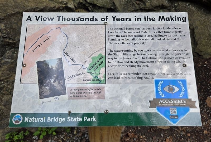
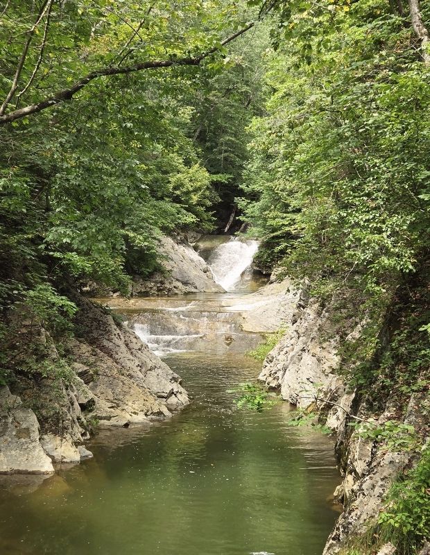
The waterfall before you has been known for decades as Lace Falls. The waters of Cedar Creek that tumble gently down the rock face resemble lace, leading to its nickname. Standing 50 feet tall, this waterfall marked the end of Thomas Jefferson's property.
The water running by you now starts several miles away in the Short Hills range before flowing through the park on its way to the James River. The Natural Bridge owes its creation to the slow and steady movement of water doing what it always does: seeking its level.
Lace Falls is a reminder that small things, and a lot of time, can lead to breathtaking results.
(Caption):
A 1906 postcard of Lace Falls with a map showing the path of Cedar Creek.
Erected by Natural Bridge State Park.
Topics and series. This historical marker is listed in these topic lists: Natural Features • Waterways & Vessels. In addition, it is included in the Former U.S. Presidents: #03 Thomas Jefferson series list. A significant historical year for this entry is 1906.
Location. 37° 38.059′ N, 79° 33.244′ W. Marker is in Natural Bridge, Virginia, in Rockbridge County. It can be
this page online

Regionally, this marker is in the Mountain Region. It is also in the American South, specifically in the Upper South, in Appalachia, and specifically in Southern Appalachia. Globally, it is in North America, the Western Hemisphere, the Western World, and the Anglosphere. Historically, it finds itself in what was once the territory of the Mississippian Culture, one of the original Thirteen Colonies, one of the Confederate States of America, and the Antebellum South.
Other nearby markers. At least 8 other markers are within walking distance of this marker: Lost and Found (approx. 0.2 miles away); A Cave that Armed American Soldiers (approx. 0.4 miles away); George Washington (approx. 0.6 miles away); Once Enslaved, He Became Natural Bridge's First Caretaker
Photographed by Bradley Owen, August 12, 2024
2. A View Thousands of Years in the Making Marker
Other markers no longer nearby. Lace Waterfalls (was within shouting distance of this marker but has been reported to have been replaced with another marker now near it); Lost River (was approx. 0.3 miles away but has been permanently removed); Monacan Village (was approx. 0.4 miles away but has been permanently removed); Saltpetre Cave (was approx. 0.4 miles away but has been permanently removed); a different marker also named Natural Bridge (was approx. 0.7 miles away but has been permanently removed).
Related marker. Click here for another marker that is related to this marker. This marker has replaced another near this location.
Photographed by Bradley Owen, August 12, 2024
3. Lace Falls
Credits. This page was last revised on August 12, 2024. It was originally submitted on August 12, 2024, by Bradley Owen of Morgantown, West Virginia. This page has been viewed 290 times since then and 33 times this year. Photos: 1, 2, 3. submitted on August 12, 2024, by Bradley Owen of Morgantown, West Virginia.
