Riverfront in Chattanooga in Hamilton County, Tennessee — The American South (East South Central)
Flooding Along the Tennessee River
Photographed by Joel Seewald, April 29, 2024
1. Flooding Along the Tennessee River Marker
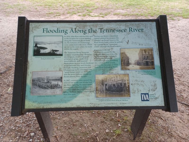
In 1816, John Ross selected this spot as the location for a river landing along the Tennessee River. Early on, the fortunes of Chattanooga were connected to the river, which served as the main artery for trade within the region.
The Tennessee River, however, could be unpredictable. Obstacles downstream, in the "Narrows" of the river gorge, made river travel difficult, and seasonal fluctuations in river levels hindered travel between July and October. Periodic flooding, moreover, led Chattanooga to be considered the "great danger point on the river," and the town suffered disastrous floods almost every decade.
In 1867, constant rains caused the river to rise at the rate of one foot per hour, burying the town under several feet of muddy water and washing away the Civil War-era Meigs Military Bridge, which stood near this spot.
During one flood, a steamboat captain piloted his steamer, the Cherokee, up Broad Street to the Road House hotel, where he picked up a group for an "excursion cruise" through the flood waters.
Frustrated with the destruction caused by the repeated flooding of the city, by the turn of the
this page online
Top left image caption: Chattanooga viewed from Lookout Mountain during the flood of 1867.
Courtesy of Chattanooga Public Library
Bottom left image caption: Chattanooga Shipyard, c. 1865
Courtesy of Chattanooga Public Library, Paul A. Hiener Collection
Top right image caption: The Tennessee River floods the heart of downtown. Corner of Market and Seventh Streets, 1888.
Courtesy of Chattanooga Public Library, Paul A. Hiener Collection
Bottom right image caption: Crowds gather in front of the Loveman's Department Store at Eighth and Market Streets during the 1886 flood.
Courtesy of Chattanooga Public Library, Paul A. Hiener Collection
Erected by Tennessee Valley Authority.
Topics. This historical marker is listed in these topic lists: Disasters • Settlements & Settlers • Waterways & Vessels. A significant historical year for this entry is 1816.
Location. 35° 3.383′ N, 85° 18.695′ W. Marker is in Chattanooga, Tennessee, in Hamilton County. It is in Riverfront. It is at

Photographed by Joel Seewald, April 29, 2024
2. Flooding Along the Tennessee River Marker

Regionally, this marker is in the American South, specifically in the Upper South, in Appalachia, and specifically in Southern Appalachia. Globally, it is in North America, the Western Hemisphere, the Western World, and the Anglosphere. Historically, it finds itself in what was once the original Cherokee Nation, the territory of the Mississippian Culture, one of the Confederate States of America, and the Antebellum South.
Other nearby markers. At least 8 other markers are within walking distance of this marker: Ross's Landing (a few steps from this marker); Chattanooga's First Citizens (a few steps from this marker); Tennessee Valley Authority (within shouting distance of this marker); "Cherokee" (within shouting distance of this marker); a different marker also named Ross's Landing (about 400 feet away, measured in a direct line); Hazen's Raid at Brown's Ferry (about 400 feet away); Trail of Tears (about 500 feet away); Stickball / Seven Sisters (about 500 feet away). Touch for a list and map of all markers in Chattanooga.
Another marker is no longer nearby. 1790 John Ross 1866 (was a few steps from this marker but has been confirmed missing).
Also see . . . 1867 flood of Chattanooga. Wikipedia article (Submitted on August 12, 2024, by Joel Seewald of Madison Heights, Michigan.)
Credits. This page was last revised on August 12, 2024. It was originally submitted on August 12, 2024, by Joel Seewald of Madison Heights, Michigan. This page has been viewed 591 times since then and 45 times this year. Photos: 1, 2. submitted on August 12, 2024, by Joel Seewald of Madison Heights, Michigan.
