Natural Bridge in Rockbridge County, Virginia — The American South (Mid-Atlantic)
How Did It Happen?

Photographed by Bradley Owen, August 12, 2024
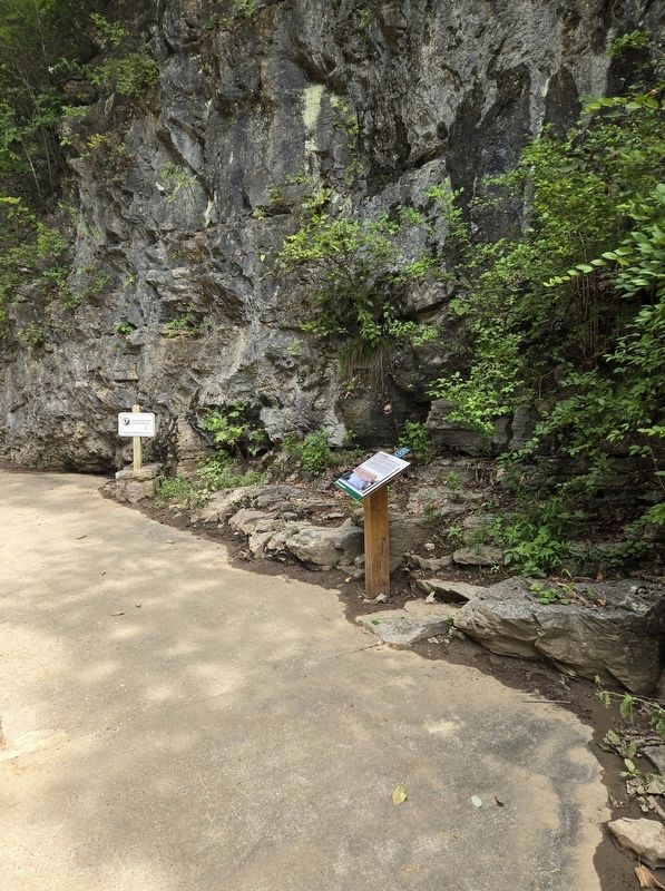
1. How Did It Happen? Marker
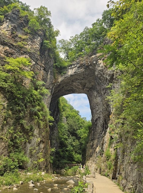
At 200 feet tall, the Natural Bridge is estimated to weigh 36,000 tons - as much as 2,500 school buses! How does something like this come about? The answer is in the limestone all around you.
Most of the rock in and under the park is limestone. Limestone slowly dissolves when in contact with carbonic acid, which is made when water and carbon dioxide mix. Places underlain by limestone may contain caves, underground rivers, and sinkholes because wherever carbonic acid forms it wears away this type of rock.
Around one million years ago, Cedar Creek was swallowed by a sinkhole that turned it into an underground river. It eventually reached the James River by means of a cave that slowly developed through the limestone deposit you are standing in now. The forces at work were small, but on the grand scale of several hundred thousand years, they carved out the walls around you.
This Cedar Creek-made cave collapsed, leaving the Natural Bridge standing at the narrowest point in the chasm.
(Sidebar):
Measuring Up
Taller than the Statue of Liberty (151 feet tall without her base) and Niagara Falls (167 feet tall),
this page online
Erected by Natural Bridge State Park.
Topics. This historical marker is listed in these topic lists: Natural Features • Science & Medicine.
Location. 37° 37.645′ N, 79° 32.64′ W. Marker is in Natural Bridge, Virginia, in Rockbridge County. It can be reached from the intersection of South Lee Highway (U.S. 11) and Rockbridge Road (Virginia Route 130), on the left when traveling south. Marker is located in Natural Bridge State Park along the Cedar Creek Trail. Touch for map. Marker is at or near this postal address: 6477 South Lee Highway, Natural Bridge VA 24578, United States of America. Touch for directions.

Regionally, this marker is in the Mountain Region. It is also in the American South, specifically in the Upper South, in Appalachia, and specifically in Southern Appalachia. Globally, it is in North America, the Western Hemisphere, the Western World,
Photographed by Bradley Owen, August 12, 2024
2. How Did It Happen? Marker
Other nearby markers. At least 8 other markers are within walking distance of this marker: Natural Bridge Patent (within shouting distance of this marker); “Vires-Acquirit-Eundo” Ancient Arbor Vitae (within shouting distance of this marker); The Time-Traveling Tree of Life (within shouting distance of this marker); A Miracle in Stone ... Old as the Dawn (about 300 feet away, measured in a direct line); “The Most Sublime of Nature’s Works” (about 300 feet away); Once Enslaved, He Became Natural Bridge's First Caretaker (about 500 feet away); a different marker also named Natural Bridge (about 600 feet away); a different marker also named Natural Bridge (about 800 feet away). Touch for a list and map of all markers in Natural Bridge.
Another marker is no longer nearby. Natural Bridge (was about 500 feet away but has been permanently removed).
Photographed by Bradley Owen, August 12, 2024
3. Natural Bridge
Credits. This page was last revised on August 12, 2024. It was originally submitted on August 12, 2024, by Bradley Owen of Morgantown, West Virginia. This page has been viewed 339 times since then and 51 times this year. Photos: 1, 2, 3. submitted on August 12, 2024, by Bradley Owen of Morgantown, West Virginia.
