Natural Bridge in Rockbridge County, Virginia — The American South (Mid-Atlantic)
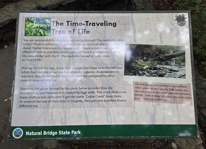
The Time-Traveling Tree of Life
Photographed by Bradley Owen, August 12, 2024
1. The Time-Traveling Tree of Life Marker
You are surrounded by time travelers along this trail. The northern white cedar (Thuja occidentalis) is mainly found far north of where you now stand. Native Americans in Canada ate its leaves to counteract the effects of scurvy, and they saved a party of French explorers by sharing this knowledge with them. The explorers named it "arborvitae," or "tree of life."
During the last Ice Age, it was cold enough that these trees thrived here while their current range was buried under a glacier. As temperatures warmed, they moved north and have been out-competed by other trees in most of Virginia.
However, the gorge formed by the creek below is cooler than the surrounding land because it is shaded by high walls. The creek shelters so many of these rare trees that it got the name "Cedar Creek" from them. As some of the last of their kind in Virginia, they are time travelers from a different era.
(Caption):
An early 1900s postcard depicting northern white cedars along Cascade Falls before you. One may even be the 1,600 year old specimen nearby - look on your left for a very wide cedar as you walk down the steps.
Erected by Natural
this page online
Topics. This historical marker is listed in these topic lists: Environment • Horticulture & Forestry • Science & Medicine.
Location. 37° 37.655′ N, 79° 32.589′ W. Marker is in Natural Bridge, Virginia, in Rockbridge County. It can be reached from the intersection of South Lee Highway (U.S. 11) and Rockbridge Road (Virginia Route 130), on the left when traveling south. Marker is located in Natural Bridge State Park along the Cedar Creek Trail. Touch for map. Marker is at or near this postal address: 6477 South Lee Highway, Natural Bridge VA 24578, United States of America. Touch for directions.

Regionally, this marker is in the Mountain Region. It is also in the American South, specifically in the Upper South, in Appalachia, and specifically in Southern Appalachia. Globally, it is in North America, the Western Hemisphere, the Western World, and the Anglosphere. Historically, it finds itself in what was once the territory of the Mississippian Culture, one of the original Thirteen Colonies, one of the Confederate States of America, and the Antebellum

Photographed by Bradley Owen, August 12, 2024
2. The Time-Traveling Tree of Life Marker
Other nearby markers. At least 8 other markers are within walking distance of this marker: A Miracle in Stone ... Old as the Dawn (a few steps from this marker); Natural Bridge Patent (within shouting distance of this marker); “Vires-Acquirit-Eundo” Ancient Arbor Vitae (within shouting distance of this marker); How Did It Happen? (within shouting distance of this marker); a different marker also named Natural Bridge (about 400 feet away); “The Most Sublime of Nature’s Works” (about 500 feet away); a different marker also named Natural Bridge (about 700 feet away); Once Enslaved, He Became Natural Bridge's First Caretaker (about 700 feet away). Touch for a list and map of all markers in Natural Bridge.
Another marker is no longer nearby. Natural Bridge (was about 400 feet away, measured in a direct line but has been permanently removed).
Credits. This page was last revised on August 12, 2024. It was originally submitted on August 12, 2024, by Bradley Owen of Morgantown, West Virginia. This page has been viewed 782 times since then and 169 times this year. Photos: 1, 2. submitted on August 12, 2024, by Bradley Owen of Morgantown, West Virginia.
