
Crown Heights in Brooklyn in Kings County, New York — The American Northeast (Mid-Atlantic)
Jackie Robinson Playground
1 acre
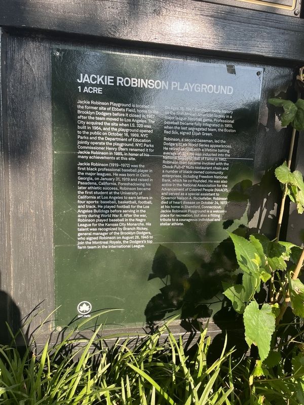
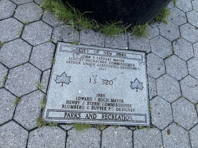
Jackie Robinson Playground is located on the former site of Ebbets Field, home to the Brooklyn Dodgers before it closed in 1957 after the team moved to Los Angeles. The City acquired the site when I.S. 320 was built in 1964, and the playground opened to the public on October 16, 1969. NYC Parks and the Department of Education jointly operate the playground. NYC Parks Commissioner Henry Stern renamed it for Jackie Robinson in 1985, in honor of his many achievements at this site.
Jackie Robinson (1919-1972) was the first black professional baseball player in the major leagues. He was born in Cairo, Georgia, on January 31, 1919 and raised in Pasadena, California. Foreshadowing his later athletic success, Robinson became the first student at the University of California at Los Angeles to earn letters in four sports: baseball, basketball, football, and track. He played football for the Los Angeles Bulldogs before serving the army during World War II. After the war, Robinson played baseball in the Negro League for the Kansas City Monarchs. His talent was recognized by Branch Rickey, general manager of the Brooklyn Dodgers, who signed Robinson on August 28, 1945 to join the Montreal Royals, the Dodger's top farm team in the International League.
On April 15, 1947, Robinson made history as the first African American to play in a major league baseball game. Professional baseball became fully integrated in 1959, when the last segregated team, the Boston Red Sox, signed Elijah Green.
Robinson, a second baseman, led the Dodgers to six World Series appearances. He retired in 1956 with a lifetime batting average of .311. He was inducted into the National Baseball Hall of Fame in 1962. Robinson then became involved with the Cock-Full-O' Nuts restaurant chain and a number of black-owned community enterprises, including Freedom National Bank, which he co-founded. He was also active in the National Association for the Advancement of Colored People (NAACP), and served as a special assistant to Governor Nelson A. Rockefeller. Robinson died of heart disease on October 24, 1972, at his home in Stamford, Connecticut. Jackie Robinson Playground is a welcome place for recreation, but also a fitting tribute to a courageous individual and stellar athlete.
Erected by NYC
this page online
Topics and series. This historical marker is listed in these topic lists: African Americans • Civil Rights • Parks & Recreational Areas • Sports. In addition, it is included in the NYC Parks series list. A significant historical date for this entry is January 31, 1919.
Location. 40° 39.961′ N, 73° 57.525′ W. Marker is in Brooklyn, New York, in Kings County. It is in Crown Heights. It is at the intersection of Montgomery Street and Zenita Thompson Place, on the right when traveling east on Montgomery Street. Touch for map. Marker is at or near this postal address: 10 McKeever Pl, Brooklyn NY 11225, United States of America. Touch for directions.

Regionally, this marker is in New York City. It is also in the American Northeast. Globally, it is in the North Atlantic Region, the Western Hemisphere, and the Anglosphere. Historically, it finds itself in what was once one of the original Thirteen Colonies.
Other nearby markers. At least 8 other markers are within walking distance of this marker: A different marker also named Jackie Robinson Playground (here, next to this marker); Reginald Nero / In Celebration of Trevor Mantel Campbell


Credits. This page was last revised on August 15, 2024. It was originally submitted on August 13, 2024, by Devry Becker Jones of Washington, District of Columbia. This page has been viewed 150 times since then and 19 times this year. Photos: 1, 2, 3, 4. submitted on August 13, 2024, by Devry Becker Jones of Washington, District of Columbia.
