Memphis in Shelby County, Tennessee — The American South (East South Central)
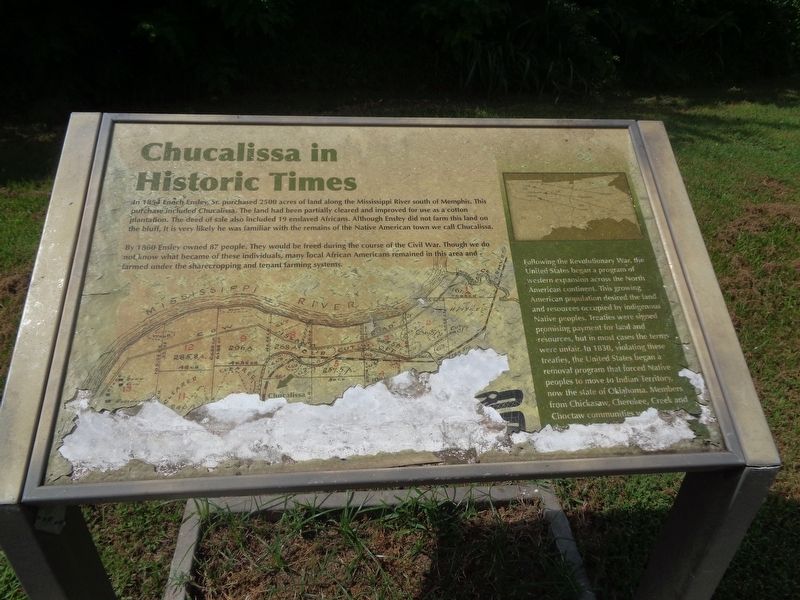
Chucalissa in Historic Times
Photographed by Jason Voigt, August 1, 2024
1. Chucalissa in Historic Times Marker
In 1854 Enoch Ensley, Sr. purchased 2500 acres of land along the Mississippi River south of Memphis. This purchase included Chucalissa. The land had been partially cleared and improved for use as a cotton plantation. The deed of sale also included 19 enslaved Africans. Although Ensley did not farm this land on the bluff, it is very likely he was familiar with the remains of the Native American town we call Chucalissa.
By 1860 Ensley owned 87 people. They would be freed during the course of the Civil War. Though we do not know what became of these individuals, many local African Americans remained in this area and farmed under the sharecropping and tenant farming systems.
(aside:)
Following the Revolutionary War, the United States began a program of western expansion across the North American continent. This growing American population desired the land and resources occupied by indigenous Native peoples. Treaties were signed promising payment for land and resources, but in most cases the terms were unfair. In 1830, violating these treaties, the United States began a removal program that forced Native peoples
this page online
Erected by C.H. Nash Museum, Chucalissa, the University of Memphis.
Topics. This historical marker is listed in these topic lists: African Americans • Agriculture • Indigenous Peoples and Communities. A significant historical year for this entry is 1854.
Location. 35° 3.796′ N, 90° 7.852′ W. Marker is in Memphis, Tennessee, in Shelby County. It can be reached from Indian Village Drive. Marker is on the grounds of Chucalissa site, on a walking path in the reconstructed area. Touch for map. Marker is at or near this postal address: 1987 Indian Village Dr, Memphis TN 38109, United States of America. Touch for directions.

Regionally, this marker is in West Tennessee. It is also in the American South, specifically in the Deep South, in the Upper South, in the Mississippi Delta, and in the Great River Road Region. Globally, it is in North America, the Western Hemisphere, the Western World, and the Anglosphere. Historically, it finds itself in what was once the

Photographed by Jason Voigt, August 1, 2024
2. Chucalissa in Historic Times Marker
Other nearby markers. At least 8 other markers are within walking distance of this marker: Platform Mound (within shouting distance of this marker); Building Mounds (within shouting distance of this marker); Mississippian Mounds (within shouting distance of this marker); Gardening (within shouting distance of this marker); The Central Plaza (within shouting distance of this marker); Plant Use in the Southeast (about 300 feet away, measured in a direct line); Mississippian House Life (about 300 feet away); Welcome to Chucalissa (about 300 feet away). Touch for a list and map of all markers in Memphis.
Credits. This page was last revised on July 21, 2025. It was originally submitted on August 14, 2024, by Jason Voigt of Glen Carbon, Illinois. This page has been viewed 430 times since then and 69 times this year. Photos: 1, 2. submitted on August 14, 2024, by Jason Voigt of Glen Carbon, Illinois.
