
Near Winchester in Frederick County, Virginia — The American South (Mid-Atlantic)
War in the Backyard
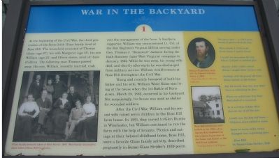
Photographed by Craig Swain, August 26, 2007
1. War in the Backyard Marker
A Virtual Tout of the Battle of Kernstown by HMDb markers:
Click for more information.
Click for more information.
At the beginning of the Civil War, the third generation of the Scots-Irish Glass family lived at Rose Hill. The household consisted of Thomas Glass (age 67), and his wife Margaret (age 51), his son William (age 25) and fifteen slaves, most of them children. The following year Thomas passed away. His son, William, recently married, took over the management of the farm. A Southern supporter, William was commissioned Lt. Col. of the 51st Regiment Virginia Militia serving under Gen. Thomas J. "Stonewall" Jackson during the Bath-Rommey (later West Virginia) campaign in January, 1862. While he was away, his young wife died, and shortly afterwards he was discharged from military service. William would remain at Rose Hill throughout the Civil War.
Young and recently bereaved of both his father and his wife, William Wood Glass was living at the house when the 1st Battle of Kernstown, March 23, 1862, occurred in his backyard. Not surprisingly, his house was used as a shelter for wounded soldiers.
After the Civil War, William and his second wife raised seven children in the Rose Hill farm house. In 1885, they moved to Glen Burnie
this page online
The way is fair - a ride I pray,(Marker Number 1.)
October's glories deck the day
The answer I, O let us go
To the home I used to know!
I would see once more the tree
Where I played in childish glee.
Had for dolls a little school
Where I taught them many a rule.
Faithful still the grand old trees --
Honey locusts in the breeze.
But the brook, how low, how slow!
Once so rollicking its flow.
Where we sailed our tiny boat
Half shell of a cocoanut.
In it sat Miss Golden Hair
Fairest one of all the fair.
Lonely now the fine old home --
Children seven called to roam.
Some so many miles away;
Youngest now is growing grey.
-Rose Hill
by Susan Glass Strider, 1939.
Topics. This historical marker is listed in this topic list: War, US Civil. A significant historical month for this entry is January 1862.
Location. Marker has been permanently removed. It was located near 39° 9.102′ N, 78° 13.189′ W. Marker was near Winchester, Virginia, in
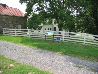
Photographed by Craig Swain, August 26, 2007
2. Walking Tour Stop One for Rose Hill
Note Rose Hill standing in the background behind the fence.
We have been informed that this marker is no longer there and will not be replaced. This page is an archival view of what was.
Regionally, this marker was in Virginia’s Shenandoah Valley. It was also in the American South, specifically in the Upper South, and in the Mid-Atlantic. Globally, it was in North America, the Western Hemisphere, the Western World, and the Anglosphere. Historically, it found itself in what was once the territory of the Mississippian Culture, one of the original Thirteen Colonies, one of the Confederate States of America, and the Antebellum South.

Other nearby markers. At least 8 other markers are within walking distance of this location: War In The Backyard (within shouting distance of this marker); a different marker also named Rose Hill (about 500 feet away); The First Battle Of Kernstown (about 600 feet away); Fight for the High Ground (about 600 feet away);
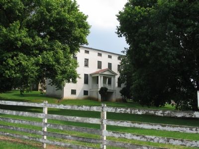
Photographed by Craig Swain, August 26, 2007
3. Rose Hill
Other markers no longer nearby. How To See the Battlefield (was a few steps from this marker but has been permanently removed); Rose Hill (was about 300 feet away, measured in a direct line but has been replaced with another marker now near it); a different marker also named Northern Victory, Southern Defeat (was approx. 0.2 miles away but has been replaced with another marker now near it); a different marker also named The Defense of the Stone Wall (was approx. ¼ mile away but has been replaced with another marker now near it); The Order for Retreat (was approx. 0.3 miles away but has been replaced with another marker now near it).
More about this marker. On the lower left side of the marker is a "Glass family portrait taken at Glen Burnie, 1895. This family returned to their beloved Rose Hill for picnics." Next to the poem on the right is a portrait
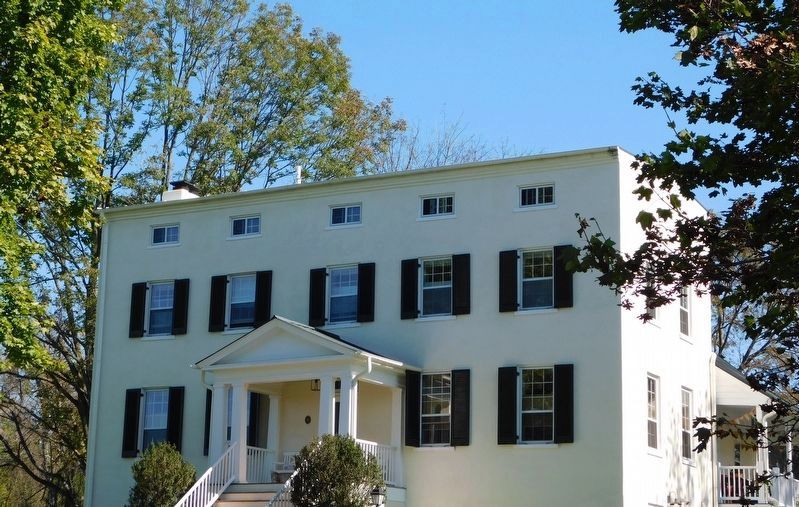
Photographed by Bradley Owen, October 18, 2017
4. The Rose Hill Farm House
Related markers. Click here for a list of markers that are related to this marker.
Also see . . .
1. Rose Hill Farm. Virginia Department of Historic Resources website entry (Submitted on November 12, 2007, by Craig Swain of Leesburg, Virginia.)
2. Rose Hill Park. Museum of the Shenandoah website entry (Submitted on November 12, 2007, by Craig Swain of Leesburg, Virginia.)
3. Battle of First Kernstown Summary. The action around Rose Hill is discussed in phase three of this National Parks Service battle summary. (Submitted on November 12, 2007, by Craig Swain of Leesburg, Virginia.)
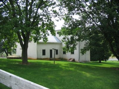
Photographed by Craig Swain, August 26, 2007
5. Rear of Rose Hill
As seen on the photo on the marker, the east facing wing off the main house is a portion of the original log structure.
Credits. This page was last revised on August 15, 2024. It was originally submitted on November 12, 2007, by Craig Swain of Leesburg, Virginia. This page has been viewed 2,180 times since then and 26 times this year. Last updated on August 15, 2024, by Carl Gordon Moore Jr. of North East, Maryland. Photos: 1, 2, 3. submitted on November 12, 2007, by Craig Swain of Leesburg, Virginia. 4. submitted on April 3, 2021, by Bradley Owen of Morgantown, West Virginia. 5. submitted on November 12, 2007, by Craig Swain of Leesburg, Virginia. • Devry Becker Jones was the editor who published this page.
