Rostraver Township near Smithton in Westmoreland County, Pennsylvania — The American Northeast (Mid-Atlantic)
Col. George Crogan (Circa 1718 - 1782)

Photographed by Bradley Owen, July 27, 2024
1. Col. George Crogan (Circa 1718 - 1782) Marker
A large portion of the primary marker is illegible.
(Marker Illegible)
. . .
Croghan organized and led the Ohio Confederation at Logstown that Pennsylvania recognized as independent of the six nations and appointed Croghan its colonial agent a few days bitore Celeron's 1749 expedition reached Logstown. Croghan purchased his 200,000 acres from the Iroquois, later learning that the deeds would be void if in Pennsylvania.
He and Andrew Montour guided Virginia's Ohio company scout Christopher Gist in 1750 and arranged his 1752 Logstown treaty. Pennsylvania plans for a fort at the forks of the Ohio has been abandoned in 1751 when Montour testified that the Indians did not want it. Virginia's 1754 stockade was commanded by Croghan's business partner William Trent and surrendered by his brother Edward Ward.
A captain in charged of the Indians under Col. Washington, then under Gen. Braddock, Croghan could do little to capture Fort Duquesne, but William Johnson's deputy Indian agent in 1758 hurried from facilitating the Easton Treaty to his Indian scouts. At the head of Gen. Forbes column for its fall ... worked with Col. Bouquet and built the first Lawrenceville Croghan
this page online
(Marker Illegible)
(Ground Level Marker):
Corrections
Paragraph 1: 2nd word in 3rd sentence, "purchasers." omitted, and Delawares" is misspelled in last sentence.
Paragraph 3: "has" should be "had" in the second sentence.
Paragraph 4: "charge" for "charged" as the 4th word.
Paragraph 5: "governor" for "govenor" as the last word.
Paragraph 6: "prefer" for "perfer" in the first sentence.
Erected 2012 by Monessen Historical Society and Rostraver Township Historical Society.
Topics. This historical marker is listed in these topic lists: Forts and Castles • Indigenous Peoples and Communities • War, French and Indian • War, US Revolutionary. A significant historical year for this entry is 1749.
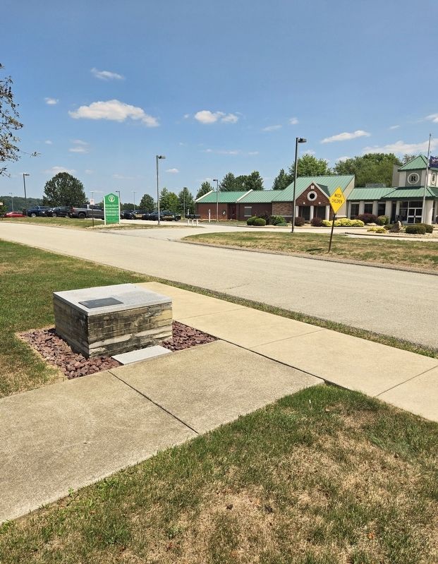
Location. 40° 9.891′ N, 79° 46.466′ W. Marker is near Smithton, Pennsylvania, in Westmoreland County. It is in Rostraver Township. It is on Recreation Drive north of Municipal Drive, on the left when traveling north. Touch for map. Marker is

Photographed by Bradley Owen, July 27, 2024
2. Ground Level Corrections Marker

Regionally, this marker is in the Laurel Highlands and in Greater Pittsburgh. It is also in the American Northeast, in the Mid-Atlantic, in Appalachia, and specifically in Northern Appalachia. Globally, it is in North America, the Western Hemisphere, the Western World, and the Anglosphere. Historically, it finds itself in what was once the Viceroyalty of New France, the Haudenosaunee (Iroquois) Confederacy, and one of the original Thirteen Colonies.
Other nearby markers. At least 8 other markers are within 2 miles of this marker, measured as the crow flies: Rostraver Veterans Memorial (within shouting distance of this marker); M102 Howitzer (within shouting distance of this marker); Cedar Creek Mill (approx. 0.7 miles away); Greenwood Homestead circa 1893 (approx. 0.8 miles away); Saw Mill (approx. one mile away); Darr Mine Disaster (approx. 1.2 miles away); Smithton Veterans Memorial (approx. 1.8 miles away); Veterans Memorial (approx. 1.8 miles away). Touch for a list and map of all markers in
Photographed by Bradley Owen, July 27, 2024
3. Col. George Crogan (Circa 1718 - 1782) Marker
Regarding Col. George Crogan (Circa 1718 - 1782). Marker includes a map of the Pittsburgh, Pa. region with the following key:
Croghan's Logstown purchases Aug. 2, 1749
1. 100.00 acres
2. 60.00 acres (flexible)
3. 40,000 acres
Inset - Land excluded for British fort at Forks of the Ohio
A large amount of the text on the marker is unreadable and the Rostraver Township Historical Society has been contacted in an attempt to collect the correct text.
Credits. This page was last revised on August 16, 2024. It was originally submitted on August 16, 2024, by Bradley Owen of Morgantown, West Virginia. This page has been viewed 280 times since then and 26 times this year. Photos: 1, 2, 3. submitted on August 16, 2024, by Bradley Owen of Morgantown, West Virginia.
