
Almonte in Lanark County, Ontario — Central Canada (North America)
Sir William E. Logan and the Geology of Canada
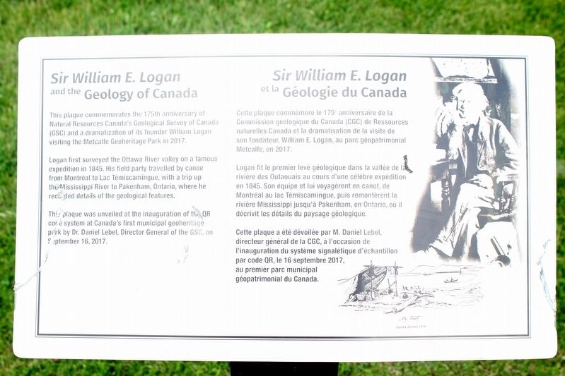
Photographed by Robert Rusaw, July 4, 2024
1. Sir William E. Logan Marker

This plaque commemorates the 175th anniversary of Natural Resources Canada's Geological Survey of Canada (GSC) and a dramatization of its founder William Logan visiting the Metcalfe Geoheritage Park in 2017.
Logan first surveyed the Ottawa River valley on a famous expedition in 1845. His field party travelled by canoe from Montréal to Lac Témiscamingue, with a trip up the Mississippi River to Pakenham, Ontario, where he recorded details of the geological features.
This plaque was unveiled at the inauguration of the QR code system at Canada's first municipal geoheritage park by Dr. Daniel Lebel, Director General of the GSC, on September 16, 2017.
Cette plaque commemore le 175 anniversaire de la Commission géologique du Canada (CGC) de Ressources naturelles Canada et la dramatisation de la visite de son fondateur, William E. Logan, au parc géopatrimonial Metcalfe, en 2017.
Logan fit le premier levé géologique dans la vallée de la rivière des Outaouais au cours d'une célèbre expédition en 1845.
this page online
Cette plaque a été dévoilée par M. Daniel Lebel, directeur général de la CGC, à l'occasion de l'inauguration du système signalétique d'échantillon par code QR, le 16 septembre 2017, au premier parc municipal géopatrimonial du Canada.
Erected 2017.
Topics. This historical marker is listed in these topic lists: Exploration • Parks & Recreational Areas • Science & Medicine. A significant historical year for this entry is 1845.
Location. 45° 13.434′ N, 76° 11.996′ W. Marker is in Almonte, Ontario, in Lanark County. It is on Almonte Street, on the left when traveling north. This marker is located in the Metcalfe Geoheritage Park. Touch for map. Touch for directions.

Regionally, this marker is in the Haliburton Highlands to Ottawa Valley and in Eastern Ontario. It is also in Central Canada. Globally, it is in North America, the Western Hemisphere, the Western World, and the Anglosphere. Historically, it finds itself in what was once a British colony, the Viceroyalty of New France, the Haudenosaunee (Iroquois) Confederacy, and Rupert’s Land.
Other nearby markers. At least 8 other markers are within 5 kilometers of this marker, measured as the crow flies: The Rosamonds in Almonte (about 240 meters away, measured in a direct line); Mississippi River Improvement Company (approx. 0.3 kilometers away); Former Almonte Post Office (approx. 0.4 kilometers away); The Founding of Almonte (approx. half a kilometer away); "Auld Kirk" 1836 (approx. 2 kilometers away); Dr. James Naismith (approx. 3.2 kilometers away); Robert Tait McKenzie (approx. 4.8 kilometers away); The Mill of Kintail and Robert Tait McKenzie (approx. 4.9 kilometers away). Touch for a list and map of all markers in Almonte.
Credits. This page was last revised on August 30, 2024. It was originally submitted on August 17, 2024, by Robert Rusaw of Massena, New York. This page has been viewed 222 times since then and 35 times this year. Photo 1. submitted on August 17, 2024, by Robert Rusaw of Massena, New York. • Andrew Ruppenstein was the editor who published this page.
Editor’s want-list for this marker. photo of the marker within its surroundings • Can you help?
