Remington in Fauquier County, Virginia — The American South (Mid-Atlantic)
Martin's Grist Mill
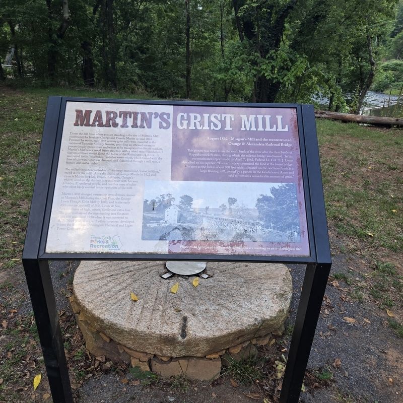
Photographed by Mike McKeown, August 17, 2024
1. Martin's Grist Mill Marker
Down the hill from where you are standing is the site of Martin's Mill constructed by brothers George and Francis Martin around 1804. Powered by water, early 19th century grist mills were essential to the success of Fauquier County farmers, providing an efficient means to process locally grown corn and wheat to be transported to distant markets. Martin's Mill was a wood frame structure with a raised stone foundation that stood three stories along the banks of the Rappahannock River. It was noted for its "undershot," interior water wheel, which turned with the flow of the water that was dammed and channeled through a mill race, a feature still visible today.
The miller's house, described as a "two story, metal roof, frame building," stood above the mill. After the deaths of George Martin in 1822 and Francis Martin 1824, Elizabeth Martin, George's widow, lived on the thirteen acre mill tract with her son Charles, 31 enslaved people, and one free man of color who most likely assisted in the operation of the mill.
Martin's Mill changed ownership several times, known as Morgan's Mill during the Civil War, the George
this page online
(sidebar)
August 1862 - Morgan's Mill and the reconstructed Orange & Alexandria Railroad Bridge
This picture was taken from the south bank of the river after the first Battle of Rappahannock Station, during which the railroad bridge was burned. In his reconnaissance report made on April 7, 1862, Federal Lt. Col. T. J. Lucas described to his superior, "The earthworks command the ford at the burnt bridge. The river at the ford is about 300 feet wide...situated on the northeast bank is a large flouring mill, owned by a person in the Confederate Army and said to contain a considerable amount of grain."
Please tread lightly and with consideration. You are walking on an archaeological site.
Erected by Fauquier County Parks & Recreation.
Topics.

Photographed by Mike McKeown, August 2, 2025
2. Martin's Grist Mill Marker
marker at a distance
Location. 38° 31.736′ N, 77° 48.739′ W. Marker is in Remington, Virginia, in Fauquier County. It can be reached from River Road 0.2 miles south of James Madison Street (Business U.S. 15). Located at the Rector Tract kayak/canoe launch site. Touch for map. Marker is at or near this postal address: 12233 River Rd, Remington VA 22734, United States of America. Touch for directions.

Regionally, this marker is in the Washington Metropolitan Area and in Northern Virginia. It is also in the American South, specifically in the Upper South, and in the Mid-Atlantic. Globally, it is in North America, the Western Hemisphere, the Western World, and the Anglosphere. Historically, it finds itself in what was once the territory of the Mississippian Culture, one of the original Thirteen Colonies, one of the Confederate States of America, and the Antebellum South.
Other nearby markers. At least 8 other markers are within

Photographed by Evan Dwyer, February 16, 2026
3. Martin's Grist Mill
The ruins of the mill are visible by the boat ramp during fall and winter. The trench is the millrace that powered the undershot water wheel, mentioned in the marker.
Other markers no longer nearby. Rappahannock Station (was approx. ¼ mile away but has been replaced with another marker now near it); The Battle of Brandy Station (was approx. 2½ miles away but has been permanently removed).
Also see . . .
1. Rector Tract Canoe/Kayak Launch. Fauquier County Parks & Recreation (Submitted on August 19, 2024.)
2. First Battle of Rappahannock Station. Wikipedia (Submitted on August 19, 2024.)
Credits. This page was last revised on March 30, 2026. It was originally submitted on August 19, 2024, by Mike McKeown of Baltimore, Maryland. This page has been viewed 668 times since then and 65 times this year. Photos: 1. submitted on August 19, 2024, by Mike McKeown of Baltimore, Maryland. 2. submitted on August 2, 2025, by Mike McKeown of Baltimore, Maryland. 3. submitted on March 19, 2026, by Evan Dwyer of Richmond, Virginia. • Bernard Fisher was the editor who published this page.
