Palmer in Matanuska-Susitna Borough, Alaska — Northwest (North America)
Land of Giants
Photographed by William Fischer, Jr., August 12, 2024
1. Land of Giants Marker
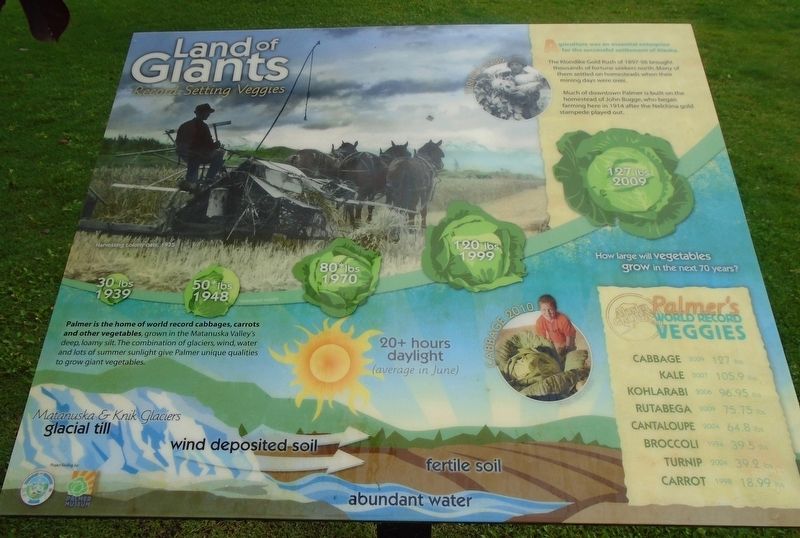
Agriculture was an essential enterprise for the successful settlement of Alaska.
The Klondike Gold Rush of 1897-98 brought thousands of fortune seekers north. Many of them settled on homesteads when their mining days were over.
Much of downtown Palmer is built on the homestead of John Bugge, who began farming here in 1914 after the Nelchina gold stampede played out.
Palmer is the home of world record cabbages, carrots and other vegetables, grown in the Matanuska Valley's deep, loamy silt. The combination of glaciers, wind, water and lots of summer sunlight give Palmer unique qualities to grow giant vegetables.
[Top left photo caption reads] Harvesting colony oats, 1935
[Top center inset photo caption reads] Turnips 1939
[Cabbage timeline reads]
30 lbs 1939 • 50* lbs 1948 • 80* lbs 1970 • 120 lbs 1999 • 127 lbs 2009
How large will vegetables grow in the next 70 years?
[Why the veggies grow so big]
Matanuska & Knik Glaciers glacial till • wind deposited soil • abundant water • fertile soil • 20+ hours daylight (average in June)
[Bottom center inset photo caption reads] Cabbage 2010
Palmer's World Record Veggies
Cabbage
this page online
Kale · 2007 · 105.9 lbs
Kohlarabi · 2006 · 96.95 lbs
Rutabega · 2009 · 75.75 lbs
Cantaloupe · 2004 · 64.8 lbs
Broccoli · 1994 · 39.5 lbs
Turnip · 2004 · 39.2 lbs
Carrot · 1998 · 18.99 lbs
Erected by Palmer Museum and Matanuska Susitna Borough.
Topics. This historical marker is listed in these topic lists: Agriculture • Environment • Settlements & Settlers. A significant historical year for this entry is 1914.
Location. 61° 35.903′ N, 149° 6.794′ W. Marker is in Palmer, Alaska, in Matanuska-Susitna Borough. It is on South Valley Way south of Elmwood Avenue, on the left when traveling south. Marker is on the Palmer Visitor Information Center grounds. Touch for map. Marker is in this post office area: Palmer AK 99645, United States of America. Touch for directions.

Regionally, this marker is in the Alaska Railroad Corridor, in the Athabascan Region, in the Mat-Su Valley, and in Southcentral Alaska. It is also on the American Pacific Coast. Globally, it is in North America, on the Pacific Rim, in the Western Hemisphere, in the Western World, and in the Anglosphere. Historically, it finds
Photographed by William Fischer, Jr., August 12, 2024
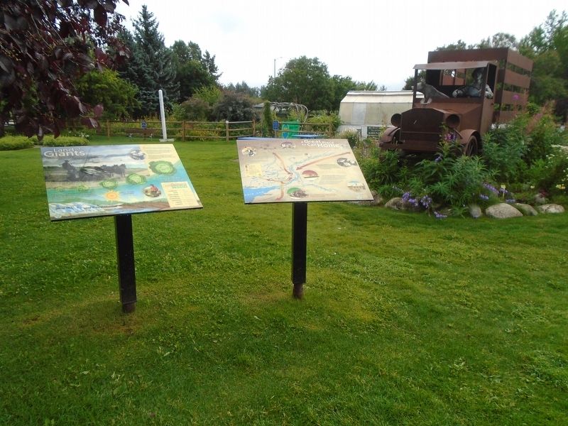
2. Land of Giants Marker
Other nearby markers. At least 8 other markers are within walking distance of this marker: a Great Place to Call Home (here, next to this marker); Welcome to the Cabbage Patch (a few steps from this marker); "Mat-Su Giants" (a few steps from this marker); a little town with BIG PLANS (a few steps from this marker); Balto (within shouting distance of this marker); Saroma-Cho, Japan and Palmer, Alaska (within shouting distance of this marker); Matanuska Colony Project (about 400 feet away, measured in a direct line); a different marker also named Matanuska Colony Project (about 400 feet away). Touch for a list and map of all markers in Palmer.
Also see . . . The Farming Colony That Grew Under the Midnight Sun. Atlas Obscura website entry (Submitted on August 19, 2024, by William Fischer, Jr. of Reynoldsburg, Ohio.)
Photographed by William Fischer, Jr., August 12, 2024
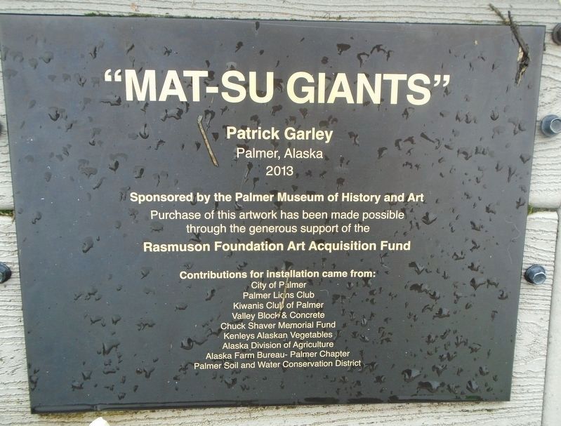
3. "Mat-Su Giants" Marker
Palmer, Alaska 2013

Photographed by William Fischer, Jr., August 12, 2024
4. "Mat-Su Giants" Sculpture
Photographed by William Fischer, Jr., August 12, 2024
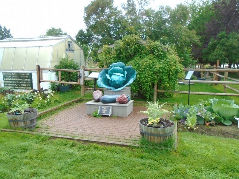
5. "Mat-Su Giants" Sculpture

Photographed by William Fischer, Jr., August 12, 2024
6. Giant Cabbage in the Cabbage Patch
Credits. This page was last revised on October 24, 2024. It was originally submitted on August 19, 2024, by William Fischer, Jr. of Reynoldsburg, Ohio. This page has been viewed 233 times since then and 45 times this year. Photos: 1, 2, 3, 4, 5, 6. submitted on August 19, 2024, by William Fischer, Jr. of Reynoldsburg, Ohio.
