Artesia in Eddy County, New Mexico — The American Mountains (Southwest)
The Goodnight-Loving Trail

Photographed by James Hulse, July 24, 2024
1. The Goodnight-Loving Trail Marker
this page online
Lonesome Dove
The fictional fate of Augustus McCrae was that, in real life, of Oliver Loving. As history states in 1867, on the third Goodnight-Loving cattle drive, Loving and another cowboy were ahead of the herd when they were ambushed by a group of Comanche Indians about 40 miles south of here, near the present day town of Loving. Oliver Loving was wounded and sent his partner to retrieve Goodnight, who was about seventy miles further down the Pecos with the herd. Goodnight arrived days later at the ambush site with no sign of Loving. Goodnight then rode up the

Photographed by James Hulse, July 24, 2024
2. The Goodnight-Loving Trail Marker
The marker is the left marker of the two markers.
Topics. This historical marker is listed in these topic lists: Animals • Indigenous Peoples and Communities • Industry & Commerce • Roads & Vehicles. A significant historical month for this entry is June 1866.
Location. 32° 50.553′ N, 104° 23.844′ W. Marker is in Artesia, New Mexico, in Eddy County. It is at the intersection of North 1st Street (U.S. 285) and East Main Street (U.S. 82), on the right when traveling north on North 1st Street. The marker is located along the base of the Trail Boss statue. Touch for map. Marker is at or near this postal address: 101 N 1st St, Artesia NM 88210, United States of America. Touch for directions.

Regionally, this marker is in the Pecos Valley. It is also in the American Southwest, on the Great Plains, on the Southern Plains, and specifically on the High Plains. Globally, it is in North America, the Western Hemisphere, the Western World, and the Anglosphere. Historically, it finds itself in what was once New Spain, the Comanchería, and the Republic of Texas.
Other nearby markers. At least 8 other markers are within walking distance of this marker: The Cattle Drive (here, next to this marker); Independent Spirit (here, next to this marker); The Cowboy's Gear (here, next to this marker); Ranchers' Brands (a few steps from this marker); Welcome to Artesia (within shouting distance of this marker); El Vaquero (about 500 feet away, measured in a direct line); First Lady of Artesia (about 700 feet away); The Baskin Building (approx. 0.2 miles away). Touch for a list and map of all markers in Artesia.
More about this marker.
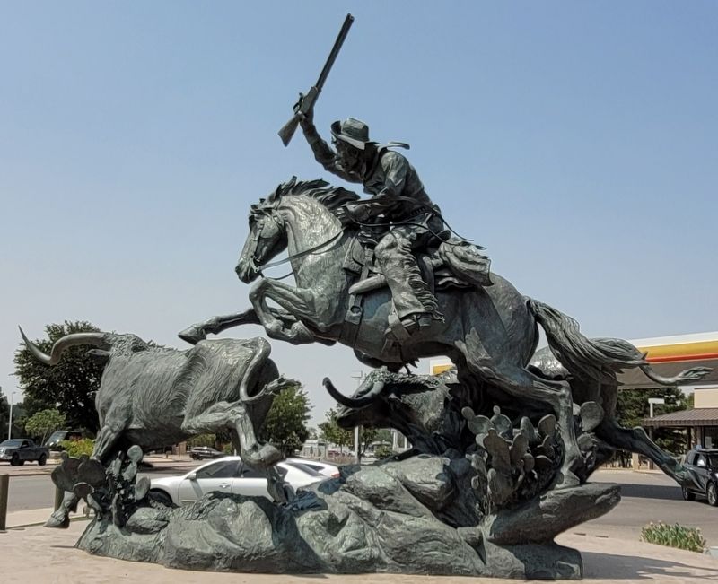
Photographed by James Hulse, July 24, 2024
3. The side view of the Trail Boss statue
Credits. This page was last revised on August 20, 2024. It was originally submitted on August 19, 2024, by James Hulse of Medina, Texas. This page has been viewed 1,055 times since then and 168 times this year. Photos: 1, 2, 3. submitted on August 20, 2024, by James Hulse of Medina, Texas.
