Split Rock Lighthouse State Park near Beaver Bay in Lake County, Minnesota — The American Midwest (Upper Plains)
Tramway
Photographed by Cosmos Mariner, June 24, 2024
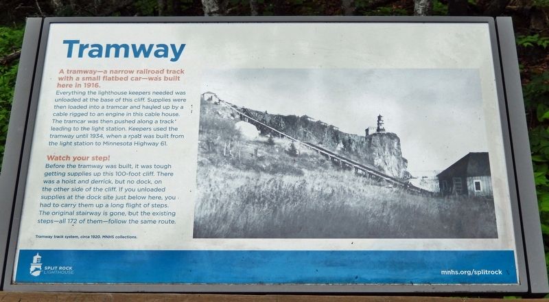
1. Tramway Marker
A tramway — a narrow railroad track with a small flatbed car — was built here in 1916.
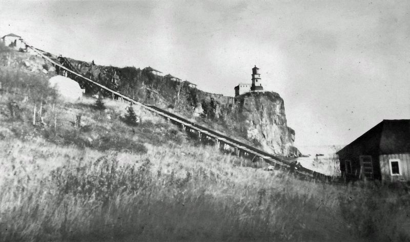
Everything the lighthouse keepers needed was unloaded at the base of this cliff. Supplies were then loaded into a tramcar and hauled up by a cable rigged to an engine in this cable house. The tramcar was then pushed along a track leading to the light station. Keepers used the tramway until 1934, when a road was built from the light station to Minnesota Highway 61.
Watch your step!
Before the tramway was built, it was tough getting supplies up this 100-foot cliff. There was a hoist and derrick, but no dock, on the other side of the cliff. If you unloaded supplies at the dock site just below here, you had to carry them up a long flight of steps. The original stairway is gone, but the existing steps — all 172 of them — follow the same route.
Erected by Minnesota Historical Society.
Topics and series. This historical marker is listed in these topic lists: Industry & Commerce • Railroads & Streetcars • Roads & Vehicles • Waterways & Vessels. In addition, it is included in the Lighthouses series list. A significant historical year for this entry is 1916.
Location. 47° 12.017′ N,
this page online

Regionally, this marker is in the Arrowhead Region, in the Iron Range, and in the North Shore. It is also in the American Midwest and in the Corn Belt. Globally, it is in North America, in the Great North Woods, on the Great Lakes, on Lake Superior’s North Shore, in the Western Hemisphere, in the Western World, and in the Anglosphere. Historically, it finds itself in what was once the Viceroyalty of New France, Rupert’s Land, the territory of the Mississippian Culture, and the Northwest Territory.
Other nearby markers. At least 8 other markers are within walking distance of this marker: Dock Site and Pumphouse (within
Minnesota Historical Society Collections
2. Marker detail: Tramway Track System, circa 1920
Also see . . . Split Rock Lighthouse: Early History.
Excerpt: The site ultimately selected for the lighthouse and fog signal was 2.5 miles northeast of the Split Rock River, on Stony Point. There were no roads yet up the North Shore, so all construction materials were brought in by barge and hoisted up the cliff with a derrick and a steam-powered hoist. By midsummer 1910 work was complete on the lighthouse, foghorn building, and three houses for the lighthouse keepers.(Submitted on August 21, 2024, by Cosmos Mariner of Cape Canaveral, Florida.)The derrick remained the only way to bring supplies up the cliff until the lighthouse staff built a tramway in 1915–16. The station finally became accessible by a road, now Minnesota State Highway 61, completed in 1929. Five years later a crew from the Civilian Conservation Corps
built a new access road and lighthouse tenders were provided with a truck to bring in supplies by land, so the tramway was dismantled.Photographed by Cosmos Mariner, June 24, 20243. Tramway MarkerThe marker is mounted on the beach access staircase, at a landing about midway between the lighthouse and the shore.

Photographed by Cosmos Mariner, June 24, 2024
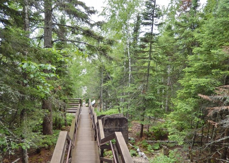
4. Beach Access Staircase (looking down)
The marker is mounted on the staircase, about halfway down on the right side. Some concrete tramway pylon ruins are visible on the right side of the staircase.

Photographed by Cosmos Mariner, June 24, 2024
5. Tramway Cable House
Located at the top of the tramway, at roughly the level of the various Split Rock Lighthouse outbuildings. It is surrounded by concrete pylon and tramway support ruins.

Photographed by Cosmos Mariner, June 24, 2024
6. Beach Access Staircase (looking up from near the shore)
Tramway pylon ruins are visible along the left side of the staircase.
Credits. This page was last revised on August 12, 2026. It was originally submitted on August 20, 2024, by Cosmos Mariner of Cape Canaveral, Florida. This page has been viewed 167 times since then and 14 times this year. Photos: 1, 2, 3, 4. submitted on August 20, 2024, by Cosmos Mariner of Cape Canaveral, Florida. 5, 6. submitted on August 21, 2024, by Cosmos Mariner of Cape Canaveral, Florida.
