Chico in Wise County, Texas — The American South (West South Central)
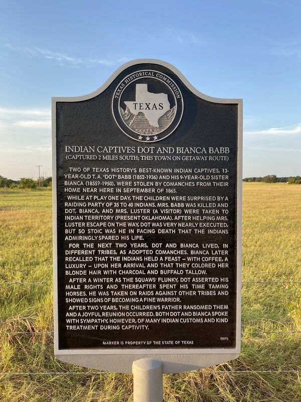
Indian Captives Dot and Bianca Babb
(Captured 2 Miles South; This Town On Getaway Route)
Photographed by Morgan Petermann, August 24, 2024
1. Indian Captives Dot and Bianca Babb Marker
Two of Texas history's best-known Indian captives, 13-year-old T.A. "Dot" Babb (1852-1936) and his 9-year-old sister Bianca (1855?-1950) were stolen by Comanches from their home near here in September of 1865.
While at play one day, the children were surprised by a raiding party of 35 to 40 Indians. Mrs. Babb was killed and Dot, Bianca, and Mrs. Luster (a visitor) were taken to Indian Territory (present Oklahoma). After helping Mrs. Luster escape on the way, Dot was very nearly executed, but so stoic was he in facing death that the Indians admiringly spared his life.
For the next two years Dot and Bianca lived, in different tribes, as adopted Comanches. Bianca later recalled that the Indians held a feast - with coffee, a luxury - upon her arrival and that they colored her blonde hair with charcoal and buffalo tallow.
After a winter as the squaws' flunky, Dot asserted his male rights and thereafter spent his time taming horses. He was taken on raids against other tribes and showed signs of becoming a fine warrior.
After two years, the children's father ransomed them and a joyful reunion occurred. Both Dot
this page online
Erected 1971 by Texas Historical Commission. (Marker Number 2632.)
Topics. This historical marker is listed in these topic lists: Indigenous Peoples and Communities • Wars, US Indian. A significant historical month for this entry is September 1865.
Location. 33° 17.46′ N, 97° 45.562′ W. Marker is in Chico, Texas, in Wise County. It is on Farm to Market Road 1810 near County Route 1340, on the right when traveling east. Touch for map. Marker is at or near this postal address: 5396 FM1810, Chico TX 76431, United States of America. Touch for directions.

Regionally, this marker is in the Prairies & Lakes Region and in the Dallas-Fort Worth Metropolitan Area. Globally, it is in North America, a Gulf of Mexico state, the Western Hemisphere, the Western World, and the Anglosphere. Historically, it finds itself in what was once New Spain, the Republic of Texas, and one of the Confederate States of America.
Other nearby markers. At least 8 other markers are within 5 miles of this marker, measured as the crow flies: Brown Hotel (approx.

Photographed by Morgan Petermann, August 24, 2024
2. Indian Captives Dot and Bianca Babb Marker

Press of John F. Worley printing co. [Courtesy Library of Congress], circa 1912
3. T.A. Babb
This image is from In the Bosom of the Comanches, available in its entirety from Library of Congress.
Click for more information.
Click for more information.
Credits. This page was last revised on February 1, 2026. It was originally submitted on August 24, 2024, by Morgan Petermann of Hurst, Texas. This page has been viewed 2,543 times since then and 1,050 times this year. Photos: 1, 2. submitted on August 24, 2024, by Morgan Petermann of Hurst, Texas. 3. submitted on February 1, 2026, by Devry Becker Jones of Washington, District of Columbia. • James Hulse was the editor who published this page.
