Richmond in Ottawa, Ontario — Central Canada (North America)
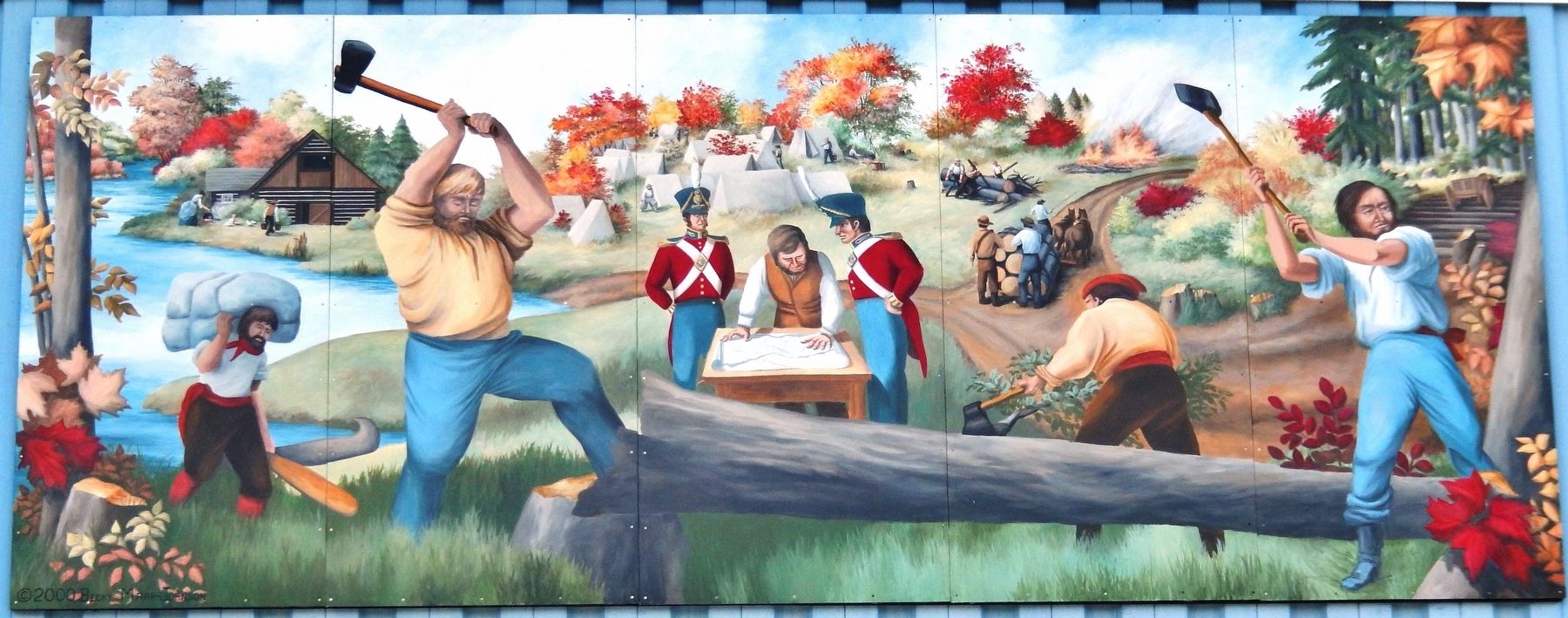
Breaking Through to the Jock River
A monumental task accomplished by truly remarkable people.
| — | Richmond Heritage Mural Gallery | — |

Photographed by Cosmos Mariner, May 29, 2024
1. Breaking Through to the Jock River Marker
Erected 2000 by Richmond Village Association. (Marker Number 1.)
Topics. This historical marker is listed in these topic lists: Roads & Vehicles •
this page online
Location. 45° 11.741′ N, 75° 50.252′ W. Marker is in Ottawa, Ontario. It is in Richmond. It is on Huntley Road just north of Perth Street, on the left when traveling north. The marker and mural are mounted high on the east facade of the Richmond Memorial Community Centre. Touch for map. Marker is at or near this postal address: 6095 Perth Street, Ottawa ON K0A 2Z0, Canada. Touch for directions.

Regionally, this marker is in Eastern Ontario. It is also in Central Canada. Globally, it is in North America, the Western Hemisphere, the Western World, and the Anglosphere. Historically, it finds itself in what was once a British colony, the Viceroyalty of New France, the Haudenosaunee (Iroquois) Confederacy, and Rupert’s Land.
Other nearby markers. At least 8 other markers are within 11 kilometers of this marker, measured as the crow flies: Richmond Settlement 1825 (a few steps from this marker); Richmond Military Settlement (within shouting distance of this marker); County of Carleton/Richmond Agricultural Society (within shouting

Photographed by Cosmos Mariner, May 29, 2024
2. Breaking Through to the Jock River Marker
Looking west from Huntley Road; the marker and mural are mounted high on the east facade of the Richmond Memorial Community Centre.
Related markers. Click here for a list of markers that are related to this marker. Richmond Heritage Mural Gallery
Also see . . . History of Richmond (by William McElroy).
Excerpt: After the final defeat of Bonaparte at Waterloo (June 18, 1815) and the treaty of peace between Great Britain and the United States, a number of British regiments were about to be sent home to England to be paid off and disbanded. In the spring of 1818 the officers and men had their choice of a passage home or, if they so elected, to remain in Canada where they would receive free grants of land in the new country to be settled on the Ottawa and Rideau rivers. They embarked on the Ottawa River late in the month of August arrived at the foot of the Chaudière Falls at a place which they(Submitted on August 24, 2024, by Cosmos Mariner of Cape Canaveral, Florida.)named Richmond Landing. Tents were pitched and families made as comfortable as possible, while the men went forward to cut out the road to their new homes. The road which is still known as "the Richmond Road", bordered along the high ground near the Ottawa River till it reached Bell's Corners (then known as Steele's Tavern). From there it struck southwesterly to Chapman's on the Jock River, and thence along the river, more or less, to the site of the village. A number of French habitants had been engaged to assist in erecting houses, which work had to be hurriedly done as the long winter was fast approaching, and it was Christmas before all were safely housed in their new homes.Photographed by Cosmos Mariner, May 29, 20243. Breaking Through to the Jock River MuralDesigned and painted by Becky Marr-Johnson of North Gower, Ontario.
Credits. This page was last revised on September 26, 2026. It was originally submitted on August 24, 2024, by Cosmos Mariner of Cape Canaveral, Florida. This page has been viewed 633 times since then and 49 times this year. Photos: 1, 2, 3. submitted on August 24, 2024, by Cosmos Mariner of Cape Canaveral, Florida.
