Near Washington in Wilkes County, Georgia — The American South (South Atlantic)
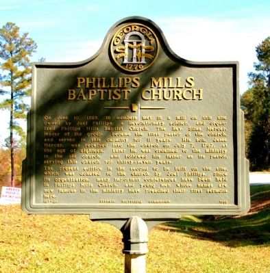
Phillips Mills Baptist Church
Photographed by David Seibert, November 15, 2009
1. Phillips Mills Baptist Church Marker
The present edifice is the second to be built on the site, which was donated to the church by Joel Phillips. Since its organization, many important conferences have been held in Phillips Mills Church, and young men whose names are now famous in the ministry have preached their first sermons here.
Erected 1958 by Georgia Historical Commission. (Marker Number 157-23.)
Topics and series. This historical marker is listed in these topic lists: Industry & Commerce • Religion & Religious Structures • War, US Revolutionary • Waterways & Vessels. In addition, it is included in the Georgia Historical Society
this page online
Location. 33° 40.088′ N, 82° 52.976′ W. Marker is near Washington, Georgia, in Wilkes County. It is at the intersection of Greensboro Road (Georgia Route 44) and Rocker Road (County Route 50), on the right when traveling west on Greensboro Road. Touch for map. Marker is in this post office area: Washington GA 30673, United States of America. Touch for directions.

Regionally, this marker is in the Piedmont. It is also in the American South and specifically in the Deep South. Globally, it is in North America, the Western Hemisphere, the Western World, and the Anglosphere. Historically, it finds itself in what was once the territory of the Mississippian Culture, one of the original Thirteen Colonies, one of the Confederate States of America, and the Antebellum South.
Other nearby markers. At least 8 other markers are within 2 miles of this marker, measured as the crow flies: Loyalists Defeat On Spurgin Hill (approx. 1½ miles away); 1920 Dredging of Kettle Creek (approx. 1½ miles away); Canebrakes Affect The Battle of Kettle Creek (approx. 1½ miles away); Clark's Attack
Photographed by David Seibert, November 15, 2009
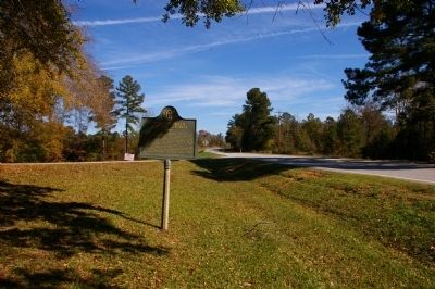
2. Phillips Mills Baptist Church Marker
Looking east on Georgia Highway 44, toward Washington
Photographed by David Seibert, November 15, 2009
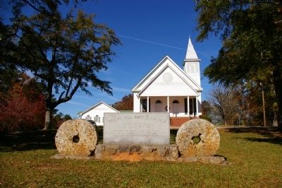
3. Phillips Mills Baptist Church
Millstones are original from Joel Phillips' grist mill and were imported from the Paris Basin in Europe.
Photographed by David Seibert, November 15, 2009
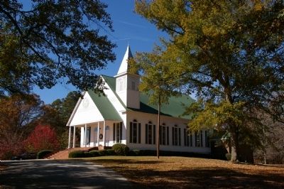
4. Phillips Mills Baptist Church
Credits. This page was last revised on February 1, 2020. It was originally submitted on December 14, 2009, by David Seibert of Sandy Springs, Georgia. This page has been viewed 1,953 times since then and 53 times this year. Photos: 1, 2, 3, 4. submitted on December 14, 2009, by David Seibert of Sandy Springs, Georgia. • Craig Swain was the editor who published this page.
