Near Iona Station in Elgin County, Ontario — Central Canada (North America)
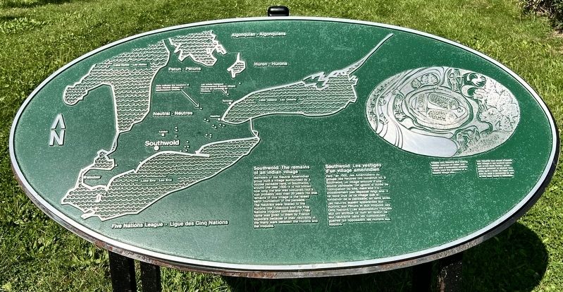
Southwold: The remains of an indian village/Southwold: Les vestiges d’un village amérindien
Photographed by Tim Boyd, August 23, 2024
1. Southwold: The remains of an indian village/Southwold: Les vestiges d’un village amérindien Marker

Members of the Neutral Amerindian group built a village surrounded by a double palisade here, in Southwold, around the year 1500, it is not known how long the site was occupied, but it was probably less than 20 years. All that remains of this village is the raised earth foundation of the palisade. The Neutrals were related to the Hurons, the Tobaccos and the Five Nations Iroquois confederacy. Their name was given to them by French explorers because of their neutrality in the many wars between the Hurons and the Iroquois.
Vers l’an 1500, les Amérindiens du groupe des Neutres ont construit ici, à Southwold, un village entouré d'une double palissade. On ignore la durée de l'occupation du site, mais elle n'a probablement pas dépassé vingt ans. Il ne reste plus de ce village que la fondation de la palissade, en terre levée. Les Neutres étalent apparentés aux Hurons, aux Pétuns et aux Iroquois des Cinq Nations. Les explorateurs français leur ont attribué ce nom en raison de leur neutralité dans les nombreuses guerres
this page online
Topics. This historical marker is listed in these topic lists: Anthropology & Archaeology • Indigenous Peoples and Communities. A significant historical year for this entry is 1500.
Location. 42° 40.404′ N, 81° 21.821′ W. Marker is near Iona Station, Ontario, in Elgin County. It is on Iona Road one kilometer north of Fingal Line, on the right when traveling north. Touch for map. Marker is at or near this postal address: 7930 Iona Road, Iona Station ON N0L 1P0, Canada. Touch for directions.

Regionally, this marker is in the Southwest Ontario Area and in Southwestern Ontario. It is also in Central Canada. Globally, it is in North America, on the Great Lakes, in the Western Hemisphere, in the Western World, and in the Anglosphere. Historically, it finds itself in what was once a British colony, the Viceroyalty of New France, the Haudenosaunee (Iroquois) Confederacy, and Rupert’s Land.
Other nearby markers. At least 8 other markers are within 10 kilometers of this marker, measured as the crow flies: Southwold Earthworks/Les Fortifications en Terre de Southwold (approx. 0.3
Photographed by Tim Boyd, August 23, 2024
2. Southwold: The remains of an indian village/Southwold: Les vestiges d’un village amérindien Marker
Also see . . . The Neutral Confederacy. The Canadian Encyclopedia website entry:
The Neutral Confederacy was a political and cultural union of Iroquoian nations who lived in the Hamilton-Niagara district of southwestern Ontario and across the Niagara River to western New York before their dispersal by the Seneca in the mid-17th century. Some surviving Neutral migrated west and south, where they were absorbed by various Haudenosaunee (Iroquois) communities. As a result of this dispersal, information about pre-contact Neutral history comes mainly from Jesuit records and archaeological excavations.(Submitted on August 28, 2024, by Tim Boyd of Hamilton, Ontario.)
Photographed by Tim Boyd, August 23, 2024
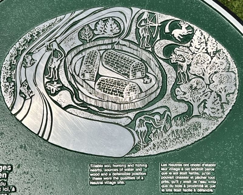
3. Southwold: The remains of an indian village marker detail

Photographed by Tim Boyd, August 23, 2024
4. Southwold: The remains of an indian village/Southwold: Les vestiges d’un village amérindien Marker

Photographed by Tim Boyd, August 2021
5. Remains of the double earthworks at Southwold
Credits. This page was last revised on July 11, 2026. It was originally submitted on August 28, 2024, by Tim Boyd of Hamilton, Ontario. This page has been viewed 180 times since then and 26 times this year. Photos: 1, 2, 3, 4, 5. submitted on August 28, 2024, by Tim Boyd of Hamilton, Ontario. • Andrew Ruppenstein was the editor who published this page.
