Barnesville in Lamar County, Georgia — The American South (South Atlantic)
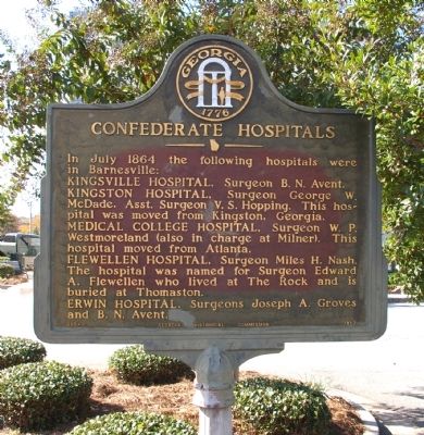
Confederate Hospitals
Kingsville Hospital, Surgeon B. N. Avent.
Kingston Hospital, Surgeon George W. McDade, Asst. Surgeon V.S. Hopping. This hospital was moved from Kingston, Georgia.
Medical College Hospital, Surgeon W. P. Westmoreland (also in charge at Milner). This hospital moved from Atlanta.
Flewellen Hospital, Surgeon Miles H. Nash. The hospital was named for Surgeon Edward A. Flewellen who lived at The Rock and is buried at Thomaston.
Erwin Hospital, Surgeons Joseph A. Groves and B. N. Avent.
Erected 1957 by Georgia Historical Commission. (Marker Number 085-9.)
Topics and series. This historical marker is listed in these topic lists: Science & Medicine • War, US Civil. In addition, it is included in the Georgia Historical Society series list. A significant historical month for this entry is July 1864.
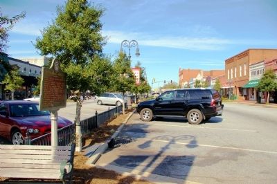
Location. 33° 3.234′ N, 84° 9.329′ W. Marker is in Barnesville, Georgia, in Lamar County. Marker is at the intersection of Mill Street (Georgia Route 36) and Market Street, in the median on Mill Street. Touch for map. Marker is in this post office area: Barnesville GA 30204, United States of America. Touch for directions.
Other nearby markers. At least 8 other markers are within walking distance of this marker. Streamliner Nancy Hanks II (a few steps from this marker); Women of the Confederacy (within shouting distance of this marker); Barnesville Presbyterian Church (within shouting distance of this marker); Confederate Hospital (about 300 feet away, measured in a direct line); Barnesville Railroad Depot (about 400 feet away); Lamar County (about 500 feet away); In Memory of America's Revolutionary War Soldiers (about 500 feet away); Barnesville Blues (about 500 feet away). Touch for a list and map of all markers in Barnesville.
Credits. This page was last revised on June 16, 2016. It was originally submitted on December 14, 2009, by David Seibert of Sandy Springs, Georgia. This page has been viewed 1,506 times since then and 47 times this year. Photos: 1, 2. submitted on December 14, 2009, by David Seibert of Sandy Springs, Georgia. • Craig Swain was the editor who published this page.

