Memphis in Shelby County, Tennessee — The American South (East South Central)
Hopefield Point, Arkansas/Chicken Island/Redman Point
Mississippi River Walk
Photographed by Jason Voigt, August 2, 2024
1. Hopefield Point, Arkansas/Chicken Island/Redman Point Marker
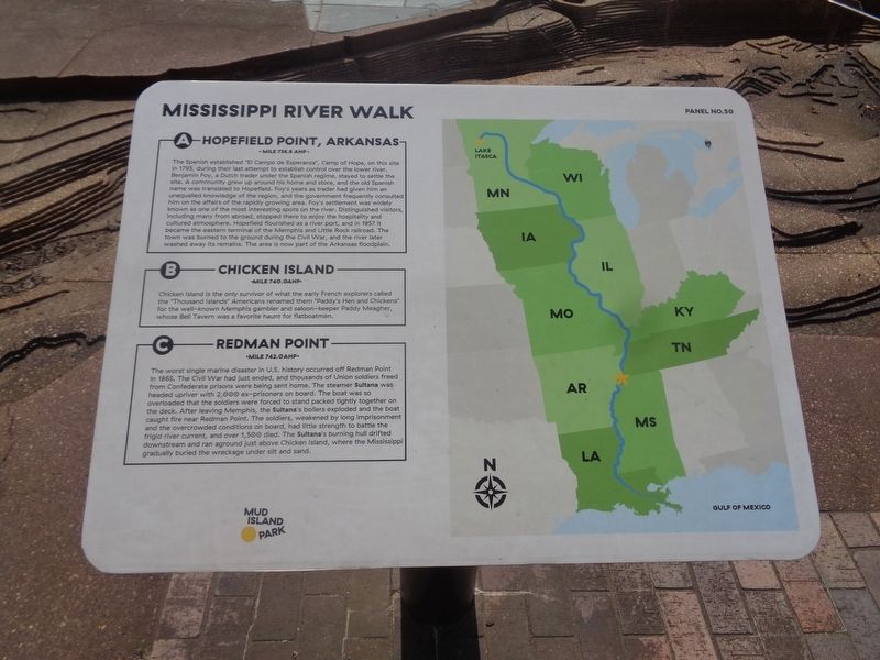
A) Hopefield Point, Arkansas
Mile 736.8 AHP
The Spanish established "El Campo de Esperanza", Camp of Hope, on this site in 1795, during their last attempt to establish control over the lower river. Benjamin Foy, a Dutch trader under the Spanish regime, stayed to settle the site. A community grew up around his home and store, and the old Spanish name was translated to Hopefield. Foy's years as trader had given him an unequalled knowledge of the region, and the government frequently consulted him on the affairs of the rapidly growing area. Foy's settlement was widely known as one of the most interesting spots on the river. Distinguished visitors, including many from abroad, stopped there to enjoy the hospitality and cultured atmosphere. Hopefield flourished as a river port, and in 1857 it became the eastern terminal of the Memphis and Little Rock railroad. The town was burned to the ground during the Civil War, and the river later washed away its remains. The area is now part of the Arkansas floodplain.
B) Chicken Island
Mile 740.0 AHP
Chicken Island is the only survivor of what the early French explorers called
this page online
C) Redman Point
Mile 742.0 AHP
The worst single marine disaster in U.S. history occurred off Redman Point in 1865. The Civil War had just ended, and thousands of Union soldiers freed from Confederate prisons were being sent home. The steamer Sultana was headed upriver with 2,000 ex-prisoners on board. The boat was so overloaded that the soldiers were forced to stand packed tightly together on the deck. After leaving Memphis, the Sultana's boilers exploded and the boat caught fire near Redman Point. The soldiers, weakened by long imprisonment and the overcrowded conditions on board, had little strength to battle the frigid river current, and over 1,500 died. The Sultana's burning hull drifted downstream and ran aground just above Chicken Island, where the Mississippi gradually buried the wreckage under silt and sand.
Erected by Mud Island Park. (Marker Number 50.)
Topics. This historical marker is listed in these topic lists:
Photographed by Jason Voigt, August 2, 2024
2. Hopefield Point, Arkansas/Chicken Island/Redman Point Marker
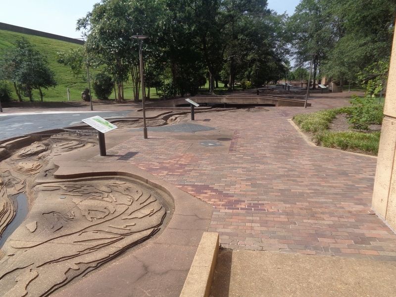
Marker is to the left of the pole
Location. 35° 8.942′ N, 90° 3.532′ W. Marker is in Memphis, Tennessee, in Shelby County. It can be reached from Island Drive. Marker is located at Mud Island Park. Touch for map. Marker is at or near this postal address: 57 North Mud Island Road, Memphis TN 38103, United States of America. Touch for directions.

Regionally, this marker is in West Tennessee. It is also in the American South, specifically in the Deep South, in the Upper South, in the Mississippi Delta, and in the Great River Road Region. Globally, it is in North America, the Western Hemisphere, the Western World, and the Anglosphere. Historically, it finds itself in what was once the territory of the Mississippian Culture, one of the Confederate States of America, and the Antebellum South.
Other nearby markers. At least 8 other markers are within walking distance of this marker: Cow Islands No. 47 and No. 48/West Memphis, Arkansas/President's Island No. 45 (here, next to this marker); Island No. 40 and No. 41/Centennial Cutoff/Chickasaw Bluff No. 3 (a few steps from this marker); The Mississippi Riverwalk (a few steps from this marker); Memphis,Tennessee / Mud Island (a few steps from this marker); Commerce, Mississippi/Buck Island No. 53/Norfolk Landing, Mississippi (a few steps from this marker); Randolph, Tennessee / Hatchie River / Fort Pillow, Tennessee (within shouting distance of this marker); Plum Point/Osceola, Arkansas (within shouting distance of this marker); St. Francis River/Hardin Cutoff/Whitehall Crevasse (within shouting distance of this marker). Touch for a list and map of all markers in Memphis.
Additional keywords. ghost towns
Credits. This page was last revised on August 30, 2024. It was originally submitted on August 30, 2024, by Jason Voigt of Glen Carbon, Illinois. This page has been viewed 576 times since then and 134 times this year. Photos: 1, 2. submitted on August 30, 2024, by Jason Voigt of Glen Carbon, Illinois.
