
Burying Yard Point in Isle La Motte in Grand Isle County, Vermont — The American Northeast (New England)
Isle La Motte

Photographed by Tim Dusablon, September 1, 2024
1. Isle La Motte Marker
1665
1791 1927
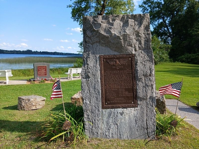
It was settled in 1665 by the French who built Fort "St. Ann" on the West shore where now is a "Shrine of St. Ann". The fort was dedicated on July 26, 1666 when Mass was celebrated for the first time in Vermont. The captain of the 300 men of the famous Carignan Regiment who built this fort was Sieur de la Motte after whom this island is named.
This tablet on Burying Yard Point was erected by the Isle la Motte Historical Society and the town, in memory of the Revolutionary Soldiers here buried
William Blanchard - Lieutenant
Enoch Hall - Lieutenant
Abraham Knapp - First Town Clerk
Nathaniel Wales - First Town Representative
William Uttley - Second Town Representative
Jesse Welden
This bridge was opened August 14, 1882
Erected 1927 by Isle la Motte Historical Society.
Topics. This memorial is listed in these topic lists: Cemeteries & Burial Sites • Colonial Era • Patriots & Patriotism •
this page online
Location. 44° 54.117′ N, 73° 19.22′ W. Memorial is in Isle La Motte, Vermont, in Grand Isle County. It is in Burying Yard Point. It is on Main Street (Vermont Route 129) half a mile east of N Shore Road, on the right when traveling east. Touch for map. Memorial is at or near this postal address: 315 Main Street, Isle La Motte VT 05463, United States of America. Touch for directions.

Regionally, this memorial is in Vermont’s Champlain Valley. It is also in the American Northeast and in New England. Globally, it is in North America, the Western Hemisphere, the Western World, and the Anglosphere. Historically, it finds itself in what was once the Viceroyalty of New France and also the Vermont Republic.
Other nearby markers. At least 8 other markers are within 3 miles of this marker, measured as the crow flies: Captain Remember Baker (here, next to this marker); Col. Seth Warner and Capt. Remember Baker (approx. 1.2 miles away); Site of French Fort Ste. Anne (approx. 1.4 miles away); A Place Of Pilgrimage (approx. 1.4 miles away); Samuel de Champlain Monument

Photographed by Tim Dusablon, September 1, 2024
2. Isle La Motte Marker
Also see . . .
1. Town of Isle La Motte, VT - Vermont's Oldest Settlement. (Submitted on September 7, 2024, by Michael Herrick of Southbury, Connecticut.)
2. Isle La Motte (Wikipedia). (Submitted on September 7, 2024, by Michael Herrick of Southbury, Connecticut.)
Photographed by Tim Dusablon, September 1, 2024
3. Isle La Motte Marker
Credits. This page was last revised on September 7, 2024. It was originally submitted on September 1, 2024, by Tim Dusablon of Georgia, Vermont. This page has been viewed 451 times since then and 77 times this year. Photos: 1, 2, 3. submitted on September 1, 2024, by Tim Dusablon of Georgia, Vermont. • Michael Herrick was the editor who published this page.
