
Manhattan Beach in Brooklyn in Kings County, New York — The American Northeast (Mid-Atlantic)
Dana Borell Garden
Manhattan Beach

What was here before?
Manhattan Beach was the site of a self-contained summer resort on 500 acres of salt marsh built in 1876 by real estate developer and railroad tycoon Austin Corbin (1827-1896). Corbin opened the opulent Manhattan Beach Hotel in 1877, followed by the Oriental Hotel in 1880, and the Argyle Hotel in 1882, transforming the sandy peninsula into a resort for upscale Manhattanites. The opening of amusement parks in Coney Island, coupled with the closing of racetracks in 1910 in the Sheepshead Bay, led to the swift decline of the hotels. Residential development began in the area in 1907, redefining the character of the neighborhood.
How did this site become a garden?
This garden is a part of Manhattan Beach. The federal government acquired this land in 1942 for the site of a Coast Guard and Maritime training station. AFter eight years of negotiations, New York State bought this 16-acre waterfront property from the federal government and turned it over to the City for park purposes in 1951. The park opened to the public in 1955.
On Sept. 18, 2005, the Manhattan Beach Community Group (MBCG) dedicated
this page online
Who is this garden named for?
This garden honors Dana Borell (1936-2004), a local activist in the Manhattan Beach area.
Borell was raised in Brooklyn, graduated cum laude from Brooklyn College and earned a master's degree from New York University. She started her career as a laboratory teacher at nearby James Madison High School.
She championed her community and was instrumental in improving the quality of life for this district. During her eight years as president of the Manhattan Beach Community Group, she prepared and guided a proposal that MBCG be designated as the local redevelopment authority for the disposal of the properties on Quentin Street.
Borell occupied many leadership positions including President of District 22 Conference of Parents' Associations, Community Board 15 member, Member of Coney Island Hospital Advisory Board, and President of P.S. 195 Parents' Association. In these roles, she helped beautify and modernize Manhattan Beach and was instrumental in regulating the speed limit and double parking in the area.
Borell served her community until her
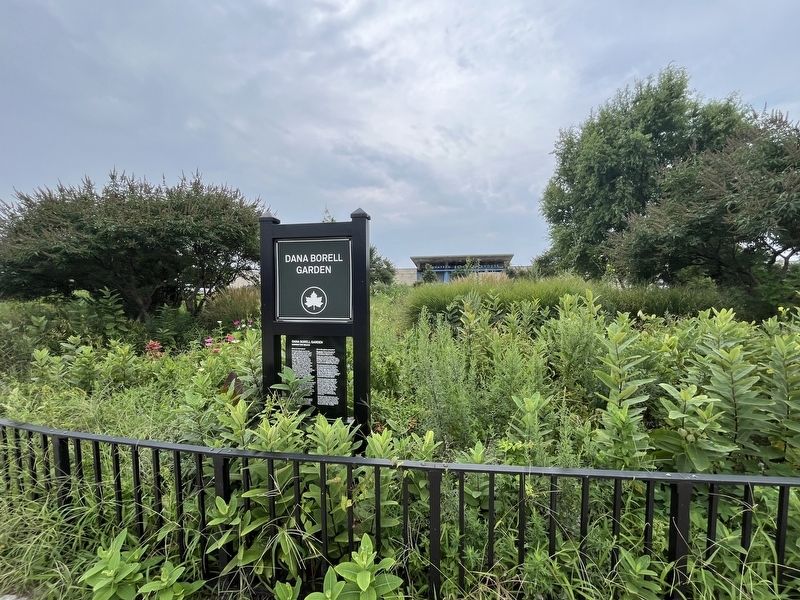
Photographed by Devry Becker Jones (CC0), September 1, 2024
2. Dana Borell Garden in Manhattan Beach
Erected by NYC Parks.
Topics and series. This historical marker is listed in these topic lists: Charity & Public Work • Industry & Commerce • Parks & Recreational Areas • Women. In addition, it is included in the NYC Parks series list. A significant historical date for this entry is September 18, 2005.
Location. 40° 34.651′ N, 73° 56.652′ W. Marker is in Brooklyn, New York, in Kings County. It is in Manhattan Beach. It is on Oriental Boulevard just east of Hastings Street, on the right when traveling east. Touch for map. Marker is at or near this postal address: 185 Oriental Blvd, Brooklyn NY 11235, United States of America. Touch for directions.

Regionally, this marker is in New York City and on Long Island. It is also in the American Northeast, in the Mid-Atlantic, and on the Eastern Seaboard. Globally, it is in the North Atlantic Region, North America, the Western Hemisphere, the Western World, and the Anglosphere. Historically, it finds itself in what was once New Netherland and also one of the original Thirteen Colonies.
Other nearby markers. At least 8 other markers are within one mile of this marker, measured as the crow flies: Babi Yar Triangle (approx. 0.6 miles away); Babi Yar Park (approx. 0.6 miles away); Chiune Sigihara (approx. 0.6 miles away); Holocaust Memorial (approx. 0.6 miles away); Sheepshead Bay Veterans Memorial (approx. 0.8 miles away); F. D. N. Y. (approx. one mile away); Bill Brown Playground (approx. one mile away); Playground 286 (approx. one mile away). Touch for a list and map of all markers in Brooklyn.
Credits. This page was last revised on September 2, 2024. It was originally submitted on September 2, 2024, by Devry Becker Jones of Washington, District of Columbia. This page has been viewed 121 times since then and 14 times this year. Photos: 1, 2. submitted on September 2, 2024, by Devry Becker Jones of Washington, District of Columbia.
