Wawatam Township in Mackinaw City in Cheboygan County, Michigan — The American Midwest (Great Lakes)
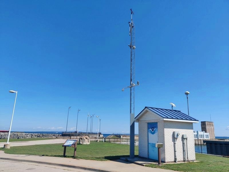
Mackinaw City Water Level Station

Photographed by John Ridley, August 31, 2024
1. Mackinaw City Water Level Station Marker
What is this NOAA building for?
This building houses the equipment that records water levels at Mackinaw City. The Center for Operational Oceanographic Products and Services (CO-OPS), part of NOAA's National Ocean Service, operates 53 water level and meteorological monitoring stations in the Great Lakes in support of safe navigation, commercial shipping, recreational boating, and coastal research. Historic records for some of these stations date back to 1860, providing over 150 years of data. The Mackinaw City station is one of six water level monitoring stations on the U.S. coastline of Lake Huron. In addition to water levels, air and water temperature, winds, barometric pressure, and relative humidity are recorded here.
Who uses water level and weather data?
Great Lakes commercial freighters and recreational boaters rely on real-time water level information for safe passage through harbors, connecting channels, and locks. When approaching the Soo Locks, for example, they call CO-OPS "glakesonline" to obtain the most recent 6-minute water level and weather data. Accurate water levels are also important for hydropower
this page online
How are water levels measured?
Wate renters the station house through a valve-controlled intake pipe into a 'stilling' well (sump), which effectively removes wind and wave effects. Six-minute average water levels are recorded and transmitted via GOES satellites to CO-OPS where all data is verified. The data is available online at hourly, daily, and monthly average intervals. These measurements are highly accurate (+- 0.003 meters for monthly means). The most recent 6-minute water level is available via phone at (301) 713-9596 (Mackinaw City Station ID #5080).
The graph at right presents water level data recorded here at the Mackinaw City station. The top panel includes annual average water levels from 1900 to 2012, and reflects the type of annual and decadal water level variability observed across Lake Huron and other Great Lakes.
The bottom panel includes
Photographed by John Ridley, August 31, 2024
2. Mackinaw City Water Level Station Marker
Most of the variability in both graphs is driven by changes in the Great Lakes water budget, including over-lake precipitation, over-lake evaporation, and runoff. Water level measurements in both panels are relative to a common benchmark located near the outlet of the St. Lawrence River (close to sea level).
Topics. This historical marker is listed in these topic lists: Environment • Science & Medicine.
Location. 45° 46.653′ N, 84° 43.269′ W. Marker is in Mackinaw City, Michigan, in Cheboygan County. It is in Wawatam Township. It can be reached from South Huron Avenue. The marker is near the station at the far end of the marina parking lots, just at the beginning of the sidewalk to the pier. Touch for map. Marker is in this post office area: Mackinaw City MI 49701, United States of America. Touch for directions.

Regionally, this marker is in Northern Michigan Lower Peninsula, on the Straits of Mackinac, and in one of the Lake Huron Shore counties. It is also in the American Midwest. Globally, it is in North America, in the Great North Woods, on the Great Lakes, in the Western Hemisphere, in the Western World, and in the Anglosphere. Historically, it finds itself in what was once the Northwest Territory.
Other nearby markers. At least 8 other markers are within walking distance of this marker: Windy City? (a few steps from this marker); Before the bridge (within shouting distance of this marker); Crossing the Straits (within shouting distance of this marker); The Mighty Mac (within shouting distance of this marker); North Central Trail (about 400 feet away, measured in a direct line); Breaking the ice (about 400 feet away); Aquatic Aliens (about 600 feet away); Village of Mackinaw City Roth Performance Shell Proclamation (approx. 0.2 miles away). Touch for a list and map of all markers in Mackinaw City.
Credits. This page was last revised on September 21, 2024. It was originally submitted on September 4, 2024, by John Ridley of Chelsea, Michigan. This page has been viewed 105 times since then and 12 times this year. Photos: 1. submitted on September 4, 2024, by John Ridley of Chelsea, Michigan. 2. submitted on September 5, 2024, by John Ridley of Chelsea, Michigan. • J. Makali Bruton was the editor who published this page.
