Shelton in Fairfield County, Connecticut — The American Northeast (New England)
Shelton
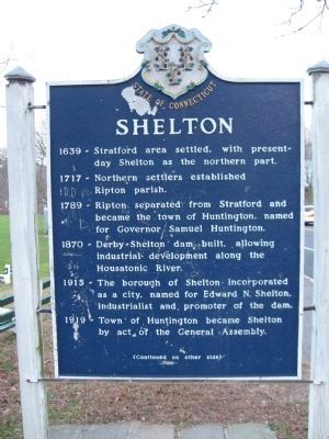
[ front ]
1717 – Northern settlers established Ripton parish.
1789 – Ripton separated from Stratford and became the town of Huntington, named for Governor Samuel Huntington.
1870 – Derby-Shelton dam built., allowing industrial development along the Housatonic River.
1915 – The borough of Shelton incorporated as a city, named for Edward N. Shelton, industrialist and promoter of the dam.
1919 – Town of Huntington became Shelton by act of the General Assembly.
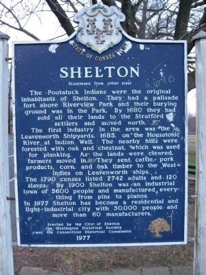
[ back ]
The Pootatuck Indians were the original inhabitants of Shelton. They had a palisade fort above Riverview Park and their burying ground was in the Park. By 1680 they had sold all their lands to the Stratford settlers and moved north.
The First industry in the area was the Leavenworth Shipyards, 1685, on the Housatonic River at Indian Well. The nearby hills were forested with oak and chestnut, which was used for planking. As the lands were cleared, farmers moved in. They sent cattle, pork products, corn, and oak timber to the West Indies on Leavenworth ships.
The 1790 census listed 2742 adults and 120 slaves. By 1900 Shelton was an industrial town of 5600 people and manufactured everything from pins to pianos.
In 1977 Shelton has become a residential and light-industrial city with 30,000 people and more than 60 manufacturers.
Erected by the City of Shelton
The Huntington Historical Society
and the Connecticut Historical Commission
1977
Erected 1977.
Topics. This historical marker is listed in these topic lists: Colonial Era • Native Americans • Settlements & Settlers. A significant historical year for this entry is 1639.
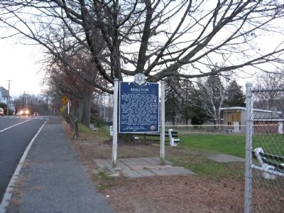
Location. 41° 19.308′ N, 73° 6.062′ W. Marker is in Shelton, Connecticut, in Fairfield County. Marker is at the intersection of Howe Avenue (Route 110) and Roberts Street, on the right when traveling north on Howe Avenue. Located next to Riverview Park. Touch for map. Marker is in this post office area: Shelton CT 06484, United States of America. Touch for directions.
Other nearby markers. At least 8 other markers are within walking distance of this marker. To Honor the Men and Women of the City of Shelton (within shouting distance of this marker); Constitution Oak (about 300 feet away, measured in a direct line); Fort Hill (about 600 feet away); Shelton Locks (approx. 0.2 miles away); Shelton World War II Memorial (approx. ¼ mile away); Derby Korea – Vietnam Memorial (approx. 0.6 miles away); Derby Veterans Monument (approx. 0.6 miles away); Derby Firemen’s Memorial (approx. 0.6 miles away). Touch for a list and map of all markers in Shelton.
Credits. This page was last revised on June 16, 2016. It was originally submitted on December 18, 2009, by Michael Herrick of Southbury, Connecticut. This page has been viewed 1,233 times since then and 23 times this year. Photos: 1, 2, 3. submitted on December 18, 2009, by Michael Herrick of Southbury, Connecticut. • Bill Pfingsten was the editor who published this page.


