Near Winchester in Frederick County, Virginia — The American South (Mid-Atlantic)
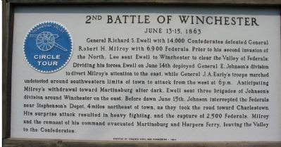
2nd Battle of Winchester
June 13–15, 1863
Photographed by Craig Swain, August 25, 2007
1. 2nd Battle of Winchester Marker
Erected 1964 by Virginia Civil War Commission.
Topics. This historical marker is listed in this topic list: War, US Civil. A significant historical date for this entry is June 13, 1863.
Location. 39° 12.059′ N, 78° 9.333′ W.
this page online

Regionally, this marker is in Virginia’s Shenandoah Valley. It is also in the American South, specifically in the Upper South, and in the Mid-Atlantic. Globally, it is in North America, the Western Hemisphere, the Western World, and the Anglosphere. Historically, it finds itself in what was once the territory of the Mississippian Culture, one of the original Thirteen Colonies, one of the Confederate States of America, and the Antebellum South.
Other nearby markers. At least 8 other markers are within walking distance of this marker: 3rd Battle of Winchester (here, next to this marker); 2nd Battle of Winchester / 3rd Battle of Winchester (here, next to this marker); Fort Collier (about 300 feet away, measured in a direct line); George Washington in Winchester (about 300 feet away); a different
Photographed by Craig Swain, August 25, 2007
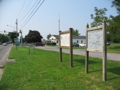
2. 2nd Battle of Winchester Marker
Other markers no longer nearby. Fort Collier Civil War Center (was within shouting distance of this marker but has been permanently removed); a different marker also named Fort Collier (was about 400 feet away but has been replaced with another marker now near it).
More about this marker. Next to this marker is a separate map detailing the actions outlined in the text. On the reverse is a marker detailing the 3rd Battle of Winchester.
Regarding 2nd Battle of Winchester. One of several markers erected by the Civil War Commission as part of the “Circle Tour” of the Shenandoah Valley.
Also see . . . Second Winchester. National Park Service summary of the battle. (Submitted on September 16, 2007, by Craig Swain of Leesburg, Virginia.)
Credits. This page was last revised on September 7, 2024. It was originally submitted on September 16, 2007, by Craig Swain of Leesburg, Virginia. This page has been viewed 2,575 times since then and 24 times this year. Last updated on September 7, 2024, by Carl Gordon Moore Jr. of North East, Maryland. Photos: 1, 2. submitted on September 16, 2007, by Craig Swain of Leesburg, Virginia. • Bernard Fisher was the editor who published this page.
