
Maymont in Richmond, Virginia — The American South (Mid-Atlantic)
Estate Crossroads
![Estate Crossroads Marker [Center panel] image. Click for full size.](Photos8/816/Photo816626.jpg?982024104200AM "Estate Crossroads Marker [Center panel]. Click for full size.")
Photographed by Devry Becker Jones (CC0), September 6, 2024
1. Estate Crossroads Marker [Center panel]
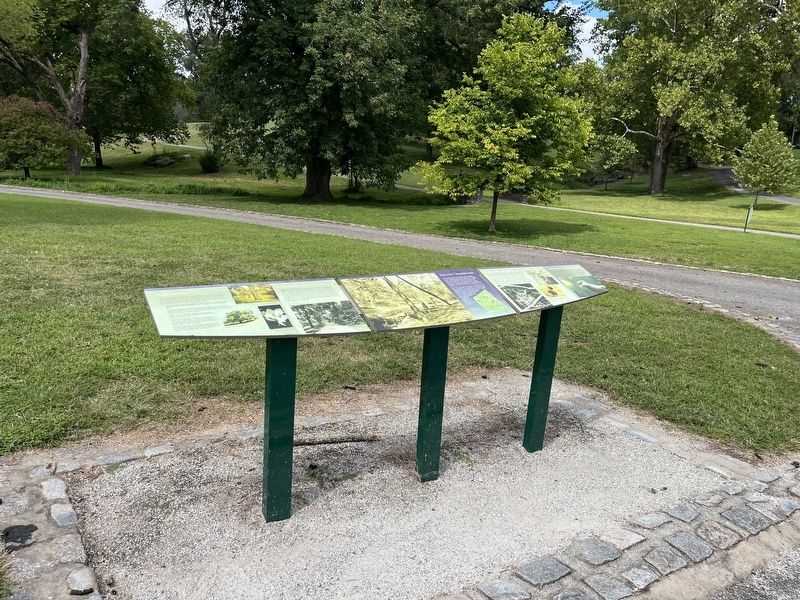
At this crossroads, the natural beauty of the landscape and several roadways of the estate intersect. The nearby stream is called Dooley Branch, named for James and Sallie Dooley who purchased the 100-acre property in 1886 and transformed it into a showplace estate. The hilly, fall-line terrain provided a perfect backdrop for the gardens, architecture and plantings added by the couple. The nearby bridges constructed of river rock date to the Dooleys' time.
At the top of the steep hill to your left is Magnolia Drive, the formal entrance road to the Dooleys' home. It leads to the Maymont Mansion, the Italian Garden, and other surviving buildings and features of the historic estate. The original carriage road in front of you follows Dooley Branch through the wildlife habitats and ends at the Japanese Garden. The forty-acre area north of Dooley Branch was maintained by the Dooleys as a naturalistic parkland. It now includes the Nature Center to your right as well as a Farm.
[Caption:]
(Left) Maymont first opened to the public in 1926. These young ladies pause near Dooley Branch in 1928.
Arboretum
James and Sallie
this page online
Darlington Oak (Quercus hemisphaerica). This impressive ornamental oak straight ahead on the left is a National Champion tree, the largest of its kind in the United States.
Princeton American Elm (Ulmus Americana 'Princeton'). A row of this hardy cultivar was planted by the Garden Club of Virginia along Magnolia Drive at the top of the hill to your left. Those trees replaced the original allée of elms that were decimated by Dutch elm disease in the 20th century.
Tulip Poplar (Liriodendron tulipifera). The magnificent tree on the knoll to the left probably pre-dates the Dooleys' ownership of the property.
Bald Cypress (Taxodium distichum) This deciduous conifer, seen straight ahead in front of the Darlington Oak, is a species typically found in low wetareas. Leaves turn brown and fall in autumn. Others are located at the Japanese Garden, Mansion lawn and wetlands.Photographed by Devry Becker Jones (CC0), September 6, 20242. Estate Crossroads Marker [Left panel]
Eastern White Pine (Pinus strobus). These native trees are used commercially and also planted for their beauty and fast growth. The specimens behind you was planted there to replace a white pine that dated to the Dooley era.
![Estate Crossroads Marker [Left panel] image. Click for full size.](Photos8/816/Photo816629.jpg?982024104300AM "Estate Crossroads Marker [Left panel]. Click for full size.")
A History of the Land
The land that became Maymont was originally part of a vast area ruled by Algonquian chief Powhatan. In the 1600s, it became part of Henrico County, and throughout the 1800s, it was used as farmland. When the Dooleys purchased the property, the land just north of it was New Reservoir Park. That area was later renamed William Byrd Park in honor of Richmond's founder who owned a huge tract along the river including the land that eventually became Maymont. Annexations in 1906 and 1914 brought the entire area within the city limits. There are two granite markers on the estate carved with "C. L. 1908" to show the city limits at that time. One is nearby, behind you along Dooley Branch. The other is in the Black Bear Habitat. The Dooleys left Maymont to the city, and it opened to
![Estate Crossroads Marker [Right panel] image. Click for full size.](Photos8/816/Photo816630.jpg?982024104300AM "Estate Crossroads Marker [Right panel]. Click for full size.")
Photographed by Devry Becker Jones (CC0), September 6, 2024
3. Estate Crossroads Marker [Right panel]
Wildlife Habitats
The roadway straight ahead along Dooley Branch leads to Maymont's outdoor wildlife exhibits were first introduced at Maymont in the 1950s through the leadership of William B. Thalhimer, Sr. Today the habitats feature native Virginia species. On the hillside next to the Nature Center, you will find American bison, which lived in the Virginia wilderness through the 1700s. The road along the stream leads to the habitats of two of Virginia's predators—gray fox and bobcat— as well as sika deer, a species introduced from Asia to the Eastern Shore of Virginia in the 1920s. You will also encounter majestic birds of prey, including bald eagles, hawks, and owls. Most of Maymont's animals were injured or orphaned or otherwise are unable to survive in the wild. Maymont serves as a sanctuary for these animals, and the special care they received gives them a second chance at life while adding great educational value to the guest experience.
The Robins Nature Center
On the hillside to your right, the Robins Nature Center presents the wonders of the natural environment along the James River. A series of
Erected by Maymont Foundation.
Topics. This historical marker is listed in these topic lists: Architecture • Horticulture & Forestry • Notable Places • Parks & Recreational Areas. A significant historical year for this entry is 1886.
Location. 37° 32.179′ N, 77° 28.559′ W. Marker is in Richmond, Virginia. It is in Maymont. It can be reached from the intersection of Hampton Street and Dakota Avenue, on the right when traveling south. Touch for map. Marker is at or near this postal address: 2201 Shields Lake Dr, Richmond VA 23220, United States of America. Touch for directions.

Regionally, this marker is in Central Virginia. It is also in the American South and specifically in the Upper South. Globally, it is in North America, the Western Hemisphere, the Western World, and the Anglosphere. Historically, it finds itself in what was once the territory of the Mississippian Culture, one of the original Thirteen Colonies, one of the Confederate States of America, and the Antebellum South.
Other nearby markers. At least 8 other markers are within walking distance of this marker: A Stately Home (about 600 feet away, measured in a direct line); Historic Estate (about 800 feet away); a different marker also named Historic Estate (about 800 feet away); Minna Dietrich Adams (approx. 0.2 miles away); James & Sallie Dooley (approx. 0.2 miles away); Maymont, Gilded Age Estate (approx. 0.2 miles away); Welcome to Maymont / Extraordinary Gift (approx. 0.2 miles away); Maymont Farm (approx. 0.2 miles away). Touch for a list and map of all markers in Richmond.
Credits. This page was last revised on September 8, 2024. It was originally submitted on September 8, 2024, by Devry Becker Jones of Washington, District of Columbia. This page has been viewed 148 times since then and 20 times this year. Photos: 1, 2, 3, 4. submitted on September 8, 2024, by Devry Becker Jones of Washington, District of Columbia.
