Gambles Hill in Richmond, Virginia — The American South (Mid-Atlantic)
"The Headman"
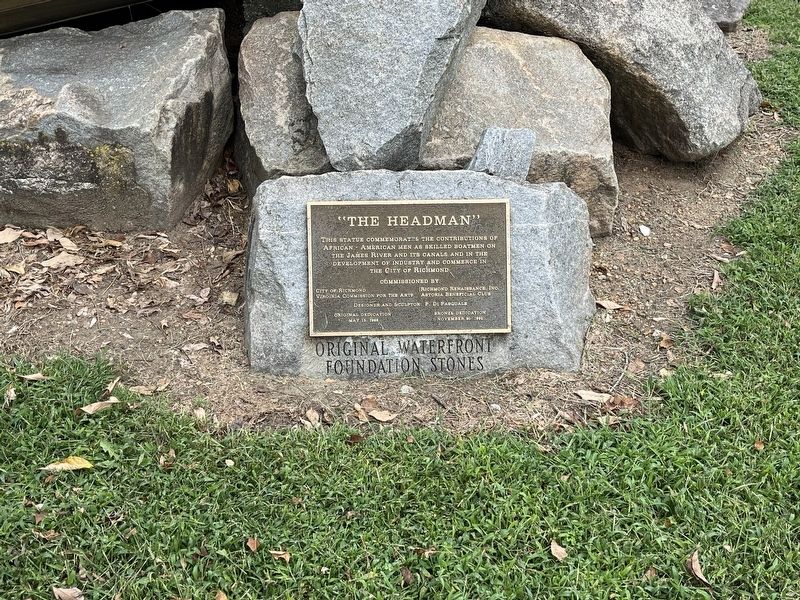
This statue commemorates the contributions of African - American men as skilled boatmen on the James River and its canals and in the development of industry and commerce in the City of Richmond
Erected 1992 by City of Richmond; Virginia Commission for the Arts; Richmond Renaissance, Inc.; Astoria Beneficial Club; P. Di Pasquale, designer and sculptor.
Topics. This historical marker is listed in these topic lists: African Americans • Industry & Commerce • Waterways & Vessels.
Location. 37° 32.072′ N, 77° 26.577′ W. Marker is in Richmond, Virginia. It is in Gambles Hill. It can be reached from Canal Walk east of 5th Street Footbridge, on the right when traveling east. Touch for map. Marker is at or near this postal address: 1 A Browns Island, Richmond VA 23219, United States of America. Touch for directions.

Regionally, this marker is in Central Virginia. It is also in the American South and specifically in the Upper South. Globally, it is in North America, the Western Hemisphere, the Western World, and
this page online
Other nearby markers. At least 8 other markers are within walking distance of this marker: Freedom Monument (within shouting distance of this marker); Confederate Laboratory (within shouting distance of this marker); Tredegar Iron Works (within shouting distance of this marker); John Jasper (within shouting distance of this marker); Albemarle Paper (about 300 feet away, measured in a direct line); Electricity for Streetcars (about 300 feet away); Falls of the James (about 300 feet away); Canal Walk / Historic Canals (about 300 feet away). Touch for a list and map of all markers in Richmond.
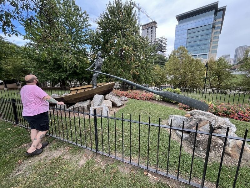
Photographed by Devry Becker Jones (CC0), September 7, 2024
2. The Headman, originally erected in 1988
Credits. This page was last revised on September 8, 2024. It was originally submitted on September 8, 2024, by Devry Becker Jones of Washington, District of Columbia. This page has been viewed 428 times since then and 32 times this year. Photos: 1, 2. submitted on September 8, 2024, by Devry Becker Jones of Washington, District of Columbia.
