Woodbury in Washington County, Minnesota — The American Midwest (Upper Plains)
Farmland to Forest
Photographed by McGhiever, September 9, 2024
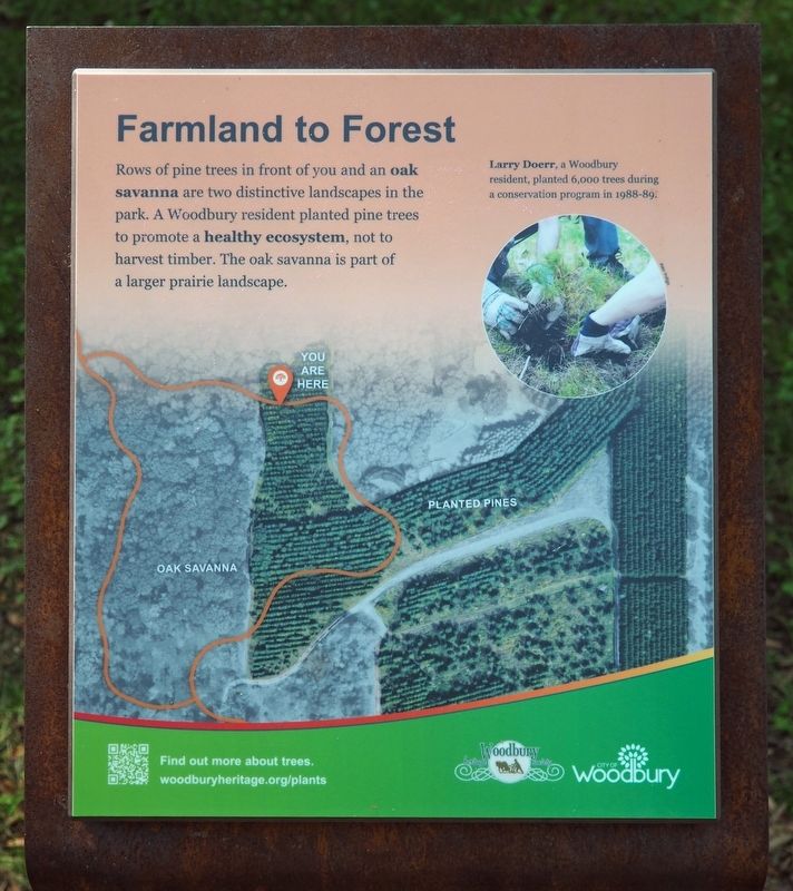
1. Farmland to Forest Marker
Rows of pine trees in front of you and an oak savanna are two distinctive landscapes in the park. A Woodbury resident planted pine trees to promote a healthy ecosystem, not to harvest timber. The oak savanna is part of a larger prairie landscape.
Larry Doerr, a Woodbury resident, planted 6,000 trees during a conservation program in 1988-89.
Erected 2023 by Woodbury Heritage Society and the City of Woodbury.
Topics. This historical marker is listed in these topic lists: Environment • Parks & Recreational Areas. A significant historical year for this entry is 1988.
Location. 44° 55.598′ N, 92° 52.354′ W. Marker is in Woodbury, Minnesota, in Washington County. It can be reached from Conifer Pass east of Whitewater Drive, on the right when traveling east. The marker is in Valley Creek Park, at the north end of the Heritage Trail. Touch for map. Marker is at or near this postal address: 11500 Valley Creek Road, Saint Paul MN 55129, United States of America. Touch for directions.

Regionally, this marker is in the Twin Cities Metropolitan Area. It is also in the American Midwest, in the Corn Belt, and in the
this page online
Other nearby markers. At least 8 other markers are within 7 miles of this marker, measured as the crow flies: What's Under Your Feet? (about 400 feet away, measured in a direct line); Farming Roots (about 500 feet away); Neighbors Helping Neighbors (approx. 0.2 miles away); Helping Hands (approx. ¼ mile away); The Miller Barn (approx. 0.3 miles away); The St. Croix River Valley / Welcome to Minnesota (approx. 3.1 miles away); Bolles Flour Mill (approx. 4.7 miles away); In the Summer of 1910 (approx. 6½ miles away in Wisconsin). Touch for a list and map of all markers in Woodbury.
Also see . . . Find out more about trees. (QR code on marker) (Submitted on September 11, 2024, by McGhiever of Minneapolis, Minnesota.)

Photographed by McGhiever, September 9, 2024
2. Farmland to Forest Marker on the Heritage Trail in Valley Creek Park

Photographed by McGhiever, September 9, 2024
3. The pines along another section of the Heritage Trail
Credits. This page was last revised on September 11, 2024. It was originally submitted on September 11, 2024, by McGhiever of Minneapolis, Minnesota. This page has been viewed 124 times since then and 16 times this year. Photos: 1, 2, 3. submitted on September 11, 2024, by McGhiever of Minneapolis, Minnesota.
