Near Mindenville in Montgomery County, New York — The American Northeast (Mid-Atlantic)
The Canalway Trail: Mindenville

Photographed by Steve Stoessel, September 9, 2024
1. The Canalway Trail: Mindenville Marker
Welcome to the Canalway Trail System, offering hundreds of miles of scenic trails and numerous parks for walking, bicycling, cross country skiing and other recreational activities. The Canalway Trail parallels the New York State Canal System, comprised of four historic waterways: the Erie, the Champlain, the Oswego and the Cayuga-Seneca Canals. The Canal System spans 524 miles across New York State, linking the Hudson River with the Lake Champlain, Lake Ontario, the Finger Lakes, the Niagara River and Lake Erie.
Cooperative initiatives between the New York State Canal Corporation, volunteers, local governments, and federal and state agencies have created this great network of trails for public use. When completed, the Canalway Trail will span over 500 miles connecting numerous cities, towns and villages along the Canal System, making it one of the most extensive trail networks in the country.
Enjoying the Canalway Trail: Safety Tips
The Canalway Trail is intended to accommodate a variety of users. It is important to extend courtesy to all trail users and respect their rights. In order to avoid conflicts, trail protocol
this page online
Each of the canal's 57 new locks, like the one built here in 1907-08, measured nearly 45 feet wide and over 300 feet long. Built with concrete rather than the cut stone of an earlier era, each lock required electrically operated steel gates that could weigh over 20 tons.
When completed in 1918, the Erie Barge Canal cost $155 million. Grain, pulpwood and coal, apples, onions and potatoes, oil, bricks and even automobiles rode to market in the larger barges that could now float through the canal's locks.
[photos:]
Excavation and construction of Lock 16 at Mindenville occurred between 1907 and 1908. The photos at the right were taken at different times during that construction.
Watching For Weakness
Since

Photographed by Steve Stoessel, September 9, 2024
2. Constructing Lock 16 Side of Marker
[photos:]
Mindenville Plan A plan of the businesses and residences along the canal at Mindenville, mid-19th century.
A break and washout flooded the area near Carter’s Basin, May 17, 1916.
New York Governor Theodore Roosevelt, 1900.
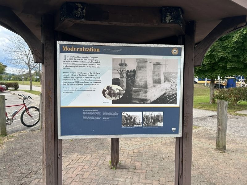
The Eric Canal kept changing. Completed in 1825, the canal has been enlarged again and again. With the introduction of self-propelled boats in the 20th century, it even changed

Photographed by Steve Stoessel, September 9, 2024
3. Modernization Side of Marker
The lock that you see today, part of the Erie Barge Canal, is evidence of the changes that kept the canal operating. Approved in 1903 and completed 15 years later, this modernized canal accommodated barges carrying 3,000 tons of cargo, 100 times more than the capacity of a canal boat from the 1820s.
An impressive engineering accomplishment conceived in an age of national expansion, the barge canal is ten times longer than the Panama Canal.
Controversial Concrete
In the early 20th century, when the state approved millions to enlarge the Eric Canal, concrete was still a controversial building material. Stonecutters and masons lined up in opposition to the use of concrete for canal construction. Some argued that concrete could never withstand the harsh winter weather of upstate New York.
Before deciding, the state sent an engineer to examine concrete structures already complete. He consulted experts familiar with concrete. Accountants tallied the cost and reported that stone structures would cost 16 million additional dollars.
The state chose concrete.
[photos:]
Enlarged Lock 32 in Fort Plain.
Concrete mixer with swinging delivery pipes, ca. 1916
Massive amounts of high strength concrete was used to construct the Medina Aqueduct in 1913.
Topics.

Photographed by Steve Stoessel, September 9, 2024
4. The Canalway Trail: Mindenville Marker
Location. 42° 59.519′ N, 74° 42.545′ W. Marker is near Mindenville, New York, in Montgomery County. It is at the intersection of Empire State Trail and Mindenville Drive (County Route 63) on Empire State Trail. Marker is at Mindenville Canalway parking area. Touch for map. Marker is in this post office area: Fort Plain NY 13339, United States of America. Touch for directions.

Regionally, this marker is in Upstate New York and in the Mohawk Valley. It is also in the American Northeast and in the Mid-Atlantic. Globally, it is in North America, the Western Hemisphere, the Western World, and the Anglosphere. Historically, it finds itself in what was once the Haudenosaunee (Iroquois) Confederacy, New Netherland, and one of the original Thirteen Colonies.
Other nearby markers. At least 8 other markers are within 3 miles of this marker, measured as the crow flies: Erie Canal (approx. 1.3 miles away); The Canalway Trail: Minden (approx. 1.4 miles away); Jacob Zimmerman (approx.
Photographed by Steve Stoessel, September 9, 2024
5. The Canalway Trail: Mindenville Marker
More about this marker. This is a three-sided marker.
Also see . . . Erie Canal (Wikipedia). (Submitted on September 12, 2024, by Steve Stoessel of Niskayuna, New York.)
Credits. This page was last revised on September 12, 2024. It was originally submitted on September 11, 2024, by Steve Stoessel of Niskayuna, New York. This page has been viewed 241 times since then and 21 times this year. Photos: 1, 2, 3, 4, 5. submitted on September 11, 2024, by Steve Stoessel of Niskayuna, New York.
