Oakland in Garrett County, Maryland — The American Northeast (Mid-Atlantic)
The Blockhouse
Photographed by Bradley Owen, September 12, 2024
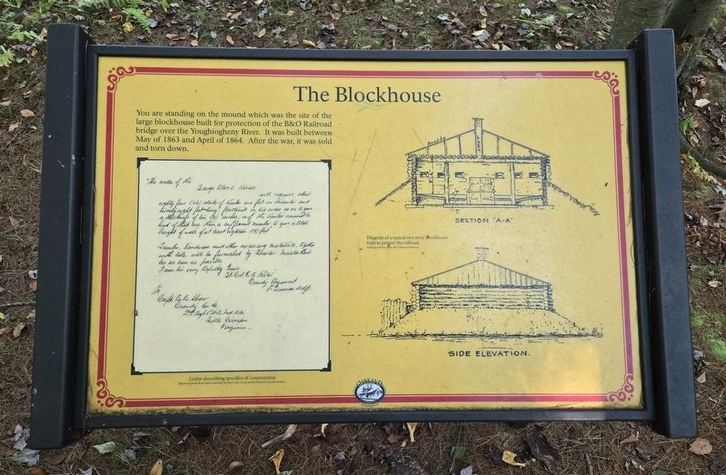
1. The Blockhouse Marker
You are standing on the mound which was the site of the large blockhouse built for protection of the B&O Railroad bridge over the Youghiogheny River. It was built between May of 1863 and April of 1864. After the war, it was sold and torn down.
(Captions):
Letter describing specifics of construction
Reprint from the Book titled, Guarding the Rivers, the Canal and the Railroad, by Jack Sanders.
Diagram of a typical one story Blockhouse built to protect the railroad.
Section "A-A"; Side Elevation.
Drawing courtesy of the B&O Railroad Museum
Erected by The Town of Oakland, Maryland.
Topics and series. This historical marker is listed in these topic lists: Railroads & Streetcars • War, US Civil • Waterways & Vessels. In addition, it is included in the Baltimore and Ohio Railroad (B&O), and the Maryland, Town of Oakland series lists. A significant historical month for this entry is April 1864.
Location. 39° 25.236′ N, 79° 25.374′ W. Marker is in Oakland, Maryland, in Garrett County. It can be reached from West Liberty Street south of Liberty Square Drive, on the left when traveling north. Marker is located
this page online

Regionally, this marker is in Western Maryland. It is also in the American Mid-Atlantic, in Appalachia, and specifically in Northern Appalachia. Globally, it is in North America, the Western Hemisphere, the Western World, and the Anglosphere. Historically, it finds itself in what was once one of the original Thirteen Colonies.
Other nearby markers. At least 8 other markers are within walking distance of this marker: Little Youghiogheny River (a few steps from this marker); Colonel Mulligan's Telegram (within shouting distance of this marker); The Baltimore & Ohio Railroad and Garrett County (approx. 0.2 miles away); Fort Alice (approx. ¼ mile away); Oakland, the B&O, and The Jones / Imboden Raid (approx. 0.3 miles away); A Tribute to Garrett County's Civil War Soldiers (approx. 0.3 miles away); Legislative Forest (approx. 0.6 miles away); Tradition of Washington Spring (approx. 0.7 miles away). Touch for a list and map of all

Photographed by Bradley Owen, September 12, 2024
2. The Blockhouse Marker

Photographed by Bradley Owen, September 12, 2024
3. The Blockhouse Marker
The marker is located at the top of the mound, the site of the former blockhouse.
Credits. This page was last revised on September 14, 2024. It was originally submitted on September 14, 2024, by Bradley Owen of Morgantown, West Virginia. This page has been viewed 206 times since then and 24 times this year. Photos: 1, 2, 3. submitted on September 14, 2024, by Bradley Owen of Morgantown, West Virginia.
