La Grange Park in Cook County, Illinois — The American Midwest (Great Lakes)
Salt Creek Woods
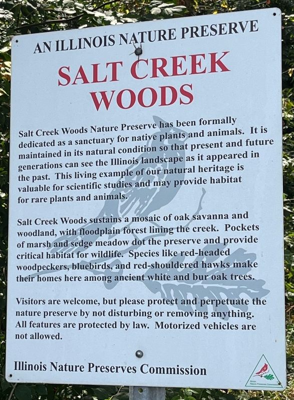
An Illinois Nature Preserve
Photographed by Sean P. Flynn, September 15, 2024
1. Salt Creek Woods Marker
Salt Creek Woods sustains a mosaic of oak savanna and woodland, with floodplain forest lining the creek. Pockets of marsh and sedge meadow dot the preserve and provide critical habitat for wildlife. Species like red-headed woodpeckers, bluebirds, and red-shouldered hawks make their homes here among ancient white and bur oak trees.
Visitors are welcome, but please protect and perpetuate the nature preserve by not disturbing or removing anything. All features are protected by law. Motorized vehicles are not allowed.
Erected by Illinois Nature Preserves Commission.
Topics. This historical marker is listed in these topic lists: Animals • Environment • Horticulture & Forestry • Parks & Recreational Areas.
Location. 41° 50.028′ N,
this page online

Regionally, this marker is in Greater Chicago. It is also in the American Midwest. Globally, it is in North America, on the Great Lakes, in the Western Hemisphere, in the Western World, and in the Anglosphere. Historically, it finds itself in what was once the Viceroyalty of New France, the territory of the Mississippian Culture, and the Northwest Territory.
Other nearby markers. At least 8 other markers are within 2 miles of this marker, measured as the crow flies: Veterans Memorial (approx. 0.4 miles away); Field of Honor (approx. 0.4 miles away); a different marker also named Salt Creek Woods (approx. half a mile away); Wolf Road Prairie (approx. 0.6 miles away); a different marker also named Wolf Road Prairie (approx. 0.7 miles

Photographed by Sean P. Flynn, September 15, 2024
2. Salt Creek Woods Marker
More about this marker. An identical sign can be found off of Wolf Road south of 31st Street, about ¾ of a mile (by car) southwest of here.
Also see . . . Forest Preserves of Cook County: Salt Creek Woods Nature Preserve.
Excerpt: "Dedicated as an Illinois Nature Preserve in 1965, the 245-acre Salt Creek Woods Nature Preserve is defined by the winding path of Salt Creek and the gently rolling topography of the Tinley Ground Moraine—an accumulation of rocks and soil deposited by the movement of glaciers. Remnant oak savanna and oak-hickory woodland dominate the site, with floodplain forest lining the creek. On the northern border, a small prairie opening hints at the expanse that Native Americans would have known before the impacts of European settlement and urban development."(Submitted on September 16, 2024, by Sean P. Flynn of Oak Park, Illinois.)

Photographed by Sean P. Flynn, September 15, 2024
3. Salt Creek Woods Marker
The marker is at the spot where Mayfair Avenue meets 31st Street.
Credits. This page was last revised on January 27, 2025. It was originally submitted on September 16, 2024, by Sean P. Flynn of Oak Park, Illinois. This page has been viewed 132 times since then and 27 times this year. Photos: 1, 2, 3. submitted on September 16, 2024, by Sean P. Flynn of Oak Park, Illinois.
