Nags Head in Dare County, North Carolina — The American South (South Atlantic)
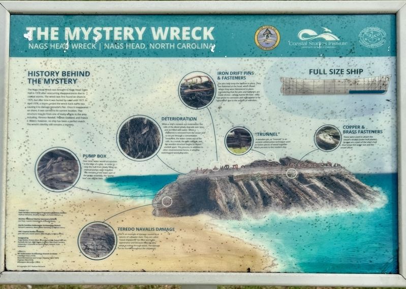
The Mystery Wreck
Nags Head Wreck | Nags Head, North Carolina
Photographed by Brandon D Cross
1. The Mystery Wreck Marker
History Behind the Mystery
The Nags Head Wreck was brought to Nags Head Town Hall in 1978 after reoccurring disappearances due to coastal storms. The wreck was first found on shore in 1975, but after time it was buried by sand until 1977. In April 1978, a storm carried the wreck back out to sea causing it to damage Jeannette’s Pier. Once it reappeared on shore, it was carried to its current location. The structure may be from one of many wrecks in the area including, Florence Randall, Thomas Goddard, and Francis E. Waters; however, no ship has been a perfect match. The wreck’s identity still remains a mystery.
Pump Box
Over time, water would accumulate in the bilge of a ship. In order to stop the hull from slowly filling up, manual pumps were installed. The remains of the lower part of the pump assembly, the “pump box” can still be seen.
Teredo Navalis Damage
This is an example of damage caused by a species of saltwater clam. They are called “naval shipworms” for the worm like appearance and because they are very adept at eating through wood. The damage can be found throughout the shipwreck.
Deterioration
When
this page online
Iron Drift Pins & Fasteners
The pins help keep the keelson in place. They are flattened at the head, which shows where they were hammered in place. Considering that the pins and fasteners are made of iron—which marine life love—they are prone to corrosion and may appear to be “concreted” due to the actions of microbes.
“Trunnel”
A wooden pin, or “treenail,” is an ancient construction technique used to fasten a piece of wood together which persists to the modern day.
Copper & Brass Fasteners
These were used to attach the vessel’s strakes (outer hull planks). Strakes are a part of the ship’s hull that keeps the water out and the vessel afloat.
Erected by The Town of Nags Head and the Coastal Studies Institute,
Photographed by Brandon D Cross
2. The Mystery Wreck Marker
Topics. This historical marker is listed in these topic lists: Anthropology & Archaeology • Industry & Commerce • Waterways & Vessels. A significant historical month for this entry is April 1978.
Location. 35° 56.073′ N, 75° 36.72′ W. Marker is in Nags Head, North Carolina, in Dare County. It can be reached from South Croatan Highway near Nags Head Town Hall, on the right when traveling north. The marker is located on the grounds of the Nags Head Municipal Building. Touch for map. Marker is at or near this postal address: 5401 S Croatan Hwy, Nags Head NC 27959, United States of America. Touch for directions.

Regionally, this marker is in North Carolina’s Coastal Plain and on the Outer Banks. It is also in the American South, specifically in the Upper South, in the Tidewater, and on the Eastern Seaboard. Globally, it is in the North Atlantic Region, North America, the Western Hemisphere, the Western World, and the Anglosphere. Historically, it finds itself in what was once the territory of the Mississippian Culture, one of the original Thirteen Colonies, one of the Confederate States

Photographed by Brandon D Cross
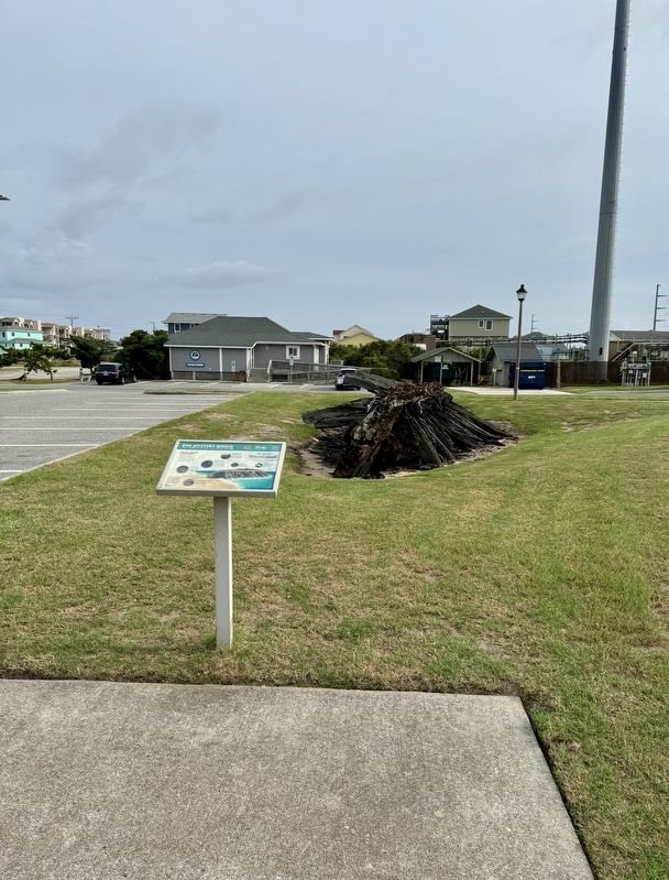
3. The Mystery Wreck remains
Other nearby markers. At least 8 other markers are within 3 miles of this marker, measured as the crow flies: Veterans Memorial (within shouting distance of this marker); Francis & Gertrude Rogallo (approx. 1.8 miles away); About the Park (approx. 2.2 miles away); Life on the Edge (approx. 2.2 miles away); A Natural Wind Laboratory (approx. 2.3 miles away); Jockey's Ridge (approx. 2.3 miles away); Jockey’s Ridge State Park (approx. 2.3 miles away); Carolista Baum (approx. 2½ miles away). Touch for a list and map of all markers in Nags Head.
Also see . . . A Shipwreck Mystery at Nags Head. Carolina Designs Realty website entry (Submitted on September 16, 2024, by Brandon D Cross of Flagler Beach, Florida.)
Credits. This page was last revised on July 16, 2025. It was originally submitted on September 16, 2024, by Brandon D Cross of Flagler Beach, Florida. This page has been viewed 725 times since then and 50 times this year. Photos: 1, 2, 3. submitted on September 16, 2024, by Brandon D Cross of Flagler Beach, Florida. • Bernard Fisher was the editor who published this page.
