
Manakin-Sabot in Goochland County, Virginia — The American South (Mid-Atlantic)
"Dover Steam Mill"
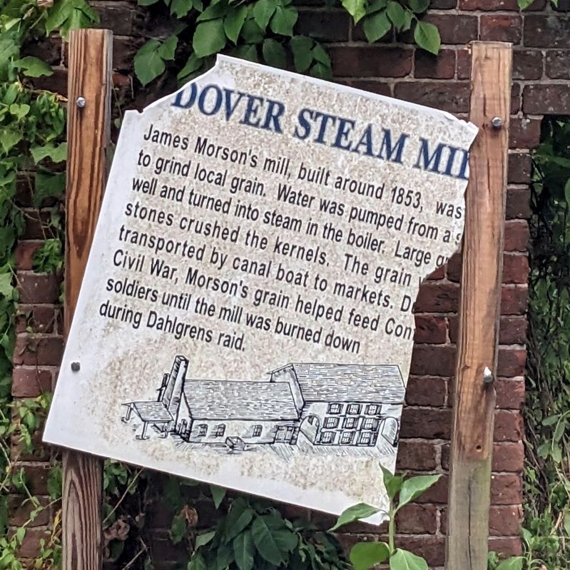
Photographed by Bernard Fisher, June 26, 2024
1. "Dover Steam Mill" Marker
Topics. This historical marker is listed in these topic lists: Agriculture • Industry & Commerce • War, US Civil. A significant historical year for this entry is 1853.
Location. 37° 37.672′ N, 77° 46.147′ W. Marker has been damaged. Marker is in Manakin-Sabot, Virginia, in Goochland County. It is on Dover Road 0.4 miles north of River Road West (Virginia Route 6), on the right when traveling north. Touch for map. Marker is at or near this postal address: 857 Dover Road, Manakin Sabot VA 23103, United States of America. Touch for directions.

Regionally, this marker is in Virginia’s Piedmont, in Central Virginia, and in the Richmond Metropolitan Area. It is also in the American South and specifically in the Upper South. Globally, it is in
this page online
Other nearby markers. At least 8 other markers are within 4 miles of this location, measured as the crow flies: "Dahlgren's Raid" (a few steps from this marker); a different marker also named Dahlgren's Raid (approx. 0.4 miles away); Sabot Hill (approx. 0.9 miles away); James Pleasants (approx. 2.1 miles away); First Union School (approx. 2.1 miles away); a different marker also named James Pleasants (approx. 3.4 miles away); Lee's Last Camp (approx. 3.7 miles away); a different marker also named Lee's Last Camp (approx. 3.7 miles away). Touch for a list and map of all markers in Manakin-Sabot.
Another marker is no longer nearby. Lee’s Last Bivouac (was approx. 3.7 miles away but has been replaced with another marker now near it).
Also see . . . Dover Mill. Botello's Adventures website entry (Submitted on August 23, 2025, by Larry Gertner of New York, New York.)

Photographed by Bernard Fisher, June 26, 2024
2. "Dover Steam Mill" Marker

Photographed by Bernard Fisher, June 26, 2024
3. Dover Mill Ruins
Credits. This page was last revised on August 23, 2025. It was originally submitted on June 26, 2024, by Bernard Fisher of Richmond, Virginia. This page has been viewed 1,042 times since then and 178 times this year. Last updated on September 16, 2024, by Carl Gordon Moore Jr. of North East, Maryland. Photos: 1, 2, 3. submitted on June 26, 2024, by Bernard Fisher of Richmond, Virginia.
