
North Central College in Naperville in DuPage County, Illinois — The American Midwest (Great Lakes)
The Potawatomi and Fort Payne

Photographed by Sean P. Flynn, September 15, 2024
1. The Potawatomi and Fort Payne Marker
this page online
Erected 2024 by Illinois State Historical Society.
Topics and series. This historical marker is listed in these topic lists: Forts and Castles • Indigenous Peoples and Communities • Settlements & Settlers

Photographed by Sean P. Flynn, September 15, 2024
2. The Potawatomi and Fort Payne Marker
Location. 41° 46.247′ N, 88° 8.691′ W. Marker is in Naperville, Illinois, in DuPage County. It is in North Central College. It can be reached from Brainard Street 0.2 miles south of Chicago Avenue, on the right when traveling west. The marker is on the campus of North Central College, in front of New Hall. It is accessible from Brainard Street via a walkway between New Hall and the parking garage. Touch for map. Marker is in this post office area: Naperville IL 60540, United States of America. Touch for directions.

Regionally, this marker is in Greater Chicago. It is also in the American Midwest. Globally, it is in North America,

Photographed by Sean P. Flynn, September 15, 2024
3. The Potawatomi and Fort Payne Marker
New Hall is on the right.
Other nearby markers. At least 8 other markers are within walking distance of this marker: Bill Shatzer (within shouting distance of this marker); North Central College Community Garden (about 300 feet away, measured in a direct line); WONC-FM 89.1 (about 400 feet away); Henry Tayama (about 500 feet away); James L. Nichols (about 500 feet away); Mildred Rebstock, Ph.D (about 500 feet away); Rev. George St. Angelo (about 600 feet away); North Central Students at Selma (about 700 feet away). Touch for a list and map of all markers in Naperville.
Another marker is no longer nearby. Fort Payne

Photographed by Paul Fehrenbach, September 2, 2016
4. The original Fort Payne Marker
This original marker, dating to 1964, was replaced by a new one in 2024.
More about this marker. This marker replaces a previous Illinois State Historical Society marker related to Fort Payne that sat at the same exact spot. That old marker, erected in 1964 in conjunction with the DuPage County Historical Society, was deemed to be both historically inaccurate and insensitive to Native American culture.
Although the sign says August 2024, the official unveiling was in April.
Related marker. Click here for another marker that is related to this marker. The previous Fort Payne marker replaced by this new one in 2024
Also see . . .
1. North Central College dedicates new historical marker on campus.
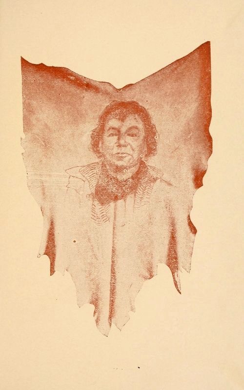
Excerpt: "The existing marker was both historically inaccurate regarding(Submitted on September 17, 2024, by Sean P. Flynn of Oak Park, Illinois.)the events of the 1832 Black Hawk War and insensitive to Native American culture. Students, faculty, staff and others expressed concern about the marker and sought a more accurate replacement. A team of North Central students supported by faculty from several disciplines worked together to make it happen. The team was led by history and secondary education major Raygn Jordan '24 and included faculty members Dr. Luke Franks, associate professor and chair of history, and Dr. Ann Keating, Dr. C. Frederick Toenniges Professor of History."Courtesy of the Library of Congress5. Chief ShabbonaFrom the 1915 book The Indian Chief Shabbona, by Luther A. Hatch, superintendent of public schools in DeKalb, Illinois. There is a village named Shabbona in DeKalb County.
2. The History of Fort Payne (1832) in the Naper settlement, today's Naperville, Illinois. From the The Digital Research Library of Illinois History Journal (Submitted on September 17, 2024, by Sean P. Flynn of Oak Park, Illinois.)
3. Naperville’s North Central College unveils new Potawatomi and Fort Payne historical marker. From Naperville Community Television
Excerpt: "In 1832, a Potawatomi chief informed local settlers in the Naperville area that people were being massacred south of the settlement by Chief Black Hawk. After hearing the news, militia Captain Morgan L. Payne guided local pioneers to construct a wooden fort stretching one-half acre, surrounded by a 10-foot high stockade.(Submitted on September 23, 2024, by Sean P. Flynn of Oak Park, Illinois.)
"The Potawatomi and other area nations were eventually forced west of the Mississippi River, but the new marker notes the Potawatomi leaders’ work to remain neutral and keep peace in the area during the time of conflict."
Credits. This page was last revised on April 2, 2026. It was originally submitted on September 16, 2024, by Sean P. Flynn of Oak Park, Illinois. This page has been viewed 628 times since then and 104 times this year. Photos: 1. submitted on September 16, 2024, by Sean P. Flynn of Oak Park, Illinois. 2, 3. submitted on September 17, 2024, by Sean P. Flynn of Oak Park, Illinois. 4. submitted on September 8, 2016, by Paul Fehrenbach of Richfield, Wisconsin. 5. submitted on September 17, 2024, by Sean P. Flynn of Oak Park, Illinois.
