Constitution near Atlanta in DeKalb County, Georgia — The American South (South Atlantic)
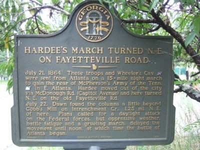
Hardee’s March Turned N.E. on Fayetteville Road
Photographed by Felch Dumas, August 11, 2008
1. Hardee’s March Turned N.E. on Fayetteville Road Marker
July 21, 1864. These troops and Wheeler’s Cav. (CS) were sent from Atlanta on a 15-mile night march to gain the rear of McPherson’s Army of the Tenn. (US) in E. Atlanta. Hardee moved out of the city via McDonough Rd. (Capital Avenue) and here turned N.E. on the old Fayetteville Rd.
July 22. Dawn found the columns a little beyond Cobb’s Mill on Intrenchment Cr., 1.25 mi. N.E. of here. Plans called for a daylight attack on the Federal forces, but oppressive weather, battle fatigue, and a grueling march, delayed the movement until noon, at which time the battle of Atlanta began.
Erected 1984 by Georgia Historic Marker. (Marker Number 044-59.)
Topics and series. This historical marker is listed in this topic list: War, US Civil. In addition, it is included in the Georgia Historical Society series list. A significant historical date for this entry is July 21, 1864.
Location. Marker has been reported permanently removed. It was located near 33° 41.25′ N, 84° 20.816′ W. Marker was near Atlanta, Georgia, in DeKalb County. It was in Constitution. It was on Fayetteville Road SE south of Fleetwood Drive SE, on the right when traveling
this page online
We have been informed that this marker is no longer there and will not be replaced. This page is an archival view of what was.
Regionally, this marker was in Georgia’s Piedmont. It was also in the American South and specifically in the Deep South. Globally, it was in North America, the Western Hemisphere, the Western World, and the Anglosphere. Historically, it found itself in what was once the territory of the Mississippian Culture, one of the original Thirteen Colonies, one of the Confederate States of America, and the Antebellum South.

Other nearby markers. At least 8 other markers are within 3 miles of this location, measured as the crow flies: Hardee's Night March (approx. 1.2 miles away); Route of Stewart's Corps from Atlanta (approx. 1.2 miles away); Site: Cobb’s Mill (approx. 1.3 miles away); Hardee at Wm. Cobb’s House (approx. 1.3 miles away); South-View Cemetery (approx. 1.9 miles away); Stewart’s & Lee’s A.C. March to Lovejoy’s Sta. (approx. 2 miles away); Hardee at Road Fork
Photographed by Felch Dumas, August 11, 2008
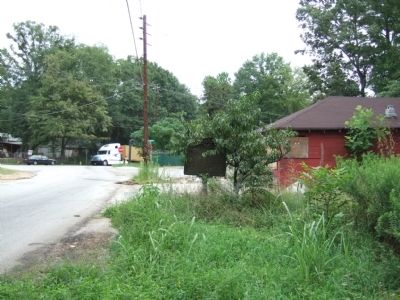
2. Hardee’s March Turned N.E. on Fayetteville Road Marker
Looking northeast towards Intrenchment Creek.
Credits. This page was last revised on September 18, 2024. It was originally submitted on August 14, 2008, by Felch Dumas of Decatur, Georgia. This page has been viewed 1,622 times since then and 33 times this year. Last updated on September 17, 2024, by Amanda Zimmer of Atlanta, Georgia. Photos: 1, 2. submitted on August 14, 2008, by Felch Dumas of Decatur, Georgia. • Bernard Fisher was the editor who published this page.
