Spring Hill in Somerville in Middlesex County, Massachusetts — The American Northeast (New England)
Civil War Monument
Milk Row Cemetery
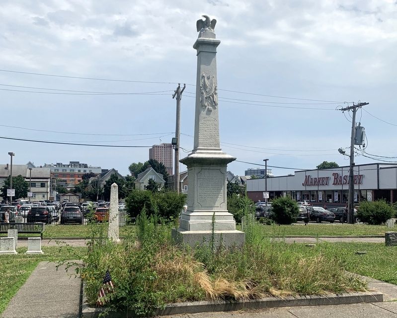
Photographed by Marc Posner, July 7, 2024
1. Civil War Monument Marker
(West Side) S.L.I.
Incorporated A.D. 1853.
Erected by the Somerville Light Infantry with the balance of a fund generously contributed by their fellow citizens in and of the company on entering the U.S. service for three months April 19, 1861.
In memory of all from this town who have fallen in the service of their country.
Their warfare is over
They sleep well.
(South Side) Entered U.S. Service for three months April 19, 1861.
Washington D.C. and Va.
E. Franklin Hanaford, Bull Run, July 21, 1861.
W. Frank Moore, Washington, July 31, 1861.
Lieut. Edward Brackett, 10th Me., Antietam, September 18, 1862.
Samuel G. Tompkins, Newbern, June 22, 1863.
N. Fletcher Nelson, 23rd Mass., Richmond, June 11, 1864.
Lieut. T.J. Van de Sande, 115th N.Y. Ft. Munroe, Sept. 3, 1864.
Erected 1863 by Citizens of Somerville.
Topics. This monument and memorial is listed in these topic lists: Cemeteries & Burial Sites • War, US Civil.
Location. 42° 22.898′ N, 71° 6.121′ W. Monument is in Somerville, Massachusetts, in Middlesex County. It is in Spring Hill. It is at the
this page online

Regionally, this memorial monument is in Historic Boston and specifically in Greater Boston. It is also in the American Northeast, in New England, and on the Eastern Seaboard. Globally, it is in the North Atlantic Region, North America, the Western Hemisphere, the Western World, and the Anglosphere. Historically, it finds itself in what was once one of the original Thirteen Colonies.
Other nearby markers. At least 8 other markers are within walking distance of this marker: Milk Row Cemetery (within shouting distance of this marker); Quincy Street Open Space (about 500 feet away, measured in a direct line); A Moment In Time (about 600 feet away); John Nunziato Field (approx. 0.2 miles away); Nunziato Field (approx. 0.2 miles away); The Richmond (approx. ¼ mile away); Duck Village (approx. ¼ mile away); The Somerville Home (approx. ¼ mile away). Touch for a list and map of all markers in Somerville.
Also see . . . The Civil War Monument. Somerville Historical Society, Somerville Museum (Submitted on September 19, 2024.)
Credits. This page was last revised on September 19, 2024. It was originally submitted on September 18, 2024, by Marc Posner of Somerville, Massachusetts. This page has been viewed 294 times since then and 18 times this year. Photo 1. submitted on September 18, 2024, by Marc Posner of Somerville, Massachusetts. • Bernard Fisher was the editor who published this page.
