Charlevoix in Charlevoix County, Michigan — The American Midwest (Great Lakes)
The Development of East Park
⎯⎯⎯
The South Shore of Round Lake
Photographed by J. J. Prats, September 10, 2024
1. The Development of East Park side of marker
Click on image to examine the photographs.
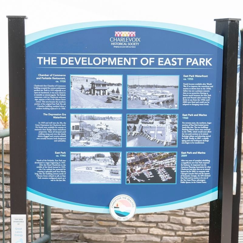
Chamber of Commerce and Parkside Restaurant, ca. 1938. Charlevoix’s first Chamber of Commerce building occupied the curent performance pavilion site. Built in 1925 originally as an open-air bandstand, it was soon closed in to resemble oriental pagoda. The Parkside restaurant, with its Charlevoix welcome signs, appears at left at the Mason Street corner. This area became the southern portion of the original East Park. The old Chamber building vanished when a modern building replaced it in 1968.
The Depression Era Waterfront In 1929 and well into the 30s, the Great Depression hit Charlevoix hard. No funds were available for anyone to maintain their Bridge Street waterfront properties. These all decayed until walking along and over this thirtly debris-clogged and vermin-infested area actually became both dangerous and unhealthy.
East Park, ca. 1940 North of the Parkside, East Park developed in stages beginning in 1937. After the Hotel Charlevoix in the middle of the block burned in 1935, the City realized the potential for creating a splendid park four blocks long. But the building owner
this page online
East Park Waterfront, ca. 1955. Funds became available after World War II to improve the waterfront and marina shown here in the 1950s. Safety was not a primary concern then as no protective fencing or barrier stood between the East Park grass and Round Lake's waters. The docks in use from the 1950s until 2008 were fixed and could not be adapted to changing water levels.
East Park and Marina, 1960. For seventy years, the northern, larger portion of East Park looked pretty much like this. The two buildings flanking Mason Street were removed in the 1990s, which would soon allow the two park sections to be joined. Redesign debate and planning started in 1998. Finally, in 2007, a rapidly aging park and inadequate dockage area began to be transformed.
East Park and Marina, 2009. After two years of complete rebuilding, a magnificent new East Park reopened for business. So impressed was the American Planning Association by what Charlevoix had done that on its annual Honors list for 2009, in company
Photographed by J. J. Prats, September 10, 2024
2. The South Shore of Round Lake side of marker
(side two)
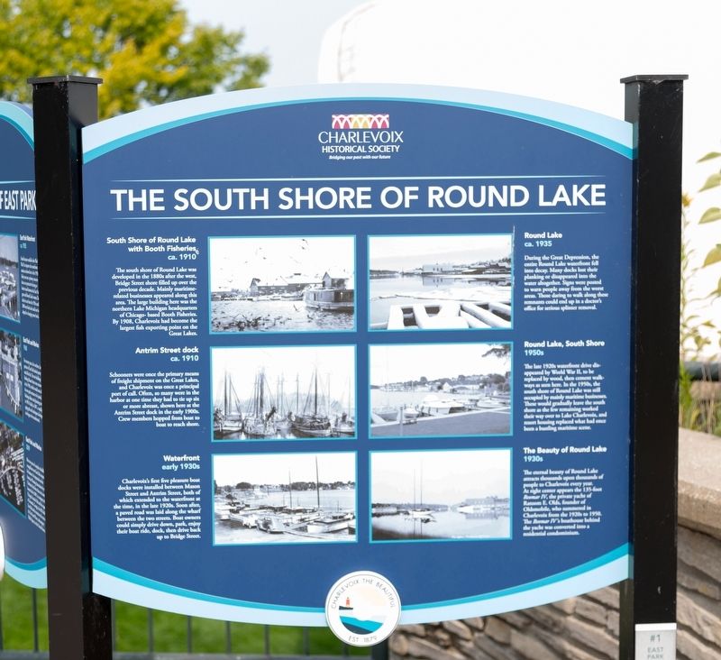
South Shore of Round Lake with Booth Fisheries, ca. 1910. The south shore of Round Lake developed in the 1880 after the west Bridge Street shore filled up over the pervious decade. Mainly maritime-related business appeared along this area. The large building here was the northern Lake Michigan headquarters of Chicago-based Booth Fisheries. By 1908, Charles had become the largest fish exporting point on the Gerat Lakes.
Antrim Street dock, ca. 1910. Schooners were once the primary of freight shipment on the Great Lakes, and Charlevoix was once a principal port of call. Often, so many were in the harbor at one time they had to the up six or more abreast, shown here at the Antrim Street dock in the early 1900s. Crew members hopped from boat to reach the shore.
Waterfront, early 1930s. Charlevoix’s first five pleasure boat docks were installed beween Mason Street and Antrim Street, both of which
Photographed by J. J. Prats, September 10, 2024
3. The Development of East Park / The South Shore of Round Lake Marker
Round Lake, ca. 1935. During the Great Depression, the entire Round Lake waterfront fell into decay. Many docks lost their planking or disappeared into the water altogether. Signs were posted to warn people away from the worst areas, Those daring to walk along these remnants could end up in a doctor’s office for serious splinter removal.
Round Lake, South Shore, 1950s. The late 1920s waterfront drive disappeared by World War II, to be replaced by wood, then cement walkways as seen here. In the 1950s, the south shore of Round Lake was still occupied by mainly maritime businesses. These would gradually leave the south shore as the few remaining worked their way over to lake Charlevoix, and resort housing replaced what had once been a bustling maritime scene.
The Beauty of Round Lake, 1930s. The eternal beauty of Round Lake attracts thousands upon thousands of people to
Photographed by J. J. Prats, September 10, 2024
4. The Development of East Park / The South Shore of Round Lake Marker
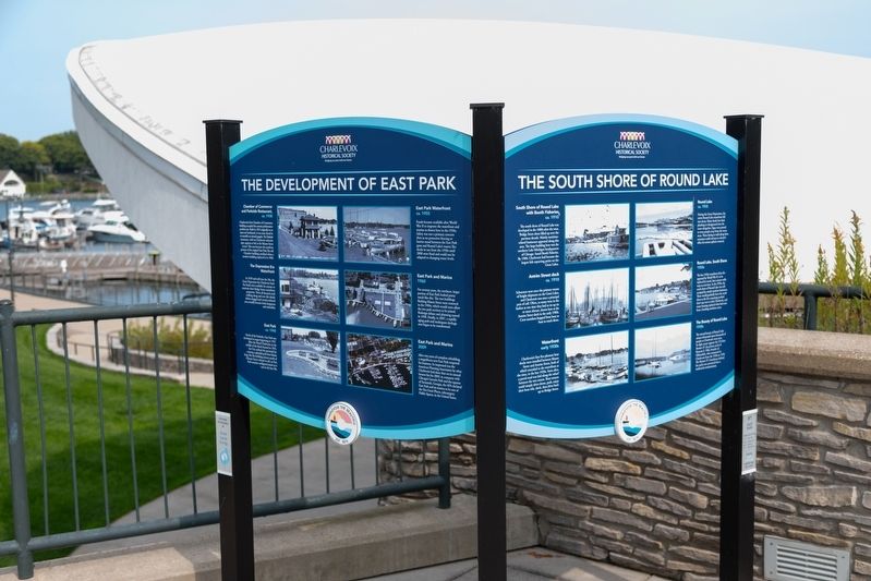
Round Lake is in the distance. The clamshell roof of the pavilion stage is behind the marker.
Erected by Charlevoix Historical Society. (Marker Number 1.)
Topics. This historical marker is listed in these topic lists: Industry & Commerce • Parks & Recreational Areas • Waterways & Vessels. A significant historical year for this entry is 1938.
Location. 45° 18.935′ N, 85° 15.506′ W. Marker is in Charlevoix, Michigan, in Charlevoix County. It is on Bridge Street north of Antrim Street, on the right when traveling north. It is in the small cement plaza above and beside the pavilion's clamshell. Touch for map. Marker is at or near this postal address: 408 Bridge St, Charlevoix MI 49720, United States of America. Touch for directions.

Regionally, this marker is in Northern Michigan Lower Peninsula, in the Grand Traverse Bay Region, and in one of the Lake Michigan Shore counties. It is also in the American Midwest. Globally, it is in North America,
Photographed by J. J. Prats, September 10, 2024
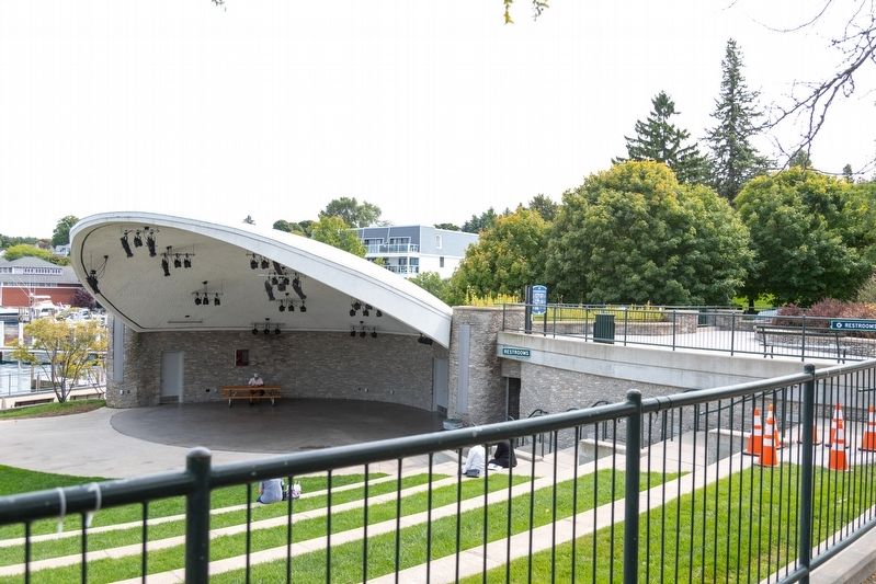
5. Odmark Pavilion in East Park
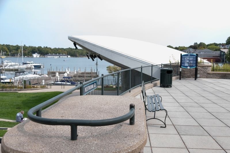
This marker is in the distance, on the upper plaza to the right of the roof.
Other nearby markers. At least 8 other markers are within walking distance of this marker: Odmark Band Pavilion (a few steps from this marker); Still On Patrol (within shouting distance of this marker); Benjamin S. Gill, EMC USN (within shouting distance of this marker); USS Escolar (SS 294) Memorial (within shouting distance of this marker); Wharfside Building and Park Acquisition (about 300 feet away, measured in a direct line); The Harsha House Museum (about 500 feet away); A Multitude of Vessels on Round Lake / The East Park Waterfront (about 700 feet away); Fishing and Lumbering - Round Lake, North Shore / Bridge Park and Bridge Street (approx. 0.2 miles away). Touch for a list and map of all markers in Charlevoix.
Credits. This page was last revised on September 21, 2024. It was originally submitted on September 20, 2024, by J. J. Prats of Powell, Ohio. This page has been viewed 177 times since then and 31 times this year. Photos: 1, 2. submitted on September 20, 2024, by J. J. Prats of Powell, Ohio. 3, 4, 5. submitted on September 21, 2024, by J. J. Prats of Powell, Ohio.
