Richmond in Henrico County, Virginia — The American South (Mid-Atlantic)
Well
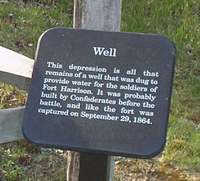
Photographed by Bill Coughlin, April 24, 2007
1. Well Marker
Erected by Richmond National Battlefield Park - National Park Service.
Topics. This historical marker is listed in this topic list: War, US Civil. A significant historical date for this entry is September 29, 1864.
Location. 37° 25.583′ N, 77° 22.428′ W. Marker is in Richmond, Virginia, in Henrico County. It can be reached from Battlefield Park Road, on the left when traveling south. Marker is located on the walking trail in the Fort Harrison Unit of Richmond National Battlefield Park. Touch for map. Marker is in this post office area: Henrico VA 23231, United States of America. Touch for directions.

Regionally, this marker is in the Piedmont and in Central Virginia. It is also in the American South, specifically in the Upper South, and on the Eastern Seaboard. Globally, it is in the North Atlantic Region, North America, the Western Hemisphere, the Western World, and the Anglosphere. Historically, it
this page online
Other nearby markers. At least 8 other markers are within walking distance of this marker: Building Fort Burnham (a few steps from this marker); Storming the Fort (within shouting distance of this marker); The Fort Parapet (within shouting distance of this marker); Bombproof (within shouting distance of this marker); Bombproof and Casemate (within shouting distance of this marker); Counterattack (about 300 feet away, measured in a direct line); A Unique Photograph (about 300 feet away); Confederate Trenches (about 300 feet away). Touch for a list and map of all markers in Richmond.
Also see . . .
1. Battlefield Tour - Ft Gilmer to Ft Brady. Richmond National Battlefield Park website. (Submitted on January 20, 2009, by Bill Coughlin of Woodland Park, New Jersey.)
2. Fort Harrison. Richmond Battlefields Fort Harrison website. (Submitted on January 20, 2009, by Bill Coughlin of Woodland Park, New Jersey.)
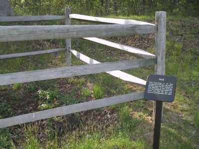
Photographed by Bill Coughlin, April 24, 2007
2. Marker in Fort Harrison
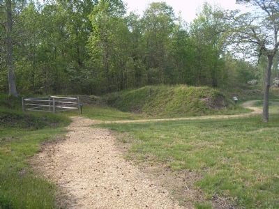
Photographed by Bill Coughlin, April 24, 2007
3. Marker on Fort Harrison Trail
The Well marker can be seen to the left in the photo.
Photographed by Bill Coughlin, April 24, 2007
4. Richmond National Battlefield Park
Marker is in the Fort Harrison Unit of Richmond National Battlefield Park.
Credits. This page was last revised on September 23, 2024. It was originally submitted on January 20, 2009, by Bill Coughlin of Woodland Park, New Jersey. This page has been viewed 1,025 times since then and 25 times this year. Last updated on September 21, 2024, by Carl Gordon Moore Jr. of North East, Maryland. Photos: 1, 2, 3, 4. submitted on January 20, 2009, by Bill Coughlin of Woodland Park, New Jersey. • Bernard Fisher was the editor who published this page.
