Sidney in Cheyenne County, Nebraska — The American Midwest (Upper Plains)
385 Gold Rush Byway

Photographed by Cosmos Mariner, August 12, 2023
1. 385 Gold Rush Byway Marker
(center kiosk panel)
(center kiosk panel)
Thar’s gold in them thar hills!
The Black Hills Gold Rush
1874: Two scientists attached to the Custer Expedition uncover gold in sacred Sioux land in South Dakota—and the Black Hills Gold Rush is on.
During the Allison Commission in 1875, the Sioux refused to sell their reservation to the U.S. government. This territory, known as the Dakotas, had been assured to them in the Treaty of 1868. But the government, despite promises to the contrary, could not discourage prospectors from invading once word of gold leaked out. By 1876, thousands of fortune hunters were in the Black Hills and another round of war with the Sioux had begun.
Sidney was already an established trailhead for shipping goods to the Nebraska Indian agencies. From 1876 to 1881, the Sidney-Blackhills Trail carried much of the traffic, supplies and gold to and from the Black Hills mining towns. During 1878 to 1879 alone, over 22 million pounds of freight moved along the trail—and some $200,000 in gold shipments moved south to Sidney to the railroad.
Today, the trail offers a different kind of riches—panoramic views, unique geology, fascinating museums and attractions,
this page online
I stepped off the train in Sidney… ready to strike it rich.
1877: They say there's gold in the Black Hills. The trail to fame and fortune begins in Sidney since the Union Pacific Railroad station here is one of the closest points to the Black Hills. It's about 260 miles or 20 days by wagon to the Deadwood mining camps—providing you don't get bit by a rattler or attacked by Sioux along the way.
I'm headed north myself. First, I need supplies—salt pork, coffee, hardtack, tools and the like. I'm worried about finding fresh water along the way. I've heard tales of sickness and death—just from drinking from the wrong stream or pond.
They tell me I should wait a couple of weeks until the worst of the spring storms has passed. I've heard tell of hailstones the size of oranges and terrible winds that turn wagons on their sides. Thankfully, the Clarke Bridge over the Platte River opened last year. Before that, gold seekers had to ford the Platte, made a mile wide and treacherous due to rains and spring thaw.
I know there's bullion coming out of the Black Hills. Yesterday, I saw the

Photographed by Cosmos Mariner, August 12, 2023
2. 385 Gold Rush Byway: Area Attractions
(right kiosk panel)
(right kiosk panel)
If Sidney isn't your final destination, Union Pacific may not even let you off the train in this town. Between the gambling houses, saloons and bordellos, it's surely no place for the casual visitor or the faint of heart. Sometimes, it seems like the only people striking it rich are the barkeeps and brothel owners. And the storekeepers who sell picks and shovels to those of us suffering from gold fever.
The trail will be long and hard. And mining for gold won't be easy either. But I know one thing for sure—when I strike it rich, my troubles will be over.
Area Attractions (right kiosk panel)
As you travel the 385 Gold Rush Byway, you're just minutes from unique and amazing attractions. Here are some near this location:
Courthouse & Jail Rocks
These unusual geological formations were significant landmarks along the Oregon and Mormon trails. 8 miles southwest of Bridgeport on Highway 88.
Chimney Rock National Historic Site and Visitor Center
Visible for several days along

Photographed by Cosmos Mariner, August 12, 2023
3. 385 Gold Rush Byway: Points of Interest
(left kiosk panel)
(left kiosk panel)
Fort Sidney Museum & Post Commander's Home
Fort Sidney was built to protect Union Pacific railroad workers from Sioux, Cheyenne and Arapahoe war parties. Today you can enter the living quarters of the fort's officers and post commander. Post Commander Home: 1108 6th Avenue in Sidney. Officers' Quarters: 6th & Jackson in Sidney.
Bayard Museum
Housed in a refurbished railroad depot, this local history museum illustrates the fascinating tales of the development of this region and the westward movement of the pioneers. South end of downtown Bayard.
Mud Springs Pony Express Station
Originally constructed in 1859 as a stage station and used later as a Pony Express home station. The station provided meals, lodging, and fresh horses. After the Pony Express ceased, the station operated as a stagecoach and telegraph station. In February of 1865, a telegraph operator and several soldiers were attacked by Sioux and Cheyenne
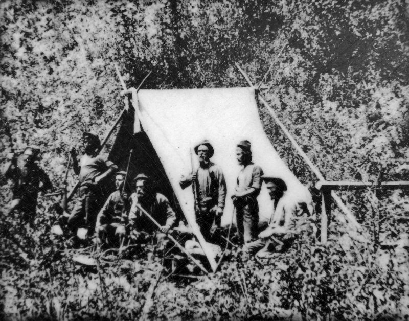
South Dakota State Historical Society State Archives
4. Marker detail: 1876 South Dakota Miners Camp
For more information on attractions and activities along the 385 Gold Rush Byway, contact the Cheyenne County Chamber of Commerce at 800.421.4769.
Points of Interest (left kiosk panel)
Sudman-Neumann Heritage House • Lodgepole Depot Museum • Fort Sidney Post Commander's Home & Officers' Quarters • Ash Hollow State Historical Park • Historical Museum • Crescent Lake National Wildlife Refuge • Court House & Jail Rocks • Garden County Historical Museum • Bridgeport Recreational Area • Chimney Rock National Historic Site • Chimney Rock Pony Express Station • Oregon Trail Wagon Train • Sallows Conservatory and Arboretum • Carnegie Arts Center • Knight Museum • Grave Site of “Old Jules” Sandoz • Carhenge • Box Butte Reservoir • Pine Ridge Mountain Bike Trail • Walgren Lake State Recreation Area • Metcalf Wildlife Management Area • Tri-State Old Time Cowboy Museum • Museum of the Fur Trade • Chadron
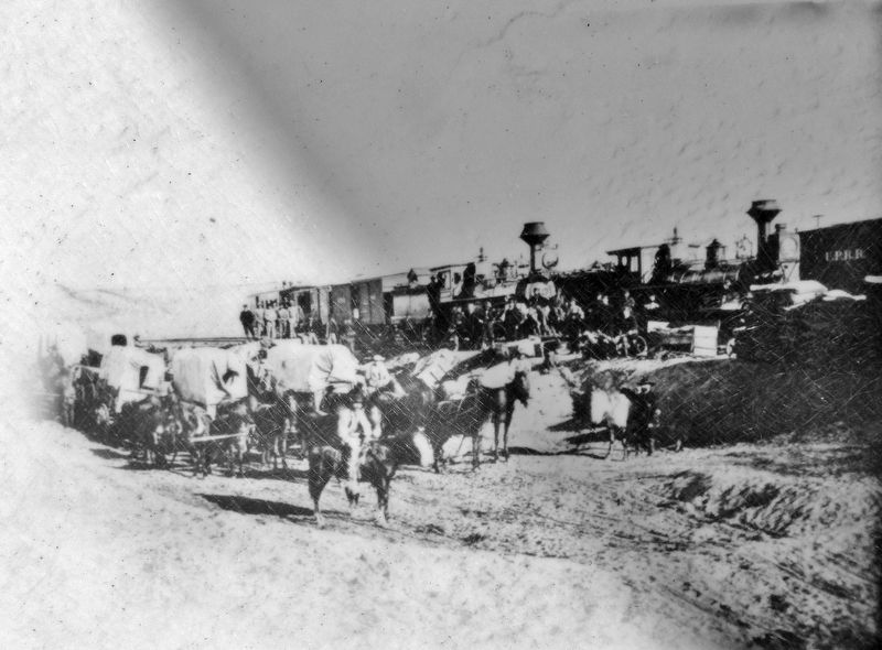
Nebraska State Historical Society
5. Marker detail: Union Pacific Railroad
This project made possible through funds provided by the Nebraska Department of Roads Nebraska Byways Program and the Federal Highway Administration. Additional funding provided by the U.S. Department of Agriculture Forest Service.
Erected by Nebraska Department of Roads Nebraska Byways Program.
Topics. This historical marker is listed in these topic lists: Exploration • Indigenous Peoples and Communities • Roads & Vehicles • Settlements & Settlers. A significant historical year for this entry is 1874.
Location. 41° 6.927′ N, 102° 57.246′ W. Marker is in Sidney, Nebraska, in Cheyenne County. It is on Cabela Drive just south of Old Post Road, on the left when traveling south. Touch for map. Marker is at or near this postal address: 115 Cabela Drive, Sidney NE 69162, United States of America. Touch for directions.

Regionally, this marker is in the Nebraska Panhandle. It is also in the American
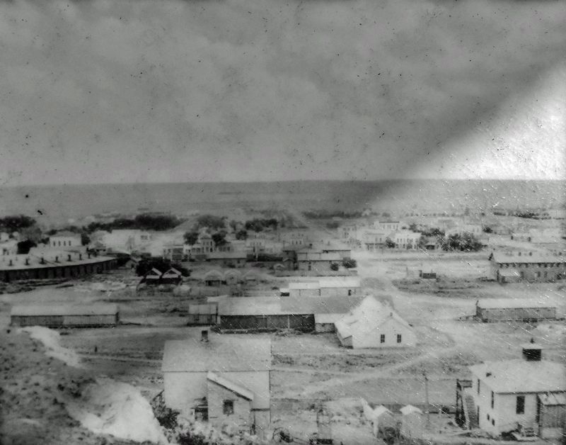
Nebraska State Historical Society
6. Marker detail: Sidney, Nebraska
Other nearby markers. At least 8 other markers are within 3 miles of this marker, measured as the crow flies: National Pony Express Monument (within shouting distance of this marker); Nebraska’s Earliest Documented Burial (approx. 1.3 miles away); Sidney ~ Cheyenne County (approx. 1½ miles away); Cheyenne County (approx. 1.6 miles away); Purple Heart Trail (approx. 1.6 miles away); Fort Sidney (approx. 2.2 miles away); Carnegie Library (approx. 2.3 miles away); Hickory Square (approx. 2.4 miles away). Touch for a list and map of all markers in Sidney.

Photographed by Cosmos Mariner, August 12, 2023
7. 385 Gold Rush Byway Kiosk
Looking east from Cabela Drive.
Credits. This page was last revised on September 21, 2024. It was originally submitted on September 21, 2024, by Cosmos Mariner of Cape Canaveral, Florida. This page has been viewed 364 times since then and 61 times this year. Photos: 1, 2, 3, 4, 5, 6, 7. submitted on September 21, 2024, by Cosmos Mariner of Cape Canaveral, Florida.
