
Downtown in Fairbanks in Fairbanks North Star Borough, Alaska — Northwest (North America)
A History of Interior Alaska's Transportation
Vignettes in History
| — | Proud to be ALASKAN | — |

Photographed by William Fischer, Jr., August 17, 2024
1. A History of Interior Alaska's Transportation Marker
The role of transportation in advancing the civilization of the north can be traced from the very first forms of river travel between settlements on Alaska's river systems. Long before the first Russian traders sailed Alaskan waters seeking furs, gold and adventure, Alaskan Natives had travelled the mighty Yukon and other rivers and tributaries in birch bark canoes. After the U.S. purchase of Alaska in 1867, the military used the rivers to survey the new territory. River traffic reached its peak during the gold rush at the turn of the century, with steamers, sternwheelers and barges carrying passengers and supplies to the growing towns along the river banks.
The pioneers who wintered in the Interior were faced each fall with the freeze-up of their transportation system. The short season for river travel necessitated an alternate year-round system. Fairbanks was linked to the ice-free port of Valdez in 1906, by a 367-mile-long trail (later named the Richardson Highway). First used only by dog teams, improvements made it passable for horse-drawn wagons and stages to carry mail, passengers and supplies on a semi-regular
this page online
Fairbanks was becoming the supply hub for the smaller towns and villages in the Interior. In 1905 the Tanana Mines Railroad (later renamed the Tanana Valley Railroad) completed the first section of what would eventually be a 39-mile line connecting Chena and Fairbanks with surrounding gold camps. The smaller, more remote villages still used river transportation in the summer months and dog teams in the winter.
It wasn't until 1925 that the Interior was serviced by a railroad that reached to an all-weather port on the southern Alaskan coast. The federal government began building the Alaska Railroad from Seward to Nenana in 1915, threading the line across more than 300 miles of challenging terrain, including some of the world's highest mountains. Completed in 1923, the rail was extended another 50 miles into Fairbanks two years later.
The immense distances between small villages and the unreliability of other winter transportation created a market ripe for the appearance of the airplane, referred to by Alaskan Natives as "moose ptarmigan.” The
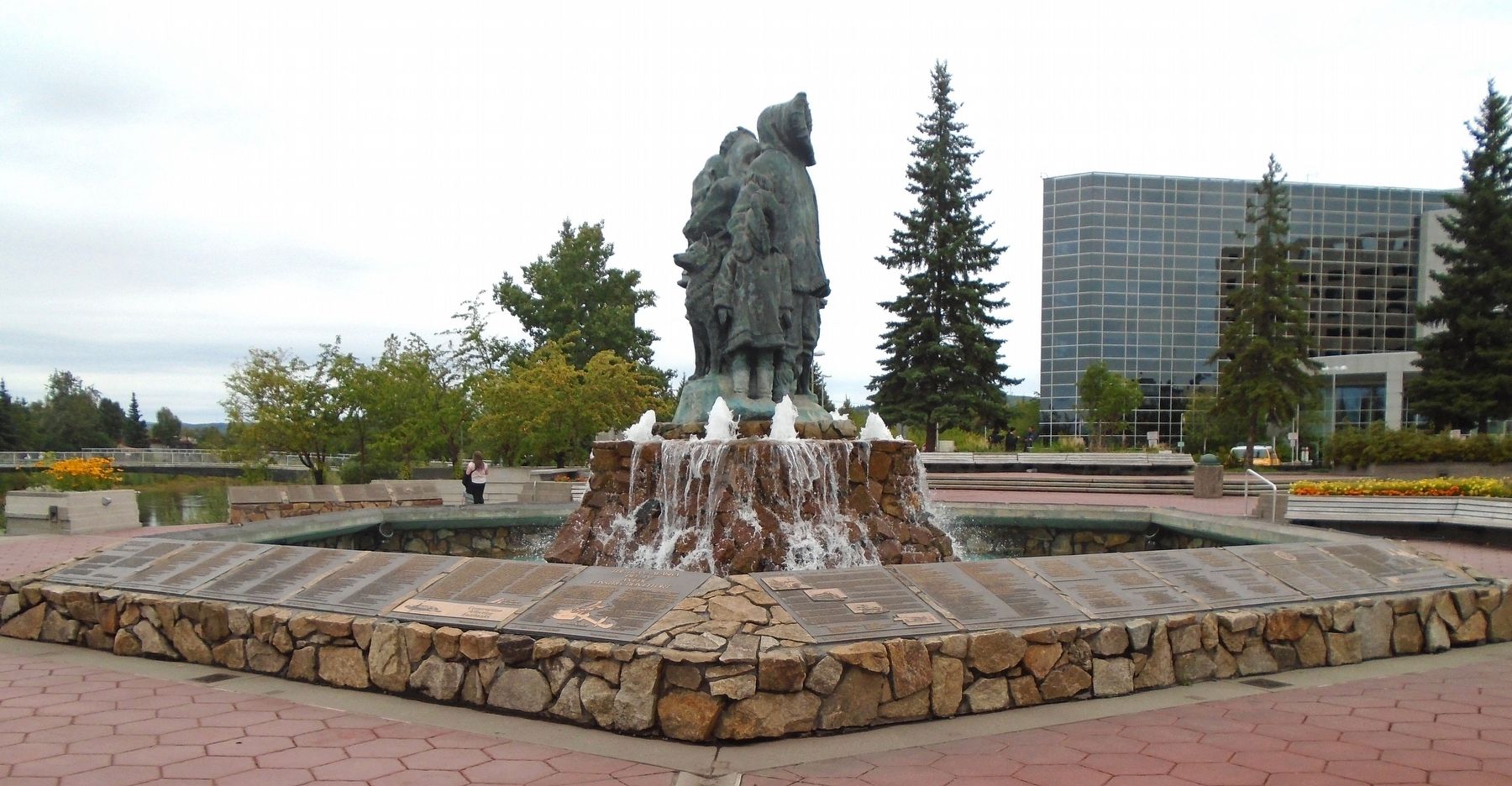
Photographed by William Fischer, Jr., August 17, 2024
2. A History of Interior Alaska's Transportation Marker
It wasn't long before another important connection was made to the "Outside." The Alaska (Alcan) Highway, from Dawson Creek, British Columbia to Delta Junction, Alaska, was completed in 1942, just four years after it was started. Built during the Second World War, as a supply line to the militarily strategic State of Alaska, the 1671-mile gravel road soon became a major supply line for the Interior, with thousands of pounds of truck freight travelling its course every day.
In 1984 each of these forms of transportation still serves the people of the Interior. Trappers, Native Alaskans and sportsmen run dogs along trails used by early Pioneers. Barges dock at Southeastern ports where goods are transferred to truck or rail for shipment to the Interior. A network of highways links Fairbanks and the surrounding area to all parts of the state and the continental U.S. Airmail, air freight and air passenger service are available to nearly every part of the Interior. The advancement of civilization in the northland, owes much to the continuing development of its transportation systems.
Erected 1984 by Festival Fairbanks '84 and Varied Alaskan Transportation Entities. (Marker Number 31.)
Topics. This historical marker is listed in these topic lists: Air & Space • Roads & Vehicles • Settlements & Settlers • Waterways & Vessels. A significant historical year for this entry is 1906.
Location. 64° 50.655′ N, 147° 43.181′ W. Marker is in Fairbanks, Alaska, in Fairbanks North Star Borough. It is in Downtown. It is on 1st Avenue east of Cushman Street, on the left when traveling east. Marker is in Golden Heart Plaza, along the fountain wall. Touch for map. Marker is at or near this postal address: 516 1st Avenue, Fairbanks AK 99701, United States of America. Touch for directions.

Regionally, this marker is in the Alaska Railroad Corridor, in the Athabascan Region, and in Interior Alaska. It is also on the American Pacific Coast. Globally, it is in North America, the Pacific Rim, the Western Hemisphere, the Western World, and the Anglosphere. Historically, it finds itself in what was once the Russian Empire.
Other nearby markers. At least 8 other markers are within walking distance of this marker: The Trans Alaska Pipeline: An Epic Construction Effort (here, next to this marker); Construction Affecting Fairbanks (here, next to this marker); Pioneers of Alaska Igloo No. 4 and Auxiliary No. 8 (here, next to this marker); University of Alaska—Fairbanks (here, next to this marker); Dr. William Ranson Wood (here, next to this marker); Annus Mirabilis (here, next to this marker); History of North Slope Oil Development (here, next to this marker); Greater Fairbanks Community Hospital Foundation (a few steps from this marker). Touch for a list and map of all markers in Fairbanks.
Credits. This page was last revised on September 22, 2024. It was originally submitted on September 22, 2024, by William Fischer, Jr. of Reynoldsburg, Ohio. This page has been viewed 314 times since then and 73 times this year. Photos: 1, 2. submitted on September 22, 2024, by William Fischer, Jr. of Reynoldsburg, Ohio.
