Near Richmond in Henrico County, Virginia — The American South (Mid-Atlantic)
Fort Harrison
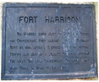
Photographed by Bernard Fisher, July 17, 2003
1. Fort Harrison Marker
Erected by Battlefield Markers Association. (Marker Number 23.)
Topics and series. This historical marker is listed in this topic list: War, US Civil. In addition, it is included in the Freeman Markers (Richmond Battlefields) series list. A significant historical date for this entry is September 29, 1864.
Location. 37° 25.741′ N, 77° 21.98′ W. Marker is near Richmond, Virginia, in Henrico County. It is on Varina Road one mile south of Mill Road, on the right when traveling south. Located at the entrance to the Fort Harrison National Cemetery. Touch for map. Marker is at or near this postal address: 8620 Varina Road, Henrico VA 23231, United States of America. Touch for directions.

Regionally, this marker is in the Piedmont and in Central Virginia. It is also in the American South, specifically in the Upper South, and on the Eastern Seaboard. Globally, it is in the North
this page online
Other nearby markers. At least 8 other markers are within walking distance of this marker: Freedom Fighters (approx. 0.3 miles away); First Park Headquarters (approx. 0.4 miles away); a different marker also named First Park Headquarters (approx. 0.4 miles away); a different marker also named Fort Harrison Trail (approx. 0.4 miles away); Surprise Attack (approx. 0.4 miles away); "The Big Guns Spoke" (approx. 0.4 miles away); a different marker also named Fort Harrison (approx. 0.4 miles away); Confederate Counterattack (approx. 0.4 miles away). Touch for a list and map of all markers in Richmond.
Other markers no longer nearby. Fort Harrison Trail (was approx. 0.4 miles away but has been replaced with another marker now near it); a different marker also named Surprise Attack (was approx. 0.4 miles away but has been replaced
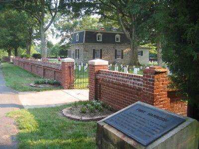
Photographed by Bernard Fisher, July 17, 2003
2. Fort Harrison Marker
Additional keywords. Freeman Markers, Richmond Battlefield Parks Corporation, Douglas Southall Freeman
Credits. This page was last revised on September 24, 2024. It was originally submitted on December 8, 2008, by Bernard Fisher of Richmond, Virginia. This page has been viewed 1,114 times since then and 19 times this year. Last updated on September 24, 2024, by Carl Gordon Moore Jr. of North East, Maryland. Photos: 1, 2. submitted on December 8, 2008, by Bernard Fisher of Richmond, Virginia. • Devry Becker Jones was the editor who published this page.
