Dexter Township in Pinckney in Washtenaw County, Michigan — The American Midwest (Great Lakes)
The Beginning
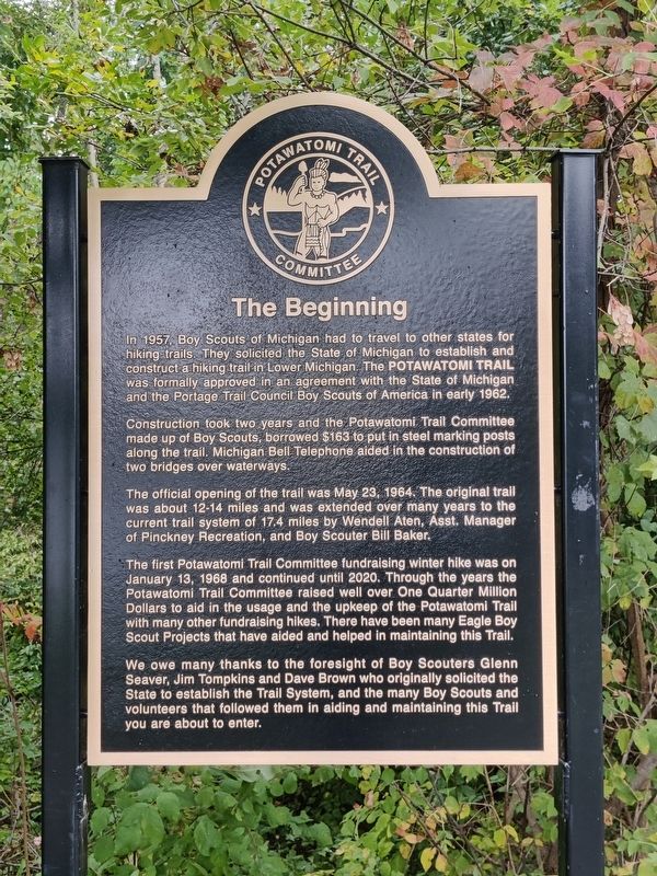
Photographed by John Ridley, September 24, 2024
1. The Beginning Marker
In 1957, Boy Scouts of Michigan had to travel to other states for hiking trails. They solicited the State of Michigan to establish and construct a hiking trail in Lower Michigan. The Potawatomi Trail was formally approved in an agreement with the State of Michigan and the Portage Trail Council Boy Scouts of America in early 1962.
Construction took two years and the Potawatomi Trail Committee made up of Boy Scouts, borrowed $163 to put in steel marking posts along the trail. Michigan Bell Telephone aided in the construction of two bridges over waterways.
The official opening of the trail was May 23, 1964. The original trail was about 12-14 miles and was extended over many years to the current trail system of 17.4 miles by Wendell Aten, Asst. Manager of Pinckney Recreation, and Boy Scouter Bill Baker.
The first Potawatomi Trail Committee fundraising winter hike was on January 13, 1968 and continued until 2020. Through the years the Potawatomi Trail Committee raised well over One Quarter Million Dollars to aid in the usage and the upkeep of the Potawatomi Trail with many other fundraising hikes. There have been many
this page online
We owe many thanks to the foresight of Boy Scouters Glenn Seaver, Jim Tompkins and Dave Brown who originally solicited the State to establish the Trail System, and the many Boy Scouts and volunteers that followed them in aiding and maintaining this Trail you are about to enter.
Erected 2024 by Potawatomi Trail Committee.
Topics. This historical marker is listed in these topic lists: Indigenous Peoples and Communities • Parks & Recreational Areas. A significant historical date for this entry is May 23, 1964.
Location. 42° 25.04′ N, 83° 57.848′ W. Marker is in Pinckney, Michigan, in Washtenaw County. It is in Dexter Township. It can be reached from Crooked Lake Trail. The marker is at the Crooked Lake Trail trailhead, about 100 feet from the farthest corner of the far parking lot at the Silver Lake DNR Day Use Area. Touch for map. Marker is at or near this postal address: 2 Crooked Lake Trail, Pinckney MI 48169, United States of America. Touch for directions.

Regionally, this marker is in Southeast Michigan and in Greater Detroit. It is also in the American Midwest. Globally, it is in North America, the Western Hemisphere, the Western World, and the Anglosphere. Historically, it finds itself in what was once the Northwest Territory.
Other nearby markers. At least 8 other markers are within 5 miles of this marker, measured as the crow flies: The Grieving Yard (approx. 1.6 miles away); Centennial Farm (approx. 2.4 miles away); Park Lawn Beach (approx. 3 miles away); North Lake Methodist Church (approx. 3.2 miles away); Pinckney (approx. 3.2 miles away); Hudson Mills (approx. 3½ miles away); Anderson (approx. 4.2 miles away); Unadilla Baseline Cemetery (approx. 4.6 miles away). Touch for a list and map of all markers in Pinckney.
Credits. This page was last revised on September 25, 2024. It was originally submitted on September 24, 2024, by John Ridley of Chelsea, Michigan. This page has been viewed 263 times since then and 48 times this year. Photo 1. submitted on September 24, 2024, by John Ridley of Chelsea, Michigan. • J. Makali Bruton was the editor who published this page.
Editor’s want-list for this marker. A wide view photo of the marker and the surrounding area together in context. • Can you help?
