Searsport in Waldo County, Maine — The American Northeast (New England)
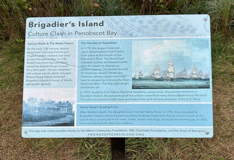
Brigadier’s Island
Culture Clash in Penobscot Bay
Photographed by Steve Stoessel, September 27, 2024
1. Brigadier’s Island Marker
Samuel Waldo & The Waldo Patent
By the early 17th century, Native Americans and early French and English settlers clashed over land around Penobscot Bay. In 1730, Boston merchant Samuel Waldo asked the English King's Council for a land grant. He was rewarded with a large parcel, which included Wassumkeag Island, renamed Brigadier's Island in honor of Waldo, a brigadier general.
Photo of the farmhouse on Sears island. The foundation can still be seen along the Homestead Trail.
The Penobscot Expedition
In 1779, the largest American naval defeat before Pearl Harbor took place at the mouth of the Penobscot River. The British had invaded Castine, so Massachusetts sent 44 vessels to attempt to reclaim Castine. The British burned all American vessels except the Defence, whose captain and crew tried to escape by crossing the Sears Island sandbar. The ship was caught and blown up. In 1975, students from Maine Maritime Academy, using sonar, discovered remnants in Stockton Harbor. An archaeological excavation unearthed many items preserved in the mud. The site is protected under state and federal law and remains property of
this page online
American Fleet at Penobscot Bay, 14 August 1779," oit on Canvas by Dominic Serres circa 1779. National Maritime Museum, Greenwich, London, Caird Collection.
Henry Knox's Grazing Farm After Waldo's death, his daughter Lucy married Henry Knox. In 1794, Knox traveled to Brigadier's Island, where he paid squatters to leave; hired John Rynier to turn much of the island into a grazing farm for oxen, cattle, sheep and hogs; and built the farmhouse. In 1804, Knox transferred the island to a debtor.
This sign was made possible thanks to the Maine Community Foundation, GBL Charitable Foundation, and the Town of Searsport
Erected by Friends of Sears Island.
Topics. This historical marker is listed in these topic lists: Agriculture • Disasters • Indigenous Peoples and Communities • War, US Revolutionary. A significant historical date for this entry is August 14, 1779.
Location. 44° 27.378′ N, 68° 52.916′ W. Marker is in Searsport, Maine, in Waldo County. It is on Sears Island Road one mile south of U.S. 1, on the left when traveling south. Touch for map. Marker is in this post office area: Searsport ME 04974, United
Photographed by Steve Stoessel, September 27, 2024
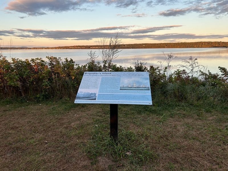
2. Brigadier’s Island Marker

Regionally, this marker is in Midcoast Maine and on Penobscot Bay. It is also in the American Northeast, in New England, and on the Eastern Seaboard. Globally, it is in the North Atlantic Region, North America, the Western Hemisphere, the Western World, and the Anglosphere.
Other nearby markers. At least 8 other markers are within 2 miles of this marker, measured as the crow flies: Wassumkeag (here, next to this marker); Sears Island (here, next to this marker); Honoring Robert and Marietta Ramsdell (a few steps from this marker); Marlboro Packard (approx. 1.4 miles away); The Home of a Hero / La maison d'un héros (approx. 1.6 miles away); The Growth of Ship Building: Isaac Carver / Le développement des chantiers navals : Isaac Carver (approx. 2 miles away); Carver Memorial Library / La Bibliothèque Carver (approx. 2 miles away); First Day at Central School: Circa 1900 / Premier jour d'école : Central school ca. 1900 (approx. 2 miles away). Touch for a list and map of all markers in Searsport.
Also see . . .
1. Penobscot Expedition (Wikipedia). (Submitted on September 30, 2024, by Steve Stoessel of Niskayuna, New York.)
2. Samuel Waldo (Wikipedia).

Photographed by Steve Stoessel, September 27, 2024
3. Brigadier’s Island Marker
Middle sign is Brigadier’s Island Marker.
3. Henry Knox (Wikipedia). (Submitted on September 30, 2024, by Steve Stoessel of Niskayuna, New York.)
Credits. This page was last revised on September 30, 2024. It was originally submitted on September 29, 2024, by Steve Stoessel of Niskayuna, New York. This page has been viewed 288 times since then and 42 times this year. Photos: 1, 2, 3. submitted on September 29, 2024, by Steve Stoessel of Niskayuna, New York.
