Dyea in Skagway in Skagway Borough, Alaska — Northwest (North America)
Welcome to Pullen Creek
Pullen Creek StreamWalk
Photographed by William Fischer, Jr., August 24, 2024
1. Welcome to Pullen Creek Marker
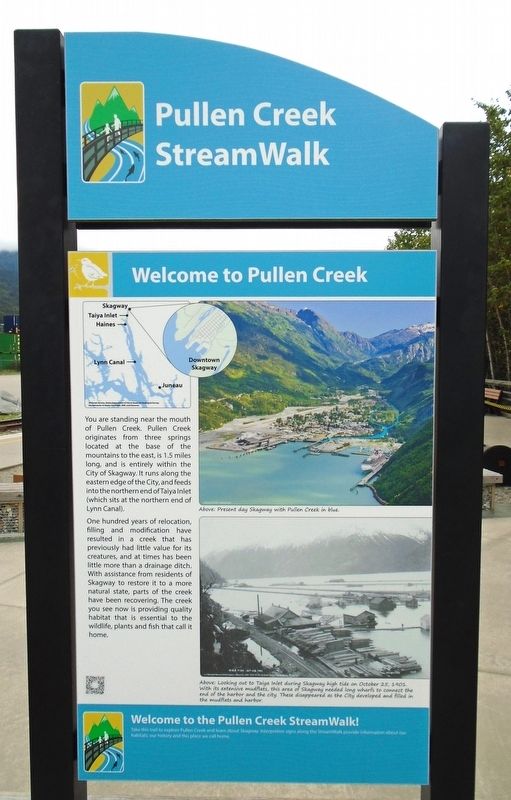
You are standing near the mouth of Pullen Creek. Pullen Creek originates from three springs located at the base of the mountains to the east, is 1.5 miles long, and is entirely within the City of Skagway. It runs along the eastern edge of the City, and feeds into the northern end of Taiya Inlet (which sits at the northern end of Lynn Canal).
One hundred years of relocation, filling and modification have resulted in a creek that has previously had little value for its creatures, and at times has been little more than a drainage ditch. With assistance from residents of Skagway to restore it to a more natural state, parts of the creek have been recovering. The creek you see now is providing quality habitat that is essential to the wildlife, plants and fish that call it home.
[Photo captions, top to bottom, read]
• Above: Present day Skagway with Pullen Creek in blue.
• Above: Looking out to Taiya Inlet during Skagway high tide on October 25, 1901. With its extensive mud flats, this area of Skagway needed long wharfs to connect the harbor and the city. These disappeared as the City developed and filled in the mudflats and harbor.
Welcome to the Pullen Creek StreamWalk!
Take this trail to explore Pullen Creek and learn about Skagway. Interpretive signs along the StreamWalk provide information about our habitats, our history and this place we call home.
Erected by the Municipality of Skagway.
Topics. This historical marker is listed in these topic lists: Environment • Industry & Commerce • Settlements & Settlers • Waterways & Vessels. A significant historical date for this entry is October 25, 1901.
Location. 59° 27.085′ N, 135° 19.342′ W. Marker is in Skagway, Alaska, in Skagway Borough. It is in Dyea. It is on Broadway, on the right when traveling south. Marker is near the head of the Broadway
this page online

Regionally, this marker is on the American Pacific Coast. Globally, it is in North America, on the Ring of Fire, on the Pacific Rim, in the Western Hemisphere, in the Western World, and in the Anglosphere. Historically, it finds itself in what was once the Russian Empire.
Other nearby markers. At least 8 other markers are within walking distance of this marker: Skagway's Shifting Shoreline (here, next to this marker); Nature Always Succeeds! (within shouting distance of this marker); Gateway to the Interior (about 400 feet away, measured in a direct line); Ho, for the Klondike! (about 400 feet away); The Road to Gold (about 500 feet away); U.S. Army Invades Skagway (about 500 feet away); Néechxwúduyaa (about 500 feet away); Captain William Moore (about 500 feet away). Touch for a list and map of all markers in Skagway.

Photographed by William Fischer, Jr., August 24, 2024
2. Welcome to Pullen Creek Marker
Credits. This page was last revised on October 4, 2024. It was originally submitted on October 1, 2024, by William Fischer, Jr. of Reynoldsburg, Ohio. This page has been viewed 237 times since then and 58 times this year. Photos: 1, 2. submitted on October 1, 2024, by William Fischer, Jr. of Reynoldsburg, Ohio.
