Lexington, Virginia — The American South (Mid-Atlantic)
Wharf, Work and Worship
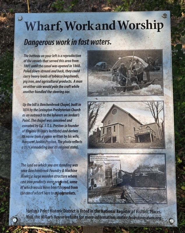
Photographed by Bradley Owen, August 12, 2024
1. Wharf, Work and Worship Marker
Dangerous work in fast waters.
The batteau on your left is a reproduction of the vessels that served this area from 1801 until the canal was opened in 1860. Poled down-stream and back, they could carry heavy loads of tobacco hogsheads, pig iron, and agricultural products. A man on either side would pole the craft while another handled the steering oar.
Up the hill is Beechenbrook Chapel, built in 1874 by the Lexington Presbyterian Church as an outreach to the laborers on Jordan's Point. The chapel was conceived and executed by Col. J. T. L. Preston (a founder of Virginia Military Institute) and derives its name from a poem written by his wife, Margaret Junkin Preston. The photo reflects a 1974 remodeling (not its original state).
The land on which you are standing was once Beechenbrook Foundry & Machine Works; a large wooden structure where cast iron products were produced, some of which would have been shipped from the canal wharf here to other markets.
Visit the Miller's House website for more information: millershousemuseum.org
(Captions):
Photo by Philip deVos.
Photo by Skip Ravenhorst.
Mountain Valley Preservation Alliance/APVA Collection, Special Collections and Archives, James G. Leyburn Library, Washington and Lee University.
Erected 2017
this page online
Topics. This historical marker is listed in these topic lists: Industry & Commerce • Religion & Religious Structures • Waterways & Vessels. A significant historical year for this entry is 1801.
Location. 37° 47.518′ N, 79° 25.747′ W. Marker is in Lexington, Virginia. It can be reached from Moses Mill Road north of Jordan Point Road, on the right when traveling north. Marker is located in Jordan's Point Park. Touch for map. Marker is at or near this postal address: 834 Moses Mill Road, Lexington VA 24450, United States of America. Touch for directions.

Regionally, this marker is in Virginia’s Shenandoah Valley. It is also in the American South and specifically in the Upper South. Globally, it is in North America, the Western Hemisphere, the Western World, and the Anglosphere. Historically, it finds itself in what was once the territory of the Mississippian Culture, one of the original Thirteen Colonies, one of the Confederate States of America, and the Antebellum South.
Other nearby markers. At least 8 other markers are within walking distance of this marker: Jordan's Point (within

Photographed by Bradley Owen, August 12, 2024
2. Wharf, Work and Worship Marker
Another marker is no longer nearby. Jordan’s Point (was within shouting distance of this marker but has been replaced with another marker now near it).
Regarding Wharf, Work and Worship. The website listed on this marker is incorrect. The website should be:
millershousemuseum.com
Credits. This page was last revised on October 3, 2024. It was originally submitted on October 3, 2024, by Bradley Owen of Morgantown, West Virginia. This page has been viewed 150 times since then and 32 times this year. Photos: 1, 2. submitted on October 3, 2024, by Bradley Owen of Morgantown, West Virginia.
