Lexington, Virginia — The American South (Mid-Atlantic)
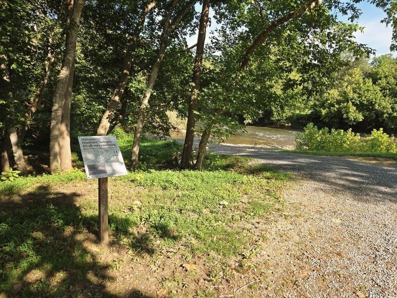
Millrace, Headrace, Tailrace: It's all very confusing.

Photographed by Bradley Owen, August 12, 2024
1. Millrace, Headrace, Tailrace: It's all very confusing. Marker
The narrow channel or "race" powered several mills.
From as early as 1806, several dams located on the (North) Maury River directed water into this manmade channel that was, in all probability, dug by enslaved labor. It is called a millrace because the water flowed through a 1,250 feet long, narrow channel or "race" and powered several mills downstream before the water re-entered the river at the end of Jordan's Point. The portion of the millrace that flows from the river to the mills is called the headrace and the portion beyond the mills is called the tailrace. The dams serve to raise the upstream water level and increase the flow into the "race."
There have been numerous floods in the past 200 or so years but those of 1969 and 1972 damaged the millrace. The water-control gate and the earthen dam you see here were installed to reduce additional damage. Now, in the absence of dams in the river, the millrace inlet only carries water during storm events.
Visit the Miller's House website for more information: millershousemuseum.org
(Captions):
Wayland, John W., Historic Houses of Northern Virginia and the Eastern Panhandle of West Virginia, Staunton, VA: The McClure Company, Inc. 1937, pp. 309-312.
Millrace entrance
Erected 2017
this page online
Topics. This historical marker is listed in these topic lists: African Americans • Disasters • Waterways & Vessels. A significant historical year for this entry is 1806.
Location. 37° 47.598′ N, 79° 25.879′ W. Marker is in Lexington, Virginia. It can be reached from Moses Mill Road north of Jordan Point Road, on the left when traveling north. Marker is located in Jordan's Point Park. Touch for map. Marker is at or near this postal address: 834 Moses Mill Road, Lexington VA 24450, United States of America. Touch for directions.

Regionally, this marker is in Virginia’s Shenandoah Valley. It is also in the American South and specifically in the Upper South. Globally, it is in North America, the Western Hemisphere, the Western World, and the Anglosphere. Historically, it finds itself in what was once the territory of the Mississippian Culture, one of the original Thirteen Colonies, one of the Confederate States of America, and the Antebellum South.
Other nearby markers. At least 8 other markers are within walking distance of this marker: Saunders Fields (about 500 feet away, measured
Photographed by Bradley Owen, August 12, 2024
2. Millrace, Headrace, Tailrace: It's all very confusing. Marker
Another marker is no longer nearby. Jordan’s Point (was about 600 feet away but has been replaced with another marker now near it).
Regarding Millrace, Headrace, Tailrace: It's all very confusing.. The website listed on this marker is incorrect. The website should be:
millershousemuseum.com
Credits. This page was last revised on October 3, 2024. It was originally submitted on October 3, 2024, by Bradley Owen of Morgantown, West Virginia. This page has been viewed 338 times since then and 72 times this year. Photos: 1, 2. submitted on October 3, 2024, by Bradley Owen of Morgantown, West Virginia.
