
Highland Park in Saint Paul in Ramsey County, Minnesota — The American Midwest (Upper Plains)
The Lay of the Land

Photographed by McGhiever, October 11, 2024
1. The Lay of the Land Marker
—Mark Twain, Life on the Mississippi (1896)
Two Rivers
The Mississippi River is 2,350 miles long making it the largest and longest river in North America and the third largest in the world. Flowing from its headwaters in northern Minnesota to New Orleans, it serves as a watershed for the entire central portion of the United States. The Mississippi River, seen below this site, joins with the Minnesota River just east of this overlook. The Minnesota River serves as a watershed for the western portion of Minnesota.
450 million years ago, a huge sea covered most of North America. The rock of this cliff was soft sediment on the sea floor. The white sandstone along the lower part of the river bluffs was formed from sand carried and laid down along the coastline by sea currents. The limestone directly under your feet formed when small sea creatures accumulated on the sea floor and created a layer of lime mud. The layers of sand and lime mud were deeply buried by more sediment and hardened.
During the Ice Age, walls of ice moved in and out of Minnesota. As the last section of ice retreated and melted 12,000 years ago, it formed Glacial Lake Agassiz. This vast lake covered parts of Minnesota, South Dakota, North Dakota, and Saskatchewan, Manitoba, and Ontario, Canada. The outlet for the lake was River Warren, today's Minnesota River. The force of water from the draining lake carved away the soft sandstone and limestone and created the Minnesota River Valley. During this period, the Mississippi River was flooded with the draining waters of the melting glaciers that covered north and central Minnesota. At one time, the view before you included two large waterfalls dropping 150 feet. One falls can still be found upriver at
this page online
Look around you-the area where you stand and the bluff top across from you is interspersed with remnants of Oak savanna, an increasingly rare landscape that is a cross between prairie and forest. Oak savanna is home to hardy plants that can withstand fire, limited water, and intense grazing such as bur oak trees, tall prairie grasses, and purple coneflowers. Insects, including the monarch and red admiral butterflies, are drawn to the grasses and flowers for food and shelter. The insects attract birds like bobolink and bluebirds. Coyotes, red-tailed hawks, and red fox hunt for mice, voles, and woodchucks that live on the river bluff.
The landscape below this overlook, a flood plain forest, is in constant change. Floodwaters cover the area, move the soil, and leave sediment behind. Trees like the silver maple and cottonwood grow quickly in the rich soil and can tolerate periods of flooding. Egrets, blue heron, and bald eagles all perch on branches to hunt fish. In the river's backwater channels you might
Photographed by McGhiever, October 11, 2024
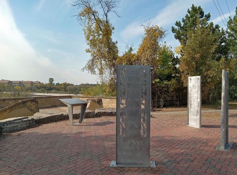
2. The Lay of the Land Marker (center foreground) at the Two Rivers Overlook
Topics. This historical marker is listed in these topic lists: Environment • Waterways & Vessels.
Location. 44° 53.746′ N, 93° 10.717′ W. Marker is in Saint Paul, Minnesota, in Ramsey County. It is in Highland Park. It is at the intersection of Mississippi River Boulevard and Crosby Farm Road, on the right when traveling east on Mississippi River Boulevard. The marker is at the Two Rivers Overlook. Touch for map. Marker is at or near this postal address: 2711 Shepard Road, Saint Paul MN 55116, United States of America. Touch for directions.

Regionally, this marker is in the Twin Cities Metropolitan Area. It is also in the American Midwest, in the Corn Belt, and in the Great River Road Region. Globally, it is in North America, the Western Hemisphere, the Western World, and the Anglosphere. Historically, it finds itself in what was once Rupert’s Land, the territory of the Mississippian Culture, and the Louisiana Purchase.
Other nearby markers. At least 8 other markers are within walking distance of this marker: De Dakod Makoce Unkitawapi E E (here, next to this marker); Settling the Frontier (here, next to this marker); Two Rivers Overlook (here, next to this marker); Enlisted Barracks (approx. 0.2 miles away); Commanding Officer’s House (approx. 0.2 miles away); Officers’ Quarters (approx. ¼ mile away); Working Women of Fort Snelling (approx. ¼ mile away); The Sutler Store (approx. ¼ mile away). Touch for a list and map of all markers in Saint Paul.
Credits. This page was last revised on October 12, 2024. It was originally submitted on October 12, 2024, by McGhiever of Minneapolis, Minnesota. This page has been viewed 174 times since then and 34 times this year. Photos: 1, 2. submitted on October 12, 2024, by McGhiever of Minneapolis, Minnesota.
