Big Springs in Deuel County, Nebraska — The American Midwest (Upper Plains)
The Big Spring
Photographed by Barry Swackhamer, December 12, 2011
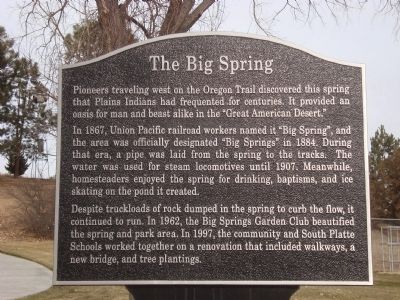
1. The Big Spring Marker
Pioneers traveling west on the Oregon Trail discovered this spring that Plains Indians had frequented for centuries. It provided an oasis for man and beast alike in the "Great American Desert."
In 1867, Union Pacific railroad workers named it "Big Spring", and the area was officially designated "Big Springs" in 1884. During that era, a pipe was laid from the spring to the tracks. The water was used for steam locomotives until 1907. Meanwhile homesteaders enjoyed the spring for drinking, baptisms, and ice skating on the pond it created.
Despite truckloads of rock dumped in the spring to curb the flow, it continues to run. In 1962, the Big Spring Garden Club beautified the spring and park area. In 1997, the community and South Platte Schools worked together on a renovation that included walkways, a new bridge, and tree plantings.
Topics and series. This historical marker is listed in these topic lists: Roads & Vehicles • Waterways & Vessels. In addition, it is included in the Oregon Trail series list. A significant historical year for this entry is 1867.
Location. 41° 3.812′ N, 102° 4.607′ W. Marker is in Big Springs,
this page online

Regionally, this marker is in the Nebraska Panhandle. It is also in the American Midwest, in the Corn Belt, on the prairies, on the Great Plains, and specifically on the High Plains. Globally, it is in North America, the Western Hemisphere, the Western World, and the Anglosphere. Historically, it finds itself in what was once the Louisiana Purchase.
Other nearby markers. At least 8 other markers are within 5 miles of this marker, measured as the crow flies: The Lone Tree (within shouting distance of this marker); The Pony Express (about 600 feet away, measured in a direct line); Phelps Hotel (about 700 feet away); Sam Bass and the Big Springs Robbery (about 700 feet away); Waterman Sod House (about 700 feet away); South Platte Station (approx. 3.9 miles away); Deuel County Nebraska (approx. 4.4 miles away); Keith County Nebraska
Photographed by Barry Swackhamer, December 12, 2011
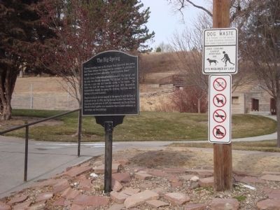
2. The Big Spring Marker
Additional keywords. Oregon California Trail
Photographed by Barry Swackhamer, December 12, 2011
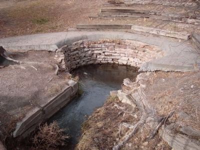
3. The Big Spring
Credits. This page was last revised on October 15, 2024. It was originally submitted on January 2, 2012, by Barry Swackhamer of Brentwood, California. This page has been viewed 1,574 times since then and 121 times this year. Last updated on October 14, 2024, by Buck Tanzi of Poughkeepsie, New York. Photos: 1, 2, 3. submitted on January 2, 2012, by Barry Swackhamer of Brentwood, California. • Devry Becker Jones was the editor who published this page.
