Near Richmond in Henrico County, Virginia — The American South (Mid-Atlantic)
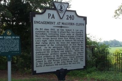
Engagement at Malvern Cliffs
Photographed by Kathy Walker, August 3, 2007
1. Engagement at Malvern Cliffs Marker
On 30 June 1862, as Gen. Robert E. Lee concentrated his troops to attack Maj. Gen. George B. McClellan's retreating Union army at Glendale, Maj. Gen. Theophilus H. Holmes's brigade of Confederate troops moved down New Market Road on Lee's right. Union forces on Malvern Hill noticed dust rising above the trees and suspected the movement of the Confederates on New Market Road. As he advanced, Holmes observed the Union troops atop Malvern Hill to the east and deployed his artillery and infantry. When the Confederate artillery opened fire, the massed Union artillery on the hill concentrated its firepower on Holmes's small force. Union gunboats joined in, and Holmes withdrew his force west to the junction of the Long Bridge Road. The Battle of Malvern Hill took place the next day.
Erected 1994 by Department of Historic Resources. (Marker Number PA-240.)
Topics and series. This historical marker is listed in this topic list: War, US Civil. In addition, it is included in the Virginia Department of Historic Resources (DHR) series list. A significant historical date for this entry is June 30, 1862.
Location. 37° 24.369′ N, 77° 16.167′ W.
this page online

Regionally, this marker is in the Piedmont and in Central Virginia. It is also in the American South, specifically in the Upper South, and on the Eastern Seaboard. Globally, it is in the North Atlantic Region, North America, the Western Hemisphere, the Western World, and the Anglosphere. Historically, it finds itself in what was once the territory of the Mississippian Culture, one of the original Thirteen Colonies, one of the Confederate States of America, and the Antebellum South.
Other nearby markers. At least 8 other markers are within walking distance of this marker: The Flood of 1771 (here, next to this marker); Turkey Island (here, next to this
Photographed by Kathy Walker, August 3, 2007
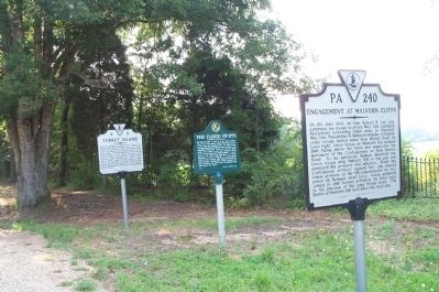
2. Engagement at Malvern Cliffs Marker
Located alongside The Flood of 1771 and Turkey Island Markers.
Another marker is no longer nearby. Curles Neck and Bremo (was approx. 0.4 miles away but has been replaced with another marker now near it).
Also see . . . Battle of Malvern Hill. Encyclopedia Virginia website entry:
The fighting at Malvern Cliffs was a lead up to the larger battle of Malvern Hill, the last battle in the "Seven Days Battles" around Richmond in 1862. (Submitted on March 25, 2024, by Larry Gertner of New York, New York.)
Credits. This page was last revised on October 21, 2024. It was originally submitted on July 17, 2008, by Kathy Walker of Stafford, Virginia. This page has been viewed 2,174 times since then and 46 times this year. Last updated on October 18, 2024, by Carl Gordon Moore Jr. of North East, Maryland. Photos: 1, 2. submitted on July 17, 2008, by Kathy Walker of Stafford, Virginia. • Bernard Fisher was the editor who published this page.
