
Wiscasset in Lincoln County, Maine — The American Northeast (New England)
Welcome to Wiscasset
Wiscasset, Maine
| — | The Museum in the Streets | — |

Photographed by Darren Jefferson Clay, October 14, 2024
1. Welcome to Wiscasset Marker
The land on which you stand has been inhabited for thousands of years. The earliest known residents were the Red Paint People, a pre-historic group of inhabitants. The saltwater Sheepscot River, teeming with marine life and the forested land full of animal, bird and plant life provided an ideal home for native peoples.
The first Europeans arrived near here in 1607, first in an exploratory capacity and later with an interest in settlement. The earliest communities were fishing and trading villages. By 1660, the Davie brothers, George and John, arrived from Massachusetts, of which Maine was then a district. They ventured up the tidal Sheepscot to the "high land" opposite what is now the Old Jail Museum on Federal Street, and built cabins.
In the first written record, an English deed from 1666, the Davies purchased a large tract of land that included present-day Wiscasset from three Native American sagamores, or chiefs.
European settlers were taking more and more land from the native tribes, who were also being decimated by European diseases. King Philip's War of 1675 began a series of brutal and bloody wars that wiped
this page online
In 1729, when peace seemed likely, Robert Hooper and his family came up the river, built a cabin near a "great rock" on land that became Water Street, and made a new beginning.
The newly built settlement continued to grow. By the mid-18th century, there were several competing claims for ownership of the land. It was eventually deemed the property of a group of wealthy Boston investors called the Kennebec Proprietors. The town of Pownalborough was incorporated in 1760, encompassing present-day Wiscasset, Alna and Dresden. In 1794, Wiscasset became the county seat. It was incorporated as a separate town in 1802.
The name Wiscasset has never been satisfactorily translated from the Abenaki language and has been thought to mean, variously, "confluence of three rivers," or "at the hidden outlet."
Wiscasset remained a part of Massachusetts until 1820 when Maine became a state with the passage of the Missouri Compromise.
The Davies brothers might be astonished to see us now. Their small settlement has grown to a town of over 3,000, their humble turf and log huts have given way
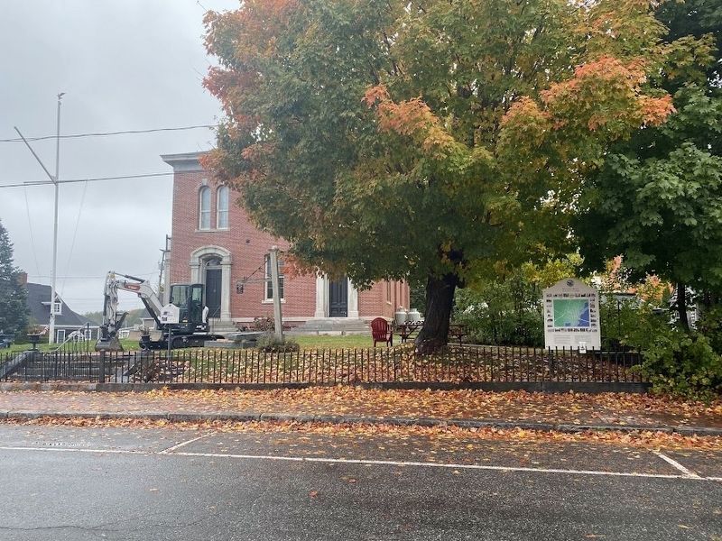
Photographed by Darren Jefferson Clay, October 14, 2024
2. Welcome to Wiscasset Marker
We are proud of our richly varied past, one of early economic prosperity due to our safe, deep water anchorage that brought the opportunity for world wide shipping and commerce. We are also proud of our triumph over poverty and adversity following the Embargo of 1807, though periods of epidemics, wars, depressions and recessions.
The Davies brothers would recognize the Yankee spirit they handed down to us and would approve of our famous Maine hospitality as we invite you to stroll through our village streets. You, too, are now part of our story and we welcome you.
Erected by The Museum in the Streets. (Marker Number Map.)
Topics. This historical marker is listed in these topic lists: Colonial Era • Indigenous Peoples and Communities • Industry & Commerce • Settlements & Settlers.
Location. 44° 0.025′ N, 69° 39.914′ W. Marker is in Wiscasset, Maine, in Lincoln County. It is at the intersection of Water Street and Fore Street, on the right when traveling south on Water Street. Touch for map. Marker is at or near this postal address: 1 Water Street, Wiscasset ME 04578, United States of America. Touch for directions.

Regionally, this marker is in Midcoast Maine. It is also in the American Northeast, in New England, and on the Eastern Seaboard. Globally, it is in the North Atlantic Region, North America, the Western Hemisphere, the Western World, and the Anglosphere.
Other nearby markers. At least 8 other markers are within walking distance of this marker: Custom House - 1870 (here, next to this marker); Revive the Wiscasset Schooners with Augmented Reality (within shouting distance of this marker); Wiscasset Sailing Vessels (within shouting distance of this marker); Wiscasset's Railroads 1849 - 2013 (about 300 feet away, measured in a direct line); Sunday Sailing Party c. 1900 (about 300 feet away); Haggett's Garage (about 500 feet away); Richard III - 1859 (about 600 feet away); Hesper and Luther Little - 1932 (about 600 feet away). Touch for a list and map of all markers in Wiscasset.
Regarding Welcome to Wiscasset. This marker is a guiide to The Museum in the Streets
markers in Wiscasset.
Also see . . .
1. Town of Wiscasset, Maine. (Submitted on October 24, 2024, by Michael Herrick of Southbury, Connecticut.)
2. Wiscasset, Maine (Wikipedia). (Submitted on October 24, 2024, by Michael Herrick of Southbury, Connecticut.)
Credits. This page was last revised on March 19, 2026. It was originally submitted on October 20, 2024, by Darren Jefferson Clay of Duluth, Georgia. This page has been viewed 404 times since then and 71 times this year. Photos: 1, 2. submitted on October 20, 2024, by Darren Jefferson Clay of Duluth, Georgia. • Michael Herrick was the editor who published this page.
